Download
1 / 32
320 likes | 414 Vues
This project review presents the conceptual definition, model results, and implementation process of assessing aquifer vulnerability in Columbia County, Florida. The study focuses on developing evidential layers, training sites, and conceptual models for identifying contamination risks. By analyzing soil properties, overburden thickness, and karst features, vulnerability maps are generated to guide future protection efforts. The assessment benefits local government, planners, and developers in making informed decisions to safeguard groundwater resources effectively.

E N D
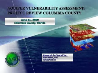
June 11, 2009 Columbia County, Florida AQUIFER VULNERABILITY ASSESSMENT: PROJECT REVIEW COLUMBIA COUNTY Advanced GeoSpatial Inc. Alan Baker, P.G. James Cichon
Presentation Overview • Conceptual Definition • Model Results • Implementing Model Results • Generalization with examples
Model Limitations • Vulnerability is relative; all aquifers are vulnerable • Based on features of the natural system that have association with location aquifer vulnerability • Does not account for human activity • Does not take account for contamination types • Does not estimate ground-water flow paths • Does not model fate/transport of chemical constituents • Large surface water features omitted
Study Area over which to search for a particular occurrence • Usually a county or some political boundary • Can be aquifer or springshed specific Conceptual Definition
Development of evidential layers used as predictors: • Soil Properties • Confinement or Overburden Thickness • Sinkhole Features or closed topographic depressions Conceptual Definition
Training Sites • Dataset of occurrences in our case ground water wells • Maximize knowledge by locating as many as possible • Evaluate water quality records to locate upper quartile • Ultimately use a subset of total wells Conceptual Definition
Conceptual Model • Evidential layers are spatially associated with the distribution of known occurrences and then generalized into binary patters • Individual evidence layers are combined together as a map depicting the best areas to search for contamination
Conceptual Model • Use known locations and assess their distribution spatially with respect to each factor causing occurrence • Where are the relationships or breaks between the data and the training points?
Input • Soil Permeability • Overburden Thickness • Hydraulic Head Difference • Karst Features
Soil permeability • Determine spatial association between theme and training points • Analysis reveals that highest contrast occurs at a soil permeability rate of 7.66 in/hr
Overburden thickness • Determine spatial association between theme and training points • Analysis reveals that highest contrast occurs at a overburden thickness of 117 feet
Karst Features • Determine spatial association between theme and training points • Analysis reveals that highest contrast occurs at a distance of 210 m from a karst feature
Aquifer Vulnerability Maps • We now have a map showing where to focus our efforts in similar locations • Results are based on data collected about existing occurrences • Model reveals a map showing favorable areas with greater probablity of finding occurrence Relative Vulnerability Vulnerable More Vulnerable Most Vulnerable
Local versus regional assessment • Larger scale study area: Wekiva Aquifer Vulnerability Assessment • Results are normalized across smaller study area, not entire statewide extent of aquifer system • Can include refined input data such as LIDAR • Provides more usable final product for planners, developers, regulators, and local government Local versus Regional
Regional Local
Aquifer Vulnerability Assessment Benefits • Assists local government, planners and developers in guiding growth into areas delineated as lower vulnerability • Enables more focused protection of sensitive areas, e.g., springsheds and ground-water recharge areas • Public tax dollars used more wisely as a result • Has be used to help guide wastewater management requirements – septic zones vs. centralized sewer • Leon County & Alachua County Purpose, End Users, and Benefits
Implementing model results • Results are not static; model is based on best available data and is snapshot in time • New and refined data reveals more accurate or complex statistical patterns allowing higher confidence in results • Lidar: Karst and Overburden • Accuracy is function input data • Approach is highly adaptable and useful tool for implementing ongoing protection of ground-water resources Implementing Model Results
Generalization of CAVA Model Results • Alachua and Leon Counties contracted with AGI for development of derivative protection-zone maps based on each of the County Aquifer Vulnerability Models • Deliver an aquifer protection zone map based on individula results that is directly applicable to land use and environmental regulatory decisions
Methodology • Generalization of the vulnerability map into specific aquifer protection zones • Raster Smoothing techniques employed • Help guide implementation • Avoid use of results on parcel to parcel scale • Account for highly resolved but isolated areas of vulnerability • Use of ArcGIS Spatial Analyst extension
Determination of Appropriate Analysis Window • Recent projects recommended that model results be applied on a local scale of greater than or equal to approximately 1.0 mi2 for statewide studies (Florida Aquifer Vulnerability Assessment) • Or approximately 0.75 mi2 for localized studies (Alachua, Wekiva, Leon and Marion County Aquifer Vulnerability Assessments). • Based on similarities to larger scale projects, AGI determined that model results be used at a recommended scale of 0.75 mi2, or an approximate 4,500-ft grid cell size.
Draft test results Focal Mean Filters on a window with a radius of 12 cells Cell size is 345 m. Calculates a statistic on a raster over a specified neighborhood. Focal Mean Finds the mean of the values for each cell location on an input raster within a specified neighborhood and sends it to the corresponding cell location on the output raster.
http://www.1000friendsofflorida.org/water/WakPowerPoits/Wayne%20Tedder%20TLCPD%20Wakulla%20Springs%20Workshop.ppt.pdfhttp://www.1000friendsofflorida.org/water/WakPowerPoits/Wayne%20Tedder%20TLCPD%20Wakulla%20Springs%20Workshop.ppt.pdf
http://www.1000friendsofflorida.org/water/WakPowerPoits/Wayne%20Tedder%20TLCPD%20Wakulla%20Springs%20Workshop.ppt.pdfhttp://www.1000friendsofflorida.org/water/WakPowerPoits/Wayne%20Tedder%20TLCPD%20Wakulla%20Springs%20Workshop.ppt.pdf
http://www.1000friendsofflorida.org/water/WakPowerPoits/Wayne%20Tedder%20TLCPD%20Wakulla%20Springs%20Workshop.ppt.pdfhttp://www.1000friendsofflorida.org/water/WakPowerPoits/Wayne%20Tedder%20TLCPD%20Wakulla%20Springs%20Workshop.ppt.pdf
http://www.1000friendsofflorida.org/water/WakPowerPoits/Wayne%20Tedder%20TLCPD%20Wakulla%20Springs%20Workshop.ppt.pdfhttp://www.1000friendsofflorida.org/water/WakPowerPoits/Wayne%20Tedder%20TLCPD%20Wakulla%20Springs%20Workshop.ppt.pdf
http://www.1000friendsofflorida.org/water/WakPowerPoits/Wayne%20Tedder%20TLCPD%20Wakulla%20Springs%20Workshop.ppt.pdfhttp://www.1000friendsofflorida.org/water/WakPowerPoits/Wayne%20Tedder%20TLCPD%20Wakulla%20Springs%20Workshop.ppt.pdf
http://www.1000friendsofflorida.org/water/WakPowerPoits/Wayne%20Tedder%20TLCPD%20Wakulla%20Springs%20Workshop.ppt.pdfhttp://www.1000friendsofflorida.org/water/WakPowerPoits/Wayne%20Tedder%20TLCPD%20Wakulla%20Springs%20Workshop.ppt.pdf
Note on CCAVA • Protection zone map will be a derivative product of the original model CCAVA results • Not intended as a replacement of the CCAVA results • As a result, the protection zone map will represent a standalone map product based on CCAVA results and additional supplemental datasets
Any Questions? 1949 Raymond Diehl Rd, Ste. D Tallahassee, FL 32308 abaker@adgeo.net 850/580-4GIS