Terrestrial Laser Scanning Systems
Terrestrial Laser Scanning Systems. Sara Walsh. Overview. Features How laser scanning works Time of flight Phase Shift Operation Leica HDS 2500 Other models Applications. Features of Laser Scanning. Captures 3D position data of any point Dense data acquisition

Terrestrial Laser Scanning Systems
E N D
Presentation Transcript
Terrestrial Laser Scanning Systems Sara Walsh
Overview • Features • How laser scanning works • Time of flight • Phase Shift • Operation • Leica HDS 2500 • Other models • Applications
Features of Laser Scanning • Captures 3D position data of any point • Dense data acquisition • Non-contact No need for instrumentation of sensors on structure • Ability to capture data for structures that are not easy to access • Reasonably accurate for many applications • Versatile • Efficient • Easy to use
How Laser Scanning Works • Time of Flight • Measures time it takes a laser pulse to travel to target and back to determine distance Image: herkules.oulu.fi
How Laser Scanning Works • Phase Shift • Measures change in phase of multiple sinusoidal laser pulses to determine time and distance Image: www.optical-metrology-centre.com
Leica HDS 2500 • Time of flight • Accuracy: ± 6 mm • Range: Up to 100 m • Scan rate: 1000 pts/s • Field of View: 40° by 40° • Software: Cyclone
Operation • Set up equipment • Scanner, computer • Position targets as needed • Scan • Use software for post-processing • Visualization • Stitching/Registration • Meshing
Other Scanning Systems • Leica • HDS 6000 • Faro • LS 880 • Riegl • LMS Z420 • Optech • Trimble • Price range: $70,000-$150,000 Faro LS 880 Riegl LMS Z420
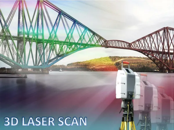
Applications Historical Documentation Palace Museum in the “Forbidden City” in Beijing Images from www.leica-geosystems.com
Applications Survey Construction Inspection Images from www.leica-geosystems.com
Applications As-built documentation Retrofit Images from www.leica-geosystems.com
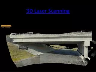
Applications The Big Dig • Survey • Closeout drawings Images from www.leica-geosystems.com
Applications Forensics • I-35 W bridge in Minnesota • Riegl LMS Z420