Capital Area Cross-River Connections Study
340 likes | 436 Vues
This study, conducted for the Harrisburg Area Transportation Study in cooperation with PennDOT, focuses on improving safety and accessibility for motorists, pedestrians, and bicyclists through data collection, safety audits, and public input. The results highlight key areas for improvement and propose phased projects for enhanced connectivity and mobility.

Capital Area Cross-River Connections Study
E N D
Presentation Transcript
Capital Area Cross-River Connections Study prepared for Harrisburg Area Transportation Study (HATS) in cooperation with Pennsylvania Department of Transportation prepared by Gannett Fleming, Inc.
Study Background • Conducted to improve safety and mobility for all modes of cross-river transportation • Data Collection and Existing Conditions Analyses Fall 2012 – Fall 2013 • Bridge existing conditions • Traffic data collection • Transportation safety audit • Public surveys and open house
Transportation Safety Audit • Projects to improve the use of the bridges should enhance safety for motorists, pedestrians, and bicyclists. • A road safety audit identified top safety concerns as follows: • Sidewalks end abruptly, are narrow, or non-existent • No barrier between sidewalks and driving lane • Poor or missing signs • Pavement markings faded
Transportation Safety Audit • Top safety concerns (continued): • Inadequate accommodation for people with disabilities (such as curb ramps) • Poor lighting at night • Road surface uneven • Poor drainage, snow/ice obstructions • Poor pedestrian/bicycle connectivity between Wormleysburg and Lemoyne
Public Surveys • Origin-destination survey responses of travelers exiting the Market Street Bridge on both shores
Public Open House • Public Open House Oct 2013 with the following common responses: • Poor connectivity/signage for HTB • Improve MSB sidewalk and railing • Positive feedback on use of CAT Bridge, especially for bike/ped travel
Study Results • Study considered: • Future needs, multimodal mobility, and agency/public input • A phased approach to stage improvements in a cost effective and most feasible manner
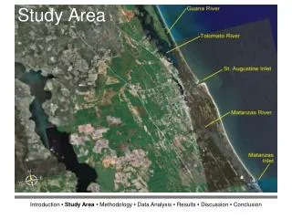
Study Results • Overview of connections
Study ResultsHarvey Taylor Bridge – West Shore Costs: <$5,000 Bike-Ped Tunnel Bikes-Peds Use Tunnel for Travel South
Study ResultsHarvey Taylor Bridge – East Shore • Near-term improve signs/markings ($2,500) • Mid-term upgrade pedestrian signal equipment and minimize pedestrian crossing distances ($170k)
Study ResultsHarvey Taylor Bridge – East Shore • Mid-term connect River Walk and Greenbelt ($1.8 M)
Study ResultsMarket Street Bridge – West Shore Near-Term • Restripe Front Street to reduce crossing distances (<$5,000)
Study ResultsMarket Street Bridge – West Shore • Repair existing sidewalk within bottleneck ($10k-$20k) • Restrict left turns to/from City Island ($5,000)
Study ResultsCity Island Near-Term • Upgrade pedestrian/bicycle connections on City Island ($20,000) • Ped/Bike signing for travel between WSB and MSB ($<5,000) • City Island bike share City Island
Study ResultsMarket Street Bridge – West Shore Spans Mid-Term • Widen bridge and sidewalk ($200k) NOTE: This would be part of a bridge rehabilitation project
Study ResultsWalnut Street Bridge • Future Use (Long Term) • No transportation “need” for the West Shore spans of the Walnut Street Bridge. • Even if the missing spans were replaced, the bridge could only accommodate bicycles and pedestrians (at $12 M - $30 M). • The Market Street Bridge is 500 feet southeast and provides vehicular, bicycle, and pedestrian connectivity. • Funds should be utilized to improve the other study bridges which provide connectivity for all modes. • MSB Ped Improvements $200k (above rehab cost) • CAT Bridge ($3.2 M) • With City Island Connection only ($150k additional) • With City Island, East & West Shore Connections ($4.5 M additional)
Study ResultsCAT Bridge • Any projects considered which involve the CAT Bridge and its shore connections will require cooperation from the railroads (Norfolk Southern and Amtrak) • Railroads are owners of right-of-way at the bridge termini • It is estimated that periodic maintenance of the bridge will be required at 5-yr intervals at a cost of $1.5 M • Concrete repairs will be necessary • This will be required whether or not the bridge is put to use
Study ResultsCAT Bridge Mid-Term • Convert bridge to pedestrian and bicycle shared-use pathway ($3.2 M) Concrete barrier shown instead of pedestrian railing, as necessary for future use as a busway.
Study ResultsCAT Bridge – City Island • Construct an elevated pedestrian connection from the bridge to the City Island parking garage ($150k)
Study ResultsCAT Bridge – West Shore • Construct pedestrian and bicycle connections between CAT bridge and Lemoyne-New Cumberland: • (14) Bosler ($450k) • (15) Lowther ($430k)
Study ResultsCAT Bridge – West Shore • Build an elevated pedestrian and bicycle connection between the CAT and Market Street bridges on the West Shore ($1.8 M)
Study ResultsCAT Bridge – East Shore • Construct a ramp to provide pedestrian and bicycle connection between the CAT bridge and Front Street/Greenbelt ($1.7 M)
Study ResultsCAT Bridge Long-Term • Bridge Rehabilitation ($12 - $15 M) • Necessary at some point even if the bridge remains unused • Includes waterproof membrane, concrete repairs, and repair of scour holes with grout bags
Study ResultsCAT Bridge Long-Term • Potential alternative use considerations • Additional stakeholder input necessary • Transit use requires • Administration agreements with railroad owners • Pavement or rail to accommodate potential transit use. • $300,000 for pavement or $700,000 for track • The limits of any potential transit corridor are uncertain, so cost for only on bridge itself and not approaches. • Does not include gates, signaling, lighting, and other appurtenances.
Study ResultsCAT Bridge Long-Term • Bridge Option 1: Shared Transit, Pedestrian, Bicycle Facility • One-lane, two-way busway • Shared-use path (as suggested for mid-term improvement)
Study ResultsCAT Bridge Long-Term • Bridge Option 2: Elevated Park • Without transit, one long-term alternative is an elevated park • Transit use will require cooperation from NS and Amtrak
Study ResultsCAT Bridge Long-Term • Bridge Option 2: Elevated Park • Safer connection for non‐vehicular traffic • Potential recreational uses include festivals, a fireworks viewing area, location for lunch hours. • Could provide emergency vehicle access (dependent upon connections at each shore) Elevated Park Example: Highline Park, NYC
Study Results • Other Long-Term Considerations • CAT approaches are on NS and Amtrak ROW
Study Results • Bus or Rail Transit use may require: • Track relocation on East Shore • Rehabilitation of 2nd Street overpass • Lemoyne Connector grade separation for NS track (West Shore)
Next Steps • Study adopted at Feb 28, 2014 Coordinating Committee Meeting • Next Steps • Establish project sponsors / follow project development process through HATS • Regional Transportation Plan (RTP) • Transportation Improvement Program (TIP) • Perform additional detailed study and analyses for mid- and long-term projects as required • Especially applies to those where continued consideration by railroad stakeholders is necessary • Evaluate the additional opportunities for funding, given the multiple uses for the CAT Bridge