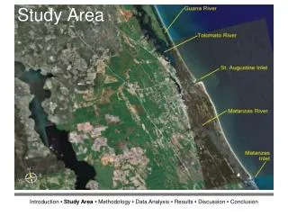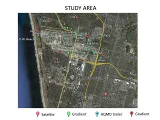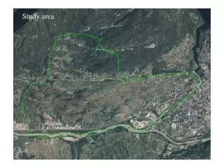
Study area
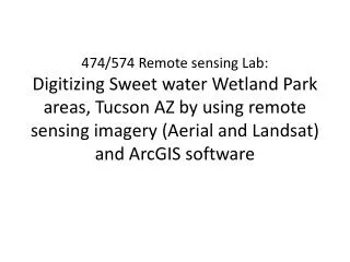
474/574 Remote sensing Lab: Digitizing Sweet water Wetland Park areas, Tucson AZ by using remote sensing imagery (Aerial and Landsat) and ArcGIS software. Study area. Sweet Water wetlands viewing from Google Earth Imagery. Objectives.

Study area
E N D
Presentation Transcript
474/574 Remote sensing Lab: Digitizing Sweet water Wetland Park areas, Tucson AZ by using remote sensing imagery (Aerial and Landsat) and ArcGIS software
Study area Sweet Water wetlands viewing from Google Earth Imagery
Objectives • Get to know different types of remote sensing imagery with different resolutions. • Identify the Sweet Water Wetlands areas in Tucson
Methods • Landsat imagery (30m resolution) 3rd June 2010 • Aerial imagery (1m resolution) with available ortho photography 27th June 2010 from NAIP (National Agriculture Program). • Digitize wetland areas by using ArcGIS 10
How to • Copy 3 available files to your folder : • sww_naip.img : geo_referenced aerial imagery (1m resolution) • sww_landsat.img : geo_referencedlandsatimagry (30m resolution) • sww.shp : available shapefile (with polygon type) of the sweet water wetland feature for digitizing process
How to display the imagery and the shape file in AcrGIS • Open ArcGIS • At Table of Content =>Layer =>Add data • Note: we are working with the aerial imagery first
How to display the imagery and the shape file in AcrGIS • The display window in your ArcGIS will be like this:
How to start digitizing Display Editor toolbar: Customize => Tools=> Editor Then click Start Editing It will appear a create feature window
Digitizing Find wetland areas and Start digitizing:
Click on Layout View feature From here to get a display like this
Create Title, Legend and North Arrow, Scale Go to Insert => Title=> give the tile for the map Go to Insert => Legend => to get Sweetwater Wetland as a legend for the map Go to Insert => North Arrow => Choose one of them Go to Insert => Scale Bar=> choose one of these
Deliverable File => Export Map => Save file as an JPG file.
Then repeat the same procedures for the Landsat imagery (using sww_landsat.img and sww.shp files)
Comparison between two maps: High resolution (1m) imagery gives better features for digitizing than the 30m resolution imagery (Landsat). We can see more detail information in the aerial imagery than the satellite imagery. • Deliverable Sweet water wetland map using Landsat Sweet water wetland map using aerial photo