Envisioning 2030: Housing Allocation and Landscape Impact Study
Explore alternate futures for urban planning in 2030 based on community workshops, housing types, land use, and demographic trends. Analyze potential housing allocation strategies and the impact on open space. Develop algorithms to predict environmental effects and guide regional development decisions.

Envisioning 2030: Housing Allocation and Landscape Impact Study
E N D
Presentation Transcript
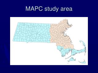
2030: Alternate Futures • WOC envisions the results of more comprehensive regional planning • Result of community workshops—what do participants want their town to look like in 2030? • Looked at housing, demographic trends, employment, land use, etc. “Let It Be” “Winds Of Change”
2030: Alternate Futures • LIB predicts much greater loss of open space • LIB: 152,000 acres lost • WOC: 48,000 acres lost • Water shortage • LIB: 50 systems exceed permit limits • WOC: Only 8 exceed limits
Housing Types -8 housing types -3 land use categories: BNW, Residential, Commercial/Industrial, -For “Buildable Non-Wetland” landuse, two different model projections
Grid data: VMT • Can do interesting things with grid data- map algebra, focal sum grids, etc. • How to combine with TAZ-level data on housing?
Task at hand: Housing Allocation • Why look at housing below the level of the TAZ? -Accessibility affects where housing will (or should) go -Smaller scale more engaging? -May be able to predict environmental impact—how VMT responds to development -A “check” on the MetroFuture model -Lofty goal: an algorithm to dump any data into
Case study: Brookline • Intermediate between urban and rural—some open space, but mostly residential and industrial
Case study: Brookline • Intermediate between urban and rural—some open space, but mostly residential and industrial
Case study: Brookline • Intermediate between urban and rural—some open space, but mostly residential and industrial
Case study: Wrentham • Rural—lots of BNW land
Case study: Wrentham • Rural area • TAZs are very large compared to intermediate/urban towns • Effect of breaking down housing to smaller scale even more apparent
Allocation: What is it for? • Assumptions are built into the allocation algorithm • This has implications for how you talk about allocation at the local level • Is the allocation a goal? • Is it a prediction?
Allocation Strategies • Shan: Housing demand and accessibility • Paul: Two algorithms: Low VMT and Random • Masa: Case study: Wrentham • Abner: Case study: Brookline • Wanli and Yi: Neighborhood Emphasis