U.S. Census Bureau
U.S. Census Bureau. 3 Censuses: Decennial Census Age Race Sex Relationship to householder Economic Census Census of Governments. Profile Maps of States. http:// www.census.gov/geo/www/maps/2010_census_profile_maps/census_profile_2010_main.html. Age Distribution of Population. Nebraska.

U.S. Census Bureau
E N D
Presentation Transcript
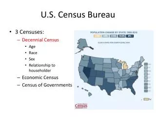
U.S. Census Bureau • 3 Censuses: • Decennial Census • Age • Race • Sex • Relationship to householder • Economic Census • Census of Governments
Profile Maps of States http://www.census.gov/geo/www/maps/2010_census_profile_maps/census_profile_2010_main.html
Age Distribution of Population Nebraska Texas Utah
Center of Population of the United States http://2010.census.gov/2010census/data/center-of-population.php
Population Change 2000-2010 http://2010.census.gov/2010census/data/
Population Change 2000-2010 in ArcGIS Online http://www.arcgis.com/home/webmap/viewer.html?webmap=0a27f5cb1f07478fbdf117b70231c5c2
Finding the Right Data Population, housing, economic & geographic data Shapefiles prepared for GIS users http://www.census.gov/
TIGERTopologically Integrated Geographic Encoding and Referencing System • TIGER is geographic data • State and county lines • Updated annually • For census data, American FactFinder (http://factfinder2.census.gov)
Getting TIGER Shapefiles http://www.census.gov/cgi-bin/geo/shapefiles2010/main
Selecting Travis County, Texas Pick a State Pick a County
Travis County Census Blocks (15922) Average of 73 Blocks per Tract
A Census Block (38 houses) Texas Travis
Census Shapefiles with Population ftp://ftp2.census.gov/geo/tiger/TIGER2010BLKPOPHU/ http://www.census.gov/geo/www/tiger/tgrshp2010/pophu.html
All the Census Blocks for a State ftp://ftp2.census.gov/geo/tiger/TIGER2010BLKPOPHU/
Population and Housing Units in Travis County Population = 1,024,266 Pop/HU = 2.32 Housing Units = 441,240
San Marcos Basin Austin San Antonio
Population of the San Marcos Basin Population (2010) = 179,727
Population Living Over the Edwards Aquifer Population (2010) = 2,352,709 Small Tracts in High Population Areas Large Tracts in Low Population Areas