Download
1 / 39
390 likes | 491 Vues
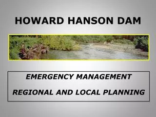
Howard Hanson Dam and Green River Basin Update. Agenda. Status of the Howard Hanson Dam Potential Flood Scenarios Potential Impact Planning Activity. Workplace and Personal Preparedness. Be Aware Stay Informed Be Prepared Take Action Get Involved. Green River. Constructed in 1962

E N D
Agenda Status of the Howard Hanson Dam Potential Flood Scenarios Potential Impact Planning Activity
Workplace and Personal Preparedness Be Aware Stay Informed Be Prepared Take Action Get Involved
Green River • Constructed in 1962 • HHD is located 64 miles from Puget Sound • The dam is an earth and rock fill structure with a sand core and gravel drain • Drainage Tunnel Completed in 1969 • Grout Curtain installed 2002 Landslide Debris Small Depression Location Existing Grout Curtain Drainage Tunnel Right Abutment Big Depression Location Spillway Engineered Filter Blanket Embankment Flood Control Tower Eagle Gorge Reservoir Fish Passage Facility Excavation
USACE Water Management Directions The Corps of Engineers will not jeopardize the Dam Reservoir will be kept “empty” Water comes in and goes out River will be run hard and long
Scenarios • Overtopping of Banks and Levees • Debris Flows • Degradation of Banks and Levees • Levee Catastrophic Failure
Potential Impact • Inundation • Evacuation • Infrastructure Disruption • Cascading Effects • Sustainable Sheltering • Re-occupancy Challenges
NOAA P-3 target from Honolulu, Hawaii: Atmospheric River NOAA P-3 target from Honolulu, Hawaii: Atmospheric River 16-Feb-04; IWV (cm) Atmospheric River Hawaii NOAA P-3 domain 1500 km radius SSM/I IWV (cm)
Inundation Map Removed The map that was on this slide is classified FOUO. If you are interested in a copy of the inundation map, please contact: Robert Romocki, US Army Corps of Engineers Dam Safety Officer206-764-3545
Prime range of wind directions in ARs for Green River flooding? Green River outlet Olympic Mts Howard Hanson Dam Green River Basin Mt. Rainier
Infrastructure Impact • Transportation • Power • Telecommunications • Waste Water • Fuel • Food • Medical
Planning Activity • Local Jurisdiction • Regional planning • Requests for State and Federal planning assistance
GREEN RIVER PLANNING GROUP CONCEPT OF OPERATIONS First response to a flood event will be by local responders,when the event is so large that their local resources are unable to handle it, additional assistance may be requested by through the declaration process. Such assistance, when authorized, will be provided on a regional (county) basis and by state agencies operating under their own authority, or as part of an effort coordinated by the Office of Emergency Management operating on behalf of the Governor. The Governor may request assistance from the federal government if the capabilities and resources of local, regional and state governments are exceeded. …
Mitigation Efforts Identification and bolstering vulnerable levees Improvement of surface water systems Training and Exercises Prepositioning response materials and equipment
Workplace and Personal Preparedness Be Aware Stay Informed Be Prepared Take Action Get Involved
Be Aware Flood Impact Map Potential Scenarios – Conditions that could cause: Overtopping Levee/Bank Degradation Debris Flows Levee Failures Clear Channel PSA
Stay Informed Notification and Warning Systems Websites Radio and TV AHAB
Be Prepared Workplace Preparedness Personal Preparedness Red Cross Partnering
Take Action Get Flood Insurance Know Evacuation Routes Evacuate When Notified DON’T Evacuate if Unaffected
Get Involved Volunteer Map Your Neighborhood
Challenges Community Awareness, Preparedness and Notification Facilities Staffing Housing Vulnerable Population identification and engagement