Download
1 / 29
300 likes | 354 Vues
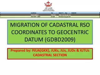
MIGRATION OF CADASTRAL RSO COORDINATES TO GEOCENTRIC DATUM (GDBD2009). Prepared by: PJUA(GKK), JUKs, JUs, JUDs & KJTUs CADASTRAL SECTION. Contents. Introduction Implementation Stages Advantages Limitations. Introduction. Moving Forward. GDBD2009. Introduction.

E N D
MIGRATION OF CADASTRAL RSO COORDINATES TO GEOCENTRIC DATUM (GDBD2009) Prepared by: PJUA(GKK), JUKs, JUs, JUDs & KJTUs CADASTRAL SECTION
Contents • Introduction • Implementation Stages • Advantages • Limitations
Introduction Moving Forward GDBD2009
Introduction • The existing cadastral survey system in Brunei Darussalam is more towards the measurement mechanism and survey records system acquisition such as area, location, and parcel’s boundary lines.
Introduction • The existing system is not compatible with the current technology in terms of reference system and the need of accurate coordinates to support widely uses of Global Navigation Satellite System (GNSS).
Introduction • Cadastral Lot in Brunei Darussalam more than 78,000 lots. • Private Lots, Gazette Lots, Land Applications (LA), and Temporary Occupation of Lands (TOL) • Most lots are in RSO Co-ordinates and others are in Cassini or Prismatic Compass (PC)
Implementation Stages • Stage 1 • Pilot Project/Cash Study • Stage 2 • Field Observation – continuous • Stage 3 • Future Project [(Coordinated Cadastral Systems (CCS)]
Stage 1 Pilot Project / Cash Study
Pilot Project • Pilot Project (April 2010) • Divided into 4 Blocks (A,B,C,D ) 5 km x 5 km • Gadong A and Berakas A) • Each Block (2.5KM X 2.5KM) • Cadastral Section – Blocks B & D • Land Development Section (KTH) – Blocks A & C
Pilot Project BlockB Block A Results 5 km Block C Block D
ISSUES: • Geodetic Control Points should be done earlier (GDBD coordinates) or parallel with the field works
ISSUES: • Computations for both RSO and New GDBD – • Save in Database .. is it overlapping?? • Do we need new file??
Stage 2 Field Observation
Field Observation • When do we Start? • January 2011 • What we Require? • Total Station with integrated GNSS • All Geodetic Control transform to GDBD2009 • New Data Base
Field Observation • Where? • All Districts • How? • Total Station will be based on Geodetic Control (GDBD2009 Coordinates) • Total Station with integrated GNSS
Stage 3 Future Project ! ! !
This Future project has 2 main objectives: • To establish the technique and procedures for the development of Cadastral Control Infrastructure (CCI) and the primary model of Cadastal Control Data Base (CCDB)
This Future project has 2 main objectives: • To establish the technique and procedures for the re-population and re-coordination of Digital Cadastral Database (DCDB) and the development of National Digital Cadastral Database (NDCDB).
Future Project (All Cadastral Lots) • Needs Consultant • Training • To Implement • Advice from Consultant (July 2010) • CCI –Cadastral Control Infrastructure • Re- coordinate base on GDBD2009 • Adjustment (Re-population) • Quality Control (QC)
GGDBD2009 Establishment of Cadastral Control Infrastructure (CCI) Tie-Up survey between CCI station and cadastral lot (parcel) Least Square Adjustment (LSA) Re-coordination and Re-population (R&R) NDCDB MethodologyCadastral data migration from BT48 to GDBD2009. Data migration processes are
Expected output and results of the Future project are: • Survey Accurate Coordinate System (SACS): • Network design for CCI with sufficient coordinate accuracy at reasonable cost. • CCI monumentation. • CCI coordinates as a layer in CCDB. • Re-coordination and re-population procedure of DCDB. • Re-coordination and re-population software. • Establishment of BSDI for Brunei Darussalam. • Documentation of the above findings.
Advantages • Real Time (GNSS observation using network RTK technique. • Straight Forward • Control marks always available • May not require Control Marks (Geodetic Control) • May use Boundary Marks
Limitations • No Satellite coverage • Needs clear area • Require new and expensive instrument (GNSS) • Require license (CORS) • Communication (GSM) • Difficult to differentiate between GDBD and RSO • Still need marker before observation can be made
Q & A Ouch… Oh no…