Download
1 / 24
240 likes | 271 Vues
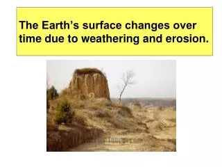
Explore the major agent of erosion—moving water and runoff's impact on Earth's surface. Learn how factors such as rain, vegetation, soil type, land shape, and human activities influence runoff and erosion over time. Discover the formation of rills, gullies, streams, rivers, tributaries, and the role of rivers in creating valleys, waterfalls, floodplains.

E N D
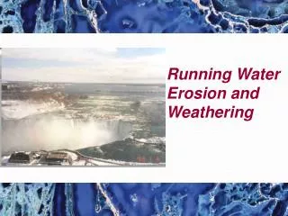
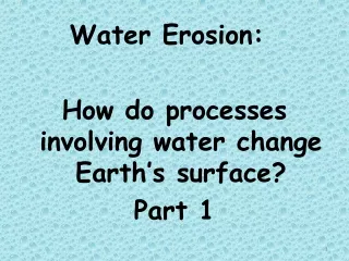
Water Erosion: How do processes involving water change Earth’s surface? Part 1
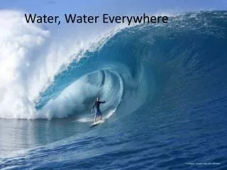
What is the MAJOR agent of erosion that has shaped Earth’s land surface? moving water
Water moving over land’s surface is called runoff. Runoff may cause sheet erosion.
The amount of water runoff in an area depends on 5 main factors:
Factors that affect Runoff • The amount of rain an area receives. *More rain = more runoff • Vegetation - grasses, shrubs & trees reduce runoff. *More vegetation=less runoff • Type of soil - some soils absorb more water than others • Shape of the land – steep slopes have more run-off, which causes more erosion • How people use the land – parking lots & crop removal increase run-off.
Runoff overtime: How does runoff over time affect the land and water?
Rills & Gullies As runoff travels across the soil, rills form. Rills are tiny grooves in the soil that grow larger forming gullies. A gully is a large groove or channel in the soil that carries runoff after a storm. It moves soil & rocks. Gullies only contain water after it rains.
Streams & Rivers Gullies join together to form a larger channel called a stream. Water continuously flows here and rarely dries up. Small streams may be called creeks or brooks. Small streams flow together to form a large stream called a river.
Rill, Gully, Stream Rill erosion at a construction site.Image by M. Mamo, Labels added by UNL Gully erosion in a pasture.Image by NRCS Stream
Tributaries Streams grow together by getting water from tributaries. A tributary is a stream or river that flows into a larger river. Tributaries collect their water from the drainage basin or watershed. An example: The Missouri & Ohio rivers are tributaries of the Mississippi river.
Rivers & Tributaries http://images.google.com/imgres?imgurl=http://knol.google.com/k/-/-/3ajhc7zrwtav1/c1ssz4/figure-1%2520(2).bmp&imgrefurl=http://knol.google.com/k/new-orleans-the-geologic-difficulties-with-the-big-easy-part-1&usg=___SPqqMAUDGF2VVgD-x0Wwvs-5xk=&h=394&w=432&sz=31&hl=en&start=5&um=1&tbnid=ShJceJzlrtYlWM:&tbnh=115&tbnw=126&prev=/images%3Fq%3DMississippi%2Briver%2Band%2Bits%2Btributaries%26hl%3Den%26um%3D1
Rivers: * cause erosion and create valleys, waterfalls, flood plains, meanders and oxbow lakes. *form on steep mountain slopes.
How do they flow? Quickly and follow a narrow path How do they erode? Rapidly The result is that rivers form deep, V-shaped valleys.
Valleys http://www.google.com/imgres?imgurl=http://cgz.e2bn.net/e2bn/leas/c99/schools/cgz/accounts/staff/rchambers/GeoBytes%2520GCSE%2520Blog%2520Resources/Images/Rivers/V-shapedvalley.jpg&imgrefurl=http://geobytesgcse.blogspot.com/2006/11/upper-course-of-river-v-shaped-valleys.html&usg=__Hp8C8YOunbWzJy9E7kbQcOiURzA=&h=308&w=411&sz=47&hl=en&start=0&zoom=1&tbnid=giwF1FppYFy8zM:&tbnh=116&tbnw=154&ei=-kk2TfKtEMH68AbI__2tBA&prev=/images%3Fq%3Dv-shaped%2Bvalley%26um%3D1%26hl%3Den%26sa%3DN%26biw%3D1280%26bih%3D531%26tbs%3Disch:10%2C35&um=1&itbs=1&iact=hc&vpx=247&vpy=77&dur=701&hovh=194&hovw=259&tx=161&ty=116&oei=g0k2TbG1L4T58Aa8nOC7Aw&esq=12&page=1&ndsp=22&ved=1t:429,r:1,s:0&biw=1280&bih=531 http://images.travelpod.com/users/the-boy_picot/3.1149265860.580x-nice-v-shaped-valley.jpg
Features of rivers: What features are formed by erosion along a river?
Waterfalls Occur where? Where a river meets an area of hard & slowly eroding rock Then flows over softer rock downstream. How does softer rock erode? The softer rock erodes away faster. What results from this erosion? A waterfall develops.
Waterfalls Waterfalls at the Plitvicka Jezera National Park in Croatia Minnehaha Falls, Minneapolis Minnesota http://images.google.com/imgres?imgurl=http://realestate-inminnesota.com/images/Minneapolis.jpg&imgrefurl=http://realestate-inminnesota.com/&usg=__kBY-WaWcelJlC-sNAEDq6zr8eLY=&h=599&w=800&sz=162&hl=en&start=5&um=1&tbnid=WO5G4jC_rIKDMM:&tbnh=107&tbnw=143&prev=/images%3Fq%3Dminnehaha%2Bfalls,%2Bmn%26ndsp%3D18%26hl%3Den%26sa%3DG%26um%3D1
Flood Plain What is a flood plain? A wide valley in which a river flows What happens to the land during a flood? The water in the river over flows its banks into this wide river valley area.
Meanders What are meanders? Loop-like bends in the course of a river. Where & how do they occur? They occur as the outer bank of a river is eroded & deposits are dropped on the inner bank of the bend in a river.
Example: The southern stretch of the Mississippi River meanders on a wide, gently sloping flood plain area.
Mississippi River Meanders http://images.google.com/imgres?imgurl=http://www.ecology.info/img/Mississippi-River.jpg&imgrefurl=http://www.ecology.info/article.aspx%3Fcid%3D12%26id%3D10&usg=__B9CvpJJ70Ydm7HE2LjHs3GW76Ec=&h=450&w=600&sz=57&hl=en&start=8&tbnid=Q3zaqdFNmc7QVM:&tbnh=101&tbnw=135&prev=/images%3Fq%3Dmeanders%26gbv%3D2%26hl%3Den%26sa%3DG
Oxbow Lakes What is an oxbow lake? A meander that has been cut-off from the river. They may form when a river floods as high water finds a straighter path downstream . As flood waters fall, sediments dam up the ends of the meander and a lake forms.
Oxbow Lakes http://muller.lbl.gov/travel_photos/AmazonWebPages/AmazonWebPages-Images/1.jpg