Download
1 / 15
150 likes | 166 Vues
Explore U.S. Geological Survey research in Handcart Gulch, Colorado, a unique alpine watershed with natural acid-rock drainage. Learn about the motivations, instrumentation, data collection methods, and preliminary findings of this critical study site.

E N D
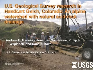
U.S. Geological Survey research in Handcart Gulch, Colorado: An alpine watershed with natural acid-rock drainage Andrew H. Manning, Jonathan Saul Caine, Philip L. Verplanck, and Dana J. Bove U.S. Geological Survey, Denver Colorado U.S. Department of the Interior U.S. Geological Survey
Handcart Gulch Research Site Continental Divide View from Webster Pass on Continental Divide looking southeast View from drainage bottom looking northwest up to Continental Divide
Handcart Gulch Research Site • Area: 1.5 mi2 • Elevation: 10,700 ft to 12,800 ft, top is at • Continental Divide • Alpine tundra, talus slopes, and sub-alpine • forest • Mean annual precip: 30 to 35 inches, about 65% • is snow • Monthly average stream discharge: 0.1 to 4.5 cfs • (small!) • Geology: underlain by mixed Precambrian • metamorphic rocks • Stream water naturally acidic (pH 3 to 4) • Some history: • Private mineral exploration company drilled 4 exploration boreholes in 2001 and 2002 • Drilled high in watershed to depths of 3500 ft, recovered core • USGS adopted holes and converted to monitoring wells up to 1300 ft deep • Installed additional monitoring wells along stream
Handcart Gulch Research Site Hydrothermal alteration and geologic structure map draped on a digital elevation model
Motivation for HCG Research Site • Primary Motivation: • Need to better understand processes controlling natural acid-rock drainage in mountain watersheds, especially the role of ground water in liberating and transporting metal-rich and low-pH water to streams • Broader Motivation: • Need to better understand mountain and alpine ground-water flow systems in general: • How important is ground water in the hydrologic budget? In delivering dissolved chemical constituents to stream? • Where is the water table? • What are characteristic permeabilities, how are they related to geologic structures and depth, and on what scale can the bedrock be modeled as a continuous porous medium? • Relevance to Land Managers: • Knowledge gained at Handcart Gulch will help better predict how land use and climate changes will impact water quality/quantity in mountain watersheds
Site Instrumentation and Data Monitoring Wells • 4 deep “WP” wells: • 300 to 1200 ft deep (original boreholes collapsed) • open or screened in bedrock • 9 shallow “HC” wells: • 10 to 170 ft deep • screened in bedrock or overlying surficial material • Basic well data: • water levels (dedicated pressure transducers in non-artesian wells) • single well aquifer tests
Site Instrumentation and Data Geologic Data • geologic and alteration mapping • fracture network and fault data • drill core logging Fault in outcrop near well WP1 Drill core record of rock type, hydrothermal alteration intensity, and pyrite content
Site Instrumentation and Data Borehole Logging and Geophysical Data
Site Instrumentation and Data Geochemical Data Variations in ground-water age with distance downstream. Ages determined using the tritium/helium-3 method. Stream tracer dilution study also performed in 2003 Polished thin section under reflected light Trace metal variations in pyrite obtained using laser ablation mass spectrometry
Site Instrumentation and Data Stream Gage and Meteorological Station Stream flow data from 2005 • Met station parameters (started 2008): • air temperature and relative humidity • wind speed • incoming solar energy • precipitation • soil moisture
Site Instrumentation and Data Temperature Data • Important for monitoring climate change and calibrating recharge rates in ground-water flow model • Air temperature from met station • Time-series shallow ground temperature (depth = 1 foot) from 3 different locations/ elevations • Time-series deep ground temperatures from depths of 55 to 600 ft • Temperature profiles from all wells
Watershed Scale Ground-Water Flow Models FEFLOW finite element coupled heat, fluid, and solute transport model (preliminary) MODFLOW model from Kahn and others (2007) Layered permeability structure used in both models (decreases with depth)
Preliminary Findings Several, but one most important in context of watershed management….. • Ground water apparently matters! • Bedrock permeability is non-trivial (up to 10-6 m/s) based on aquifer tests and considerable sustained artesian flows (up to 20 gpm) in wells along creek…this is not a “teflon basin” • Bedrock recharge rates are 10-20 cm/yr based on modeling results, equal to about 15-35% of precipitation • Roughly 5-30% of precipitation leaves site in subsurface under stream based on modeling results • Dissolved metal concentrations are commonly higher in the ground water than in the stream, so a substantial component of dissolved metals is probably transported by the ground water Measuring artesian head in well HCBW2
Implications for Watershed Managers • Failing to consider the ground water in mountain watershed studies could mean: • Neglecting a substantial component of the watershed hydrologic system • Neglecting a potentially substantial component of the watershed dissolved mass flux • An ability to successfully predict how water quality and quantity in a watershed will respond to changes in land use and climate probably requires characterizing the ground water system in addition to the surface water system • Must collect some ground-water data….need wells • Cost of well installation not as prohibitive as commonly thought. Nine stream-side wells in Handcart cost about $60K • Watershed numerical models should simulate ground-water system, not just surface water system Artesian flow in well HCBW3


