Download
1 / 135
1.35k likes | 1.59k Vues
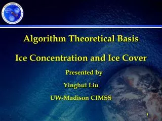
Algorithm Theoretical Basis Ice Concentration and Ice Cover Presented by Yinghui Liu UW-Madison CIMSS. 1. Ice Concentration and Ice Cover Algorithm Theoretical Basis.

E N D
Algorithm Theoretical Basis Ice Concentration and Ice Cover Presented by Yinghui Liu UW-Madison CIMSS 1
Ice Concentration and Ice Cover Algorithm Theoretical Basis The purpose of the JPSS VIIRS Ice Concentration and Ice Cover Algorithm Algorithm Theoretical Basis is to provide programmers, reviewers and users with a theoretical description (scientific and mathematical) of this algorithm. Heritage algorithm information has been documented in the GOES-R ABI ATBD. 2
Ice Concentration and Ice Cover CDR Algorithm • Preferred Solution • Daytime (solar zenith angle less than 85 degree) • Combination of MODIS sea ice mapping algorithm and NPP/VIIRS ice algorithm • This algorithm updates the tests of the MODIS sea ice mapping algorithm, and uses the ice concentration retrieval results to further refine the ice mask. • Nighttime (solar zenith angle larger than 85 degree) • Combination of ice surface temperature algorithm and NPP/VIIRS fresh water ice algorithm; further refines the ice extent from ice concentration. • Designed for easy portability and adaptation • Applicable to all water surface conditions • Algorithm simple and fast • For both day and night
Ice Concentration and Ice Cover Algorithm Objectives The JPSS VIIRS Ice Concentration and Ice Mask Product will be produced for each VIIRS image and will provide ice mask, and ice concentration over all water surfaces of the globe. The primary output consists of a map of ice concentration, ice mask, and corresponding quality control flags. Applications of ice mask and ice concentration include numerical weather prediction and data assimilation, hydrological modeling, climate modeling, transportation, recreation. 6
Ice Concentration and Mask AlgorithmObserving System Overview • Instrument Characteristics 7
JPSS VIIRS Ice concentration and mask Algorithm requires for each pixel: Calibrated/Navigated VIIRS reflectance and brightness temperatures Solar zenith angle and satellite viewing angle Cloud mask and land mask Longitude and Latitude Imagery can be in native satellite projection or remapped projection Ice Concentration and Cover Algorithm Input and Output 8
Algorithm Input:Ancillary Data • Three types of ancillary data needed: • VIIRS Product: Cloud mask • Non-VIIRS Dynamic Data: N/A • Non-VIIRS Static Data: Land/Water Mask
AlgorithmInput and Output • Output Data: • Ice concentration and cover can be presented in a variety of methods • Ice surface skin temperature derived by this algorithm 11
Ice Concentration and Cover Algorithm Description • Procedures of ice concentration and cover algorithm • Use threshold tests to detect possible ice cover: Daytime and Nighttime • Use a tie-point algorithm to derive reflectance (temperature) for pure ice pixel, and then calculate ice concentration • Reflectance (temperature) of pure ice and pure water are tied to points in a frequency histogram, and the ice fraction in a pixel (ice concentration) is determined by linearly interpolating between these tie points • Ice pixels with retrieved ice concentration larger than 15% are identified as ice. Ice pixels with retrieved ice concentration smaller than 15% are not identified as ice 13
Ice Concentration and Cover Algorithm Processing Outline Ice concentration and cover algorithm begin VIIRS channel radiance, satellite viewing angles, cloud mask, land/water mask Group-criteria detection Ice Tie point algorithm Ice concentration Ice concentration and cover algorithm end Ice cover High Level Flowchart of the ice concentration and cover algorithm step1 step2 step3 14
Ice Concentration and Cover Algorithm Description Step 1: Use threshold tests to detect possible ice cover Daytime Normalized Difference Snow Index (NDSI) is the key index used to detect ice cover in sunlit conditions (“daytime”). Reflectance at near infrared channel is another parameter considered. 15
Ice Concentration and Cover Algorithm Description • Top of the atmosphere NDSI is defined as NDSI=(Rvis-Rswir)/(Rvis+Rswir) • Rvis = visible (or near infrared) channel reflectance • Rswir = short-wave infrared channel reflectance • Retrievals require • Clear-sky conditions • Enough daylight 16
Ice Concentration and Cover Algorithm Description NDSI value: Water: ~ 0.5 New ice: ~ 1.0 Snow ice: ~ 1.0 Cloud: ~ 0.0 Reflectance means for samples of ice, clouds, and water (Riggs et al. 1999). 8% Snow reflectance shows very high values at visible channels, but low values at short-wavelength channels longer than 1.4 microns. Clouds have high reflectance at both visible and near infrared channels. Water surface is dark at almost all wavelengths. 17
Ice Concentration and Cover Algorithm Description • Pixels with both NDSI and reflectance larger than set thresholds is ice. • Reflectance at near infrared channel, 0.865 m • Threshold 0.08 • These thresholds are derived based on observed data, not directly derived from figure in the previous slide. 18
Ice Concentration and Cover Algorithm Description Step 1: Use threshold tests to detect possible ice cover Nighttime A pixel is identified as ice if the surface skin temperature is less than a threshold Threshold 273.1 K 19
Ice Concentration and Cover Algorithm Description Ice/snow surface temperature is retrieved by the following equation (Key et al. 1997). Ts = a + b T11 + cT12 + d [(T11-T12)(sec-1)] Ts = the estimated surface temperature (K) T11 = the brightness temperatures (K) at 11 um T12 = the brightness temperatures (K) at 12 um = sensor scan angle a, b, c, d = coefficients, derived for the following temperature ranges: T11 < 240K, 240K < T11 < 260K, T11 > 260K. 20
Ice Concentration and Cover Algorithm Description Step 2a: Use tie point algorithm to calculate ice concentration The first step of tie point algorithm: determine reflectance (temperature) of pure ice in a search window. In a 50 pixel by 50 pixel search window in JPSS VIIRS imager, there is only one predominant ice type. The reflectance (temperature) of a pixel in this search window increases linearly with the increasing ice fraction. In this search window covered by ice and water, pure ice pixels exist; the reflectance (temperature) of these pure ice pixels is determined. 21
Ice Concentration and Cover Algorithm Description In a search window, the reflectance (temperature) of pure ice is determined as the reflectance (temperature) with the maximum relative frequency. Figure: Reflectance probability density distribution at 0.64 m for ice cover over Lake Erie on Feb 24th, 2008 (left), and over Barents and Kara Seas on Mar 31st, 2008 (right) . The ice tie points (0.6, 0.65) are indicated by the peaks in both plots. 22
Ice Concentration and Cover Algorithm Description Step 2b: Use tie point algorithm to calculate ice concentration The second step of tie point algorithm: calculate ice concentration for each pixel in a search window Use visible reflectance at JPSS VIIRS Band M5 (I2) (0.64 m) at daytime and derived surface skin temperature at nighttime. Reflectance at 0.64 mis less sensitive to aerosols compared to other shorter wavelengths. Window size is 50 pixel by 50 pixel. Reflectance at JPSS VIIRS Band M5 (I2) (temperature) of pure water pixels is set to 0.05 (273.1 K), where water has a reflectance below that value. 23
Ice Concentration and Cover Algorithm Description Fractional ice concentration for each pixel (Fp) in a search window is then calculated as • Fp = (Bp - Bwater) / (Bice – Bwater) • Bwater = the reflectance/temperature (K) of a pure water pixel • Bice = the reflectance/temperature (K) of a pure ice pixel • Bp = the observed reflectance/temperature (K) of the pixel. • In this algorithm, reflectance at JPSS VIIRS Band M5 (I2) (0.64 m) is selected in daytime, and surface temperature is selected in nighttime. • The spatial resolution is 0.75 (0.375) km at 0.64 m channel, and 0.75 km for surface temperature at sub-satellite FOV 24
Ice Concentration and Cover Algorithm Description Step 3: For final ice extent product: Ice pixels with retrieved ice concentration larger than 15% are identified as ice. Ice pixels with retrieved ice concentration smaller than 15% are not identified as ice. 25
Ice Concentration and Cover Algorithm Description Summary of Ice Concentration and Cover Algorithm • Use threshold tests to detect possible ice cover in both daytime and nighttime • Use tie-point algorithm to determine pure ice reflectance and temperature; and calculate the ice concentration. • Use the retrieved the ice concentration to refine the final ice extent. • This algorithm is easily implementable, and effective • Suitable for routine processing of large image archives • Works in both daytime and nighttime 26
Ice Concentration and Cover Practical Considerations • Numerical Computation Considerations This ice concentration and extent algorithm is implemented sequentially. The computation time is very economic. • Programming and Procedural Considerations This ice concentration and extent algorithm requires spatial information distributions in a search window. Temporal information is not necessary.
Ice Concentration and Cover Algorithm Practical Considerations • Quality Assessment and Diagnostics The following procedures are recommended for diagnosing the performance of this algorithm. • Monitor the products with other products using different satellite input, and real time in-situ observations. • Check input data, surface skin temperature, and reflectance for all pixels. • Periodically image the individual test results to look for artifacts or non-physical behaviors. • Maintain a close collaboration with the other teams using the output of this algorithm in their product generation. • Exception Handling This algorithm includes checking the validity of input data before running. This algorithm also checks for missing input variables values.
Ice Concentration and Cover Algorithm Verification Truth Measurements and other products Truth AMSR-E/Aqua Daily L3 12.5 km Sea Ice Concentration (pixel averaging of ABI ice fraction is needed because AMSR-E is lower resolution) Ice chart from National Ice Center and Canadian Ice Service with 0.25 degree resolution (pixel averaging of ABI ice fraction is needed because AMSR-E is lower resolution) Verification (qualitative) MODIS true color imagery 29
Ice Concentration and Cover Algorithm Verification , Cont’d Sea ice concentration (SIC) (%) retrieved from (a) MODIS Sea Ice Temperature (SIT), (b) MODIS visible band reflectance, and (c) from Advanced Microwave Scanning Radiometer - Earth Observing System (AMSR-E) Level-3 gridded daily mean from NSIDC on March 31, 2006. 30
Ice Concentration and Cover Algorithm Verification, Cont’d Lake ice concentration (%) retrieved from (a) SEVIRI Surface Ice Temperature (SIT), (b) SEVIRI visible band reflectance (0.64 m, an (c) satellite true color image over Caspian Sea on January 27th, 2006 31
Ice Concentration and Cover Algorithm Verification, Cont’d Lake ice concentration (%) with MODIS Aqua data (left), MODIS true color image (middle), and from AMSR-E (right) over Great Lakes on February 24, 2008. 32
Ice Concentration and Cover Algorithm Verification, Cont’d Lake Ice Bias = -6.5% Standard Deviation = 15.0% Required accuracy: 10% Frequency distribution of ice concentration difference between AMSR-E sea ice concentration product and retrievals using this algorithm based on selected 20 clear day MODIS data from 2004 to 2008 in Great Lakes region. 33
Ice Concentration and Cover Algorithm Verification, Cont’d Bias = 0.5% Standard Deviation = 10.0% Required accuracy: 10% Frequency distribution of ice concentration difference between AMSR-E ice concentration product and retrievals using this algorithm based on selected 20 clear day MODIS data in 2007 over the Arctic Ocean. 34
Ice Concentration and Cover Algorithm Performance Estimate • Ice concentration retrievals meet the required accuracy 10%, in comparison with the AMSR-E product. • Some tuning of the algorithm, including test threshold, and some constants, may be required • This algorithm works for any water surface, including lake, river, and ocean. More verification will be done over rivers. • Quantitative validation of the product will be conducted by comparing the derived ice concentration and extent with ice chart product. • Major risks are associated with • Inaccurate cloud identification • Inaccurate identification of cloud shadows 35
Sensor Performance All satellite channel calibration will be correct and uniform from image to image Cloud mask eliminates all possible cloud contamination. Changes of reflectance/temperature in each search window are mainly caused by difference in ice concentration. Ice Concentration and Cover Algorithm Assumptions and Limitations 36
Product improvements may result from these studies: Size of the search window will be tested to get the best results. Current size of the search window is 50 pixel by 50 pixel The tie point reflectance (temperature) is being evaluated to get the best result. The instrument noise on the final retrieval results is being investigated. Ice Concentration and Cover Algorithm Assumptions and Limitations 37
Ice Concentration and Cover Algorithm Potential Risks • Risk 1: Image navigation and registration errors • Risk 2: Errors in land/water mask datasets • Risk 3: Persistent cloud cover and false cloud detection • Risk 4: Lack of truth data for ice concentration and extent validation
Ice Concentration and Cover Algorithm References Appel I., and J. A. Kenneth, 2002, Fresh water ice Visible/Infrared Imager/Radiometer Suite algorithm theoretical basis document, Version 5. SBRS document #: Y2404. Bolsenga, S.J. 1983, Spectral reflectances of snow and fresh-water ice from 340 through 1100 nm. J. Glaciology, 29(102), 296-305. Grenfell, T. C. and G. A. Maykut, 1977, The optical properties of ice and snow in the Arctic Basin, J. Glaciol., 18, 445-63. Hall D.K., G.A. Riggs, and V.V. Salomonson, 2001, Algorithm theoretical basis document for the MODIS snow and sea ice mapping algorithms. Hall D.K., G.A. Riggs, and V.V. Salomonson, 2006, MODIS sea ice products user guide to collection 5. Key, J., J. Collins, C. Fowler, and R. Stone, 1997, High-latitude surface temperature estimates from thermal satellite data. Remote Sensing Environ., 61, 302-309. Lindsay, R. W., and D. A. Rothrock 1995, Arctic sea ice leads from advanced very high resolution radiometer images, J. Geophys. Res., 100, 4533-4544. Markus, T., and D. Cavalieri 2000, And enhancement of the NASA Team sea ice algorithm, IEE Transactions on Geoscience and Remote Sensing 38, 1387-1398. Riggs G.A., D.K. Hall, and S.A. Ackerman, 1999, Sea ice extent and classification mapping with the Moderate Resolution Imaging Spectroradiometer Airborne Simulator. Remote Sensing of Environ., 68, 152-163. 39
Algorithm Theoretical Basis Ice Surface Temperature Presented by Yinghui Liu UW-Madison CIMSS 40
Ice Surface Temperature Algorithm Theoretical Basis The purpose of the JPSS VIIRS Ice Surface Temperature Algorithm ATBD is to provide programmers, reviewers and users with a theoretical description (scientific and mathematical) of this algorithm. Information has been documented in the JPSS VIIRS ATBD. 41
Ice Surface Temperature Algorithm Objectives The JPSS VIIRS Ice Surface Temperature Product will be produced for each VIIRS image and will provide values over all water surfaces of the globe. The primary output consists of a map of ice surface temperature, and corresponding quality control flags. Applications of ice surface temperature include numerical weather prediction and data assimilation, hydrological modeling, climate modeling, transportation, recreation. 43
Ice Surface Temperature AlgorithmObserving System Overview • Instrument Characteristics 44
JPSS VIIRS Ice Surface Temperature Algorithm requires for each pixel: Calibrated/Navigated VIIRS brightness temperatures Satellite viewing angle Cloud mask and land mask Ice concentration and ice cover Longitude and Latitude Imagery can be in native satellite projection or remapped projection Ice Surface Temperature Algorithm Input and Output 45
Ice Surface Temperature Algorithm Input and Output 46
Algorithm Input:Ancillary Data • Three types of ancillary data needed: • VIIRS Products: • Cloud mask • Ice concentration and ice cover • Non-VIIRS Dynamic Data: N/A • Non-VIIRS Static Data: Land/Water Mask
AlgorithmInput and Output • Output Data: • Ice surface skin temperature derived by this algorithm 48
Ice Surface Temperature Algorithm Description • Procedures of ice surface temperature algorithm • Select pixels for IST retrieval: clear sky, ice pixels only. Daytime and nighttime. • Use a regression algorithm similar to the conventional split-window (infrared) sea surface temperature algorithms. IST is a simple calculation based on two channels with regression coefficients that are a function of temperature. 49
Ice Surface TemperatureAlgorithm Processing Outline High Level Flowchart of the ice surface temperature algorithm Ice surface temperature algorithm begin VIIRS channel radiance, satellite viewing angles, cloud mask, land/water mask, ice concentration step1 Group-criteria detection Ice step2 IST regression algorithm Ice surface temperature Ice surface temperature algorithm end 50