Download
1 / 27
270 likes | 439 Vues
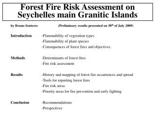
Forest Fire Risk Assessment on Seychelles main Granitic Islands. by Bruno Senterre (Preliminary results presented on 30 th of July 2009). Introduction -Flammability of vegetation types -Flammability of plant species -Consequences of forest fires and objectives

E N D
Forest Fire Risk Assessment on Seychelles main Granitic Islands by Bruno Senterre (Preliminary results presented on 30th of July 2009) Introduction -Flammability of vegetation types -Flammability of plant species -Consequences of forest fires and objectives Methods -Determinants of forest fires -Fire risk assessment Results -History and mapping of forest fire occurrences and spread -Tools for reporting forest fires -Fire risk areas -Priority areas for fire prevention and early fighting Conclusion -Recommendations -Perspectives
1. Introduction Flammability of tropical rain forests Tropical rain forest [1]- Tropical deep humid forest; Wet (evergreen) forest; foret dense hyperhumide [2]- Tropical ombrophilous forests; Rain forest; evergreen monsoon forest; foret dense humide sempervirente [3]- Tropical and subtropical evergreen seasonal forests; Moist semideciduous forest; foret dense humide a tendance semi-decidue Tropical dry forests [4]- Tropical and subtropical semi-deciduous forests; Semideciduous rain forest; monsoon forest; foret dense humide semi-decidue [5]- Tropical and subtropical deciduous forests; Dry forest; foret dense seche [6]- Evergreen broad-leaved woodlands; woodlands; foret claire Non forests [7]- Evergreen broad-leaved shrublands (or thickets); shrublands [8]- Grasslands; savanes (>1200-1300 mm / year and < 2-3 consecutive dry months) Fire immune Understory creeping fire Occasional fires Fire related 1
1. Introduction Flammability of tropical rain forests Zonal vegetation types (climate related) cf. previous slide, mostly corresponding to continentality, latitude and / or wind exposition (Foehn) Azonal vegetation types (microclimate related) 1- Drainage (sands, inselbergs, etc.) 2- Water logging or flooding (valleys, ravines, swamps) 3- Coastal 4- Temperature (altitude) 5- Disturbance 6- Non natural (% dominant ; invasive-planted sp.) Non flammable tropical rain forests may become flammable if affected by 1 or several of these limiting factors, e.g.typically associated with inselbergs and disturbance (e.g. logging) and if combined with ignition or extreme dry spell events (e.g. Amazonia and SE Asian monsoon forests (semi-deciduous)) 2
possible natural fires fires sensitive 1. Introduction Flammability of tropical rain forests Inselbergs (glacis) vegetation types within the rain forest zone equivalent to trop. semi-deciduous forests [4] equivalent to trop. moist semi-deciduous [3] trop. evergreen rain forest [2] 3
1. Introduction Understanding vegetation types and indicator species Throughout the tropics the main vegetation types are driven by the combination of the limiting factors cited here: -Climate; -Drainage; Water logging; Coastal; Temperature; Disturbance (natural or not) Each of these zonal and azonal factors corresponds to a gradient of values, with mesic situations and 1 (e.g. disturbance) or 2 extremes (e.g. macroclimate) Vegetation types can be defined as a combination of several of these limiting factors, and names are generally given based on the 1 or 2 most “visible” ones (“coastal”, “coastal swamp”, etc.) and the general physiognomy resulting (“coastal shrubby fringe”). Because more than 2 factors may combine (e.g. secondary ravine montane forest), comprehensive classification systems must be “modular”, i.e. “open classification” concept. Indicator species may be associated with 1 limiting factor and occur in several vegetation types having in common this limiting factor, combined with any other factor, or where at least 2 limiting factors are combined in different ways but result in similar ecological constraint (ecological equalizations) e.g. glacis species with wide altitudinal range e.g. submontane forest – lowland deep humid forest – lowland valley forests (bi- to tri-polar species) e.g. rain forest inselberg forest fringe – semi-deciduous early secondary tree species 4
1. Introduction Vegetation types in the Seychelles and their flammability (Vesey-Fitzgerald 1940, Procter 1984) 1 2 3 4 5 6 7 8, 9, 10, 11 12, 13 ,14, 15 Mangrove Coastal Swamps (Lowland littoral ??) Lowland hills Lowland valleys Lowland boulders Submontane swamps, hills, valleys, boulders Lower montane swamps, hills, valleys, boulders Mangrove Coastal Swamps (Lowland littoral ??) (mesic habitat to deep humid) Lowland hills (drainage limiting) Lowland valleys Lowland boulders Submontane swamps, hills, valleys, boulders Lower montane swamps, hills, valleys, boulders [2] [1] [3] [4] 1 2 2 2 3 3 5 5 7 5 7 7 7 7 9 5
1. Introduction Vegetation types in the Seychelles and their flammability Previous to human influence, extreme dry spells may have resulted in local fires in lowland glacis (type 7), which could have extended somewhat to nearby lowland hills (type 5): “dry palmetum” Pirates, French settlement, forest logging, mostly from 18th and 19th centuries have rendered the same vegetation types (5 + 7) sensitive to less extreme dry spells and most of it burned due to human ignition, resulting in today’s “bushes”, i.e. degraded open woodlands, shrublands and grasslands. Those fire-degraded habitat have often been colonized by fire-dependant species, e.g. bracken fern, and natural dry palmetum secondary species But regeneration process is slower than usual because the frequency of fires has been more intense than “usual” (in natural conditions), and therefore soils have been too degraded. In addition, the fire stress still persist due to human influence (ignition) and therefore regeneration never has the chance to get to advanced stage and such bush vegetation types maintain a high flammability. Finally, logging or understory clearing without removing drying material still persists in otherwise less sensitive vegetation types (lowland hills, and somewhat to submontane hills) which may burn from contact with nearby bushes and which may result in more bushes. 6
1. Introduction Flammability of plant species Dicranopteris linearis Probably native in the Seychelles and originally associated with shrubby and herbaceous fringes (and mosaics) on glacis, as it is on Central African inselbergs. Its range has extended due to 1-logging of mesic and hill forests from all altitudinal belts and 2-increasing available post-fire lands to be colonized. Phoenicophorium borsigianum This is one of native species with widest ecological range. When it occurs in forest environments, it is not a fire hazard. But as soon as it is in open habitats, e.g. logged woodlands, secondary woodlands, post-fire shrublands (i.e. “bushes” sensu lato), this species is without any doubt a considerable fire hazard. The same is true although less markedly for the other 2 dry zone native palms. Pandanus multispicatus and P. balfouri P. multispicatus is a species of the shrubby fringe (or mosaic) of glacis habitats, in lowland and submontane belts, so a natural fire-related plant species, also known to colonize degraded red earth. P. balfouri has a similar ecology to the previous species but limited to lowland belt, mostly coastal. Other flammable species include: Dillenia ferruginea (as Latanyen Fey), Gazon Trel, Eucalyptus spp., Pinus spp., Casuarina equisetifolia, Cinnamon (if slashed and dried in forests). 7
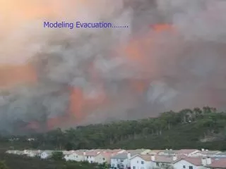
1. Introduction Consequences of forest fires and objectives -Carbon and toxic gazes to atmosphere (global climate change) -Soil erosion: -further Carbon loss -fertility loss (especially if fire repeats faster than regeneration) -downward flooding and coastal sedimentation -decreased water retention -Soil exposition: -induration and toxicity (ferralitization) -decreased water retention -Decreased evapotranspiration, and reduced rainfall (local climate change) Objectives -preserve biodiversity -preserve water catchements -preserve forest resources -preserve soil fertility -preserve coastal ecosystems -preserve climate 8
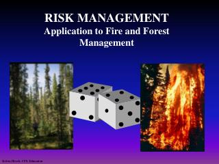
2. Methods Forest Fire Risk Assessment -Literature review -Annual Reports D. Agriculture (1883-1971) -Forest Fire Fighting Reports (>1998) -Fire calls list -La Nation Gibson 1938; Henry 1976; Swabey 1961; Dauban 1976; Duncombe 1996; Fauvel 1909; Gardiner 1907; Indufor 1993; Lanier 1995; Nevill 2007; Piggott 1968; Varley 1971; Vielle 1997; Webb 1961 -Interviews -Field Visits -Forest fire risk modeling -literature review -factor analysis (climatic, human, ecological, vegetation determinants) -semi-quantitative overlay analysis of determinant factors in GIS -qualitative observations where required data are not available 9
3. Results Distribution of forest fires (132 forest fire records) Praslin 79 (but here including very small ones) (> 1958) Mahé 41 (1919, 1950-70, >1998) Curieuse 2 (1771, 1967) La Digue 2 (1999, 2004) Félicité 1 (1894) Silhouette 3 (1914, late 1950s, 1964) Sainte Anne 1 10
3. Results Distribution of forest fires Detailed and abundant data is only available for Praslin, mostly for the last decade Therefore the study of the distribution and determinants of forest fires is basicaly from WIOLAB report more reporting large fires replaced by medium ones Increasing capacity in fire fighting methods since the late 1990s But -incomplete fire records -burnt extent and localization very approximate Need database Need GIS 11
3. Results Distribution of forest fires 12
3. Results Forest fire risk assessment Determinants of forest fires Most fires started in areas with high trail density (human as ignition) and bush vegetation Than, spread is mostly on the ridges and hill slopes, not in the valleys Finally, the total burnt extent is related to intensity of the dry spell, i.e. major fire if > 1 dry month Major forest fires: Mostly malicious, negligence (burning rubbish) and wild honey harvesting 13
3. Results Forest fire risk assessment Forest fire risk = Forest fire ignition risk + spreading risk + fighting difficulty (but most authors only consider ignition risk) Most used factors Vegetation types, Distance to settlements, Distance to roads and paths, Population density Rainfall, altitude, Topography (ridge vs. valley), Slope angle, aspect (north vs. south), aspect (windward vs. leeward) Model building -chose a limited number of factors (3-5) with GIS data -reclassify values in a semi-quantitative scale corresponding to ignition risk (5-10 classes) -overlay the GIS layers (factors) giving them a relative weight in relation to their importance 14
3. Results Forest fire risk assessment (Indufor 1993) (1 = very low; 2 = low; 3 = moderate; 4 = high; 5 = very high risk) Forest fire ignition risk = (0.55 . Veg) + (0.2 . DRoad) + (0.15 . Slope) + (0.1 . DSettlements) 15
3. Results Forest fire risk assessment 16
3. Results Forest fire risk assessment 17
3. Results Forest fire risk assessment Limitations of the model -Vegetation map is not detailed enough (Palm forest, glacis, etc.) -Vegetation map contains many errors due to unsupervised classification of satellite images and hillshades 18
3. Results Forest fire risk assessment Morne Blanc (Mahe) Fond Azore (Praslin) 19
3. Results Forest fire risk assessment Limitations of the model -Vegetation map is not detailed enough (Palm forest, glacis, etc.) -Vegetation map contains many errors due to unsupervised classification of satellite images -Choice of the determinant factors and their relative weight only supported by qualitative analysis (because historic fire occurrence data is weak: localization and records approximate) Solutions -Produce a vegetation map using a more suitable and more objective definition of classes (to be based on aerial photographs, classification methods (Landsat + Textural) and detailed field observations) -Use Landsat archives for 10 consecutive years in order to get complete data on fire occurrences -Use a qualitative approach focusing on bushes occurring near valuable areas in order to go directly to the identification of the priority areas for fire prevention and early fighting 20
3. Results Priority areas for fire prevention and early fighting Main criteria -Conservation value: -diversity of species -diversity of habitats -presence of rare species -presence of rare habitats -presence of rare environmental conditions (potential rare habitats and sp.) -size -”representativeness” (contains most of the total habitat diversity) -threat (invasive, etc.), land ownership -isolation (e.g. Praslin’s submontane patch at Fond Azore) -degree of exploration and sampling bias to be taken into account -Fire risk: -bush vegetation (highly flammable vegetation is near) -human ignition risk (trails, social tentions, etc.) -flammability of the conservation area 21
3. Results Priority areas for fire prevention and early fighting Jeffrey 1962 Swabey 1970 Carlstrom 1996 Hill 2002 Gerlach 2008 22
3. Results Conservation value 23
3. Results Fire risk 24
3. Results Priorities for fire prevention and early fighting 25
4. Conclusion -3 areas are Very High priority (5): -Bernica -Belle Vue – Gd Congomann -Jardin Maron -20 areas are High priority (4) Recommendations -Fire data should be entered into a database coupled with GIS -Vegetation maps would be needed to provide more details on the Fire Risk areas -The conservation value also need to be more investigated -Prevention through education and Silhouette priority (helicopter) 26