Download
1 / 19
190 likes | 328 Vues
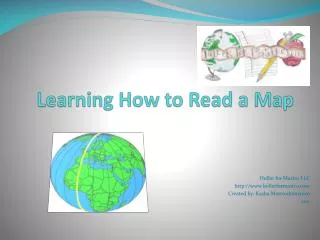
Learn to create an effective map using the TODALSIGS method: Title, Orientation, Date, Author, Legend, Scale, Index, Grid, and Source. Understand the importance of each component to convey clear information. Follow practical steps for political maps, including color usage, labeling conventions, and symbol definitions in the legend. Gain insights into coloring techniques and the use of special glossary terms. This guide will help you craft maps that are not only informative but also visually appealing, ensuring you score well on your project.

E N D
How to Make an A on a Map! Cy-Woods HS 2012/13
TODALSIGS • T : Title • O : Orientation • D : Date • A : Author • L : Legend • S : Scale • I : Index • G : Grid • S2 : Source • Your maps need to include these things.
TITLE • Title lets the reader know what the map is about
Orientation (COMPASS) • Orientation tells the reader direction - NSEW
Date • Date tells the reader when the map was made
Author • Author tells the reader who made the map
Legend • Legend tells the reader how to read the map and what the different symbols mean
Source • Source tells the reader where the cartographer got his/her information • Textbook or Atlas for you. MLA format
Index • Index provides the reader with a list of all the information portrayed on the map • This will not be applicable to most of the maps you make.
Grid • Grid helps the reader determine exact location (ex: Latitude/Longitude coordinates)
Scale • Scale tells the reader the size of the map in relation to its size in the real world
When you make your own map… • 1. Use correct TODALSIGS. • Most often this will be TODALS2 • Title, Orientation, Date, Author, Legend, Source, • Put everything in the Legend on BOTH sides of the map.
Following Directions… • 1. On Political maps: color or outline ALL countries, with no two colors that are the same touching each other • 2. Abbreviations are okay for physical features. (ex. R. Mnts. Mt.) • 3. Label everything.
Coloring and Shading… • Colored Pencils ONLY! (no crayons, markers or highlighters) • Color lightly. • You will lose points for a messy map.
Lettering… • Write Political features in ALL CAPS, horizontally where possible (Chile?) • Label cities and capitals in red. • Label physical features along the feature.
Legends, Colors and Symbols… • Everything except cities and water can be labeled in black. 2. Coloring is important. 3. Put everything in the legend.
Water… • Color at least 1/2 inch off of each coastline. 2. ALL WATER FEATURES SHOULD BE COLORED AND LABELED IN BLUE (lakes, rivers, oceans, seas)
Special Glossary Terms • Be sure to include this in your Legend. • Create a new symbol for the legend for items like valleys, canyons, etc…
8th Continent Map • This map will be worth 1 quiz grade .