Download
1 / 9
90 likes | 384 Vues
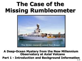
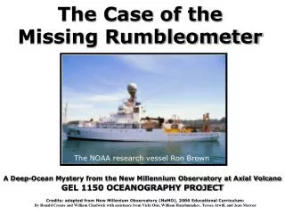
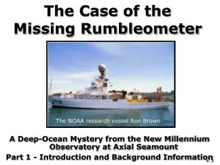
The Case of the Missing Rumbleometer. A Deep-Ocean Mystery from the New Millennium Observatory at Axial Seamount Part 1 - Introduction and Background Information. The NOAA research vessel Ron Brown. v. 2. A Mystery to Solve.

E N D
The Case of the Missing Rumbleometer A Deep-Ocean Mystery from the New Millennium Observatory at Axial Seamount Part 1 - Introduction and Background Information The NOAA research vessel Ron Brown v. 2
A Mystery to Solve Oblique view of the seafloor around Axial Seamount (white area near the center). In this computer generated image blue areas are deep and white are shallow. Several months ago, thousands of small earthquakes were detected at Axial Seamount. Something weird must be happening... Your mission is to go to Axial Seamount and find out what happened there.
Part 1Introduction and Background Information Before you go out to Axial to investigate what caused the earthquakes, you need a little background information. Fortunately, a multi-year seafloor observatory called NeMO was recently started at Axial. NeMO stands for “New Millennium Observatory”. Cartoon of the NeMO Observatory at Axial with its summit area.
Axial Seamount Axial Seamount was chosen for the NeMO Project because it is very active. Axial rises 1000 meters above the surrounding seafloor and yet is still 1400 meters below sea level. A large area, which is 3-km wide, 8-km long, and 100-meters deep marks its summit. Oblique view of the seafloor around Axial showing the summit area. In this computer generated image purple is deep and orange is shallow.
Juan de Fuca Ridge Axial is located on the Juan de Fuca Ridge, a prominent feature on the seafloor of the northeast Pacific Ocean, about 300 miles offshore of Oregon and Washington. Map of the northeast Pacific Ocean.
The ROPOS Vehicle You will be going on an expedition to Axial on the NOAA Ship Ron Brown, an oceanographic research vessel. To reach the seafloor nearly a mile below the surface, you must use an unmanned submersible called ROPOS which is lowered on a fiber-optic cable and controlled from the ship. ROPOS is capable of performing a variety of scientific tasks. The ROPOS remotely operated vehicle (ROV). ROPOS pilots at the control console.
What happened to the Rumbleometer? In the classroom, your goal is to find out what happened at Axial during the recent events. What happened to it? If you get it back, the data it recorded will help you interpret what happened at Axial during these mysterious events. The Rumbleometer instrument on deck before it was lowered to the seafloor.
Get Ready to Set Sail Now you are ready to go to sea to try and discover what happened out at Axial. The Ron Brown is waiting at the dock…… The NOAA ship Ron Brown at the dock.
This is Part 1 of 4 of the NeMO Curriculum, which is available at http://www.pmel.noaa.gov/vents/nemo/education.html The NeMO Curriculum was funded byThe National Science Foundation Geoscience Education Program With additional support from the NOAA Vents Program and Oregon SeaGrant Written by Ronald Crouse and William Chadwick with assistance from Vicki Osis, William Hanshumaker, Teresa Atwill, and Jean Marcus