Download
1 / 35
350 likes | 548 Vues
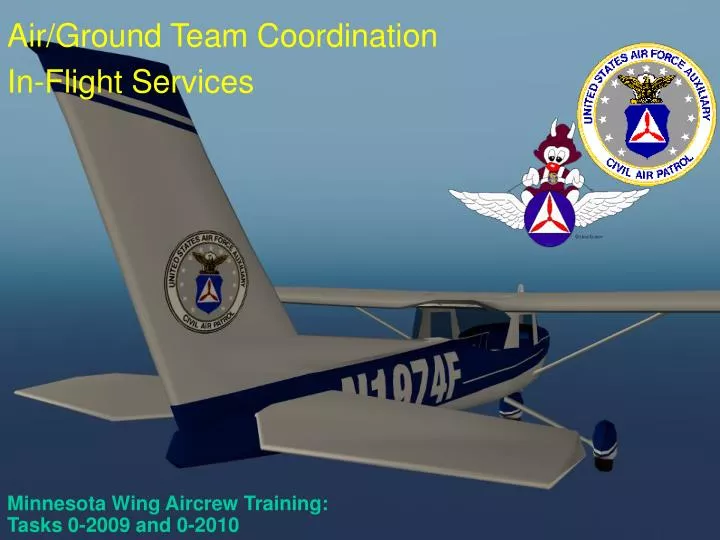
Minnesota Wing Aircrew Training: Tasks 0-2009 and 0-2010. Air/Ground Team Coordination In-Flight Services. Air/Ground Team Coordination. N98987. Introduction. The importance of air-to-ground coordination in CAP missions cannot be overstated.

E N D
Minnesota Wing Aircrew Training: Tasks 0-2009 and 0-2010 Air/Ground Team Coordination In-Flight Services
N98987 Introduction • The importance of air-to-ground coordination in CAP missions cannot be overstated. • The purpose of this block is to teach appropriate techniques and avoid common air-to-ground coordination pitfalls.
Why Air-To-Ground Coordination? • Air-to-Ground Coordination is a core competency: • It is the best way to keep CAP in the SAR business! • CAP is the nation’s premier air-to-ground coordination SAR organization: in fact, we are the only nationwide organization that practices it! • CAP must continue specialize in this area to eliminate duplication of resources with other organizations. • CAP capitalizes upon this strength during interagency (ICS) operations for the mutual benefit of all.
Staging • If aircraft are the primary search resource, ground units should be placed on standby at the same time, or preferably dispatched to advance positions. • Sudden weather changes may force suspension of the air search. If ground units aren’t staged, considerable time may be lost. • Should the aircrew make a sighting and ground units aren’t immediately available, valuable time is lost. • If ground units are the primary search resource but aircrews may be needed, the air units should be alerted at the beginning of the search. • Time is needed to locate aircraft and aircrews, brief them, plan and preflight, launch, and fly to the scene.
The Briefing • Often, aircrews will ignore the importance of the ground team and will not brief with the team prior to launch. Although this is not always possible, the opportunity to establish ground rules can be the difference between success and failure on an actual mission.
The Briefing • Air and ground teams should agree on… • Communication frequencies • A rendezvous location and time window • Pre-coordinated signals • Lost communications procedures • The type of support the aircraft can provide the ground team
The Briefing • Air and ground teams should use the same maps: • Sectionals are not detailed enough for ground search, but are necessary when ground units work with aircraft. • Medium-scale maps, such as U.S. Forest Service, Bureau of Land Management, U.S. Geological Survey intermediate scale (1:100,000), and local maps are the most versatile for air/ground coordination. • Topographic maps are difficult for aircrews to use but are needed when low-level and contour searches are flown.
The Basic Plan • The aircrew locates the search objective. • The aircrew then must bring the ground team to the objective to complete the mission. • There are several ways to accomplish this. • A combination of techniques is also effective.
GPS Coordination • An aircrew can mark the target using GPS (or LORAN) equipment. • The crew can then radio the Lat/Long coordinates to the ground team. • Even if the ground team is not GPS-equipped, they can mark the coordinates on a map and navigate to them.
Getting It Together • It is often difficult to get the aircrew and ground team within positive visual contact of one another. • A common rendezvous point may be used • e.g., “Bill’s Gas Station at the corner of I-15 & Hwy 66” • Ground team can also radio their current GPS coordinates to the aircrew, and the aircrew then navigates to the GT. • Aircrews must know what the ground team members are wearing (high visibility).
What Did You See on the Last Slide? • There were four people in the previous slide • Did you see them all? • Two individuals are wearing orange vests • Two aren’t • Conclusion: • Ground Team Members need to wear highly visible vests! • Aircrews can’t help Ground Teams very well if they can’t see them!
Who Does What? • Once positive visual contact is established, one of the most challenging tasks is to maintain sight of the ground team. • Distinctive vehicle markings of the roof of the vehicle aid in this task. • The scanner is usually the best choice to keep sight of the ground team.
Leading the Team by Radio • The most common method of coordination is also the easiest: • Example: • Aircraft leads GT to site (i.e., aircraft to ground team: “CAPPER 112, CAPFLIGHT 4239; turn left at the next dirt road”). • Transmit the lat/longs from the GPS unit: i.e., aircraft to ground team: “CAPPER 112, CAPFLIGHT 4239, the target is at coordinates N 45º 23.72’, W 106º 47.32’, the ground team then may self-navigate to the target or may also continue to be led by the aircrew.
Common Pitfalls • Problem: The aircraft is working from a aeronautical chart and the ground team is working from a road map. • Solution: The aircrew can have two copies of identical road atlases which will provide a common set references. Crews can also photocopy each other’s maps. This communications failure (which occurs before either crew leaves mission base) can be the first link an a chain of errors.
Common Pitfalls • Problem: The aircraft flies much faster than the vehicle, which only averages around 45 miles per hour on the highway. • Solution: The aircraft can fly a daisy chain or creeping line over the aircraft to increase its over ground distance, allowing it to stay with the vehicle.
Aircraft Motion Signals NO YES Message received and understood
KEEPING UP WITH THE GROUND TEAM • AIRCRAFT ACTION: Aircraft approaches the vehicle from the rear and turns in a normal manner right (or left) to re-approach the vehicle from the rear. Circle back as necessary using oval patterns and flying over the team from behind, indicating that they should continue. This process may be referred to as a “Daisy Chain.” Daisy Chain over the ground team as long as necessary. • DESIRED TEAM ACTION: Continue driving in indicated direction along this road.
Comm-Out Air to Ground Coordination • These signals are designed to be used if two-way radio communication cannot be established • They may also be used as a standard to be followed in addition to two-way radio communication • This adds to the clarity of coordination • This practice also enables you and the ground team to keep proficiency in these signals
TURNING THE GROUND TEAM AROUND • AIRCRAFT ACTION :Aircraft approaches the vehicle from the rear and then turns sharply right (or left) in front of the vehicle while in motion. Circle back as necessary flying against the team’s direction of travel, then take up the ‘keeping up’ procedure outlined above. • DESIRED TEAM ACTION: Turn vehicle around.
TURN • AIRCRAFT ACTION: Aircraft approaches the vehicle from the rear and then turns sharply right (or left) in front of the vehicle while in motion. Circle back as necessary using oval patterns and flying over the team from behind, indicating that they should continue. • DESIRED TEAM ACTION: Turn vehicle to right (or left) at the same spot the aircraft did and then continue in that direction until further signals are received.
STOP or DISMOUNT • STOP • AIRCRAFT ACTION :Aircraft approaches the vehicle low and head-on while the vehicle is moving • DESIRED TEAM ACTION: STOP the vehicle and await further instructions • DISMOUNT • AIRCRAFT ACTION: Aircraft makes two (or more) passes in same direction over a stopped ground team • DESIRED TEAM ACTION: DISMOUNT (get out of) the vehicle, then follow the aircraft and obey further signals (proceed on foot)
OBJECTIVE IS HERE • AIRCRAFT ACTION : Aircraft circles one geographic place • DESIRED TEAM ACTION: Proceed to the location where the low wing of the aircraft is pointing; that is the location of the target.
Communications • The radio is the primary link to the ATC system • The most important part of pilot-controller communications is understanding • Brevity is important • Professionalism is important; it enhances safety and brings you better service
Technique • Check for proper frequency. • Check volume. • Mentally compose message before transmitting. • Listen before transmitting. • Key mike, pause briefly before talking.
Message Format • Who*Who you are calling.*Who you are. • Where*Your location • What*Your request
CAP Aircraft Call Signs • CAP has the FAA authorized call sign “Capflight.” • FAA call signs are stated in group form. • CPF4239 is stated as “Capflight forty-twothirty-nine.” • Required by AIM and FAA 7110.65
CAP Aircraft Call Signs • CAP aircraft should use the word “Rescue” in their call sign when priority handling is critical. • “Capflight forty-two thirty-nine Rescue.” • DO NOT abuse this.
In-Flight Services - FSS • Flight Service Stations (FSS) provide weather information before and after takeoff • Some FSS provide transcribed weather briefings • FSS can provide assistance to a pilot who has temporarily misplaced himself (i.e., he’s lost) • FSS having voice services on VOR or NDB broadcast at 15 minutes after the hour • Weather reports and advisories • Pilot and radar reports • Alerts and Notices to Airmen (NOTAM)
In-Flight Services - ATIS • Broadcast continuously (taped) • Actual weather information, updated hourly or when special conditions warrant • Frequency found on sectional or in A/FD
In-Flight Services - AWOS • Automated Weather Observation System • On sectional by airport name • Transmitted UHF or on navaid • Real time information includes: • Location and time • Wind speed, direction and gusts • Temperature and dew point • Altimeter setting • Density altitude when it exceeds field elevation by 1000’ • Can go to www.anyAWOS.com or call 800-any-awos
In-Flight Services - ASOS • Automated Surface Observing System • On sectional by airport name • Transmitted VHF or on navaid; also telephone • Real time information may include: • Location and time • Wind speed, direction and gusts • Visibility and cloud height • Temperature and dew point • Altimeter setting • Density altitude when it exceeds field elevation by 1000’
In-Flight Services – PIREP’s • Pilot Weather Reports • Very useful to other pilots • Information should include: • Type of aircraft (Cessna 172) • Location (usually in relation to a VOR) • Cloud bases, tops and layers • Flight visibility • Precipitation • Visibility restrictions (e.g., smoke, haze and dust) • Temperature and wind