Download

1 / 28
280 likes | 432 Vues
Monitoring Saturated and Un-saturated Zone Processes for Improving Integrated Modeling. Patrick Tara, Jeff Vomacka, Mark Ross Center for Hydrologic Modeling and Aquatic Systems Jeff Geurink, Ron Basso. Why Collect Data? Determine Water Budget Terms. ET budget? Vadose zone ET Groundwater ET

E N D
Monitoring Saturated and Un-saturated Zone Processes for Improving Integrated Modeling Patrick Tara, Jeff Vomacka, Mark Ross Center for Hydrologic Modeling and Aquatic Systems Jeff Geurink, Ron Basso
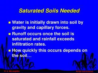
Why Collect Data?Determine Water Budget Terms • ET budget? • Vadose zone ET • Groundwater ET • Surface water runoff? • Infiltration excess • Saturation excess • Baseflow flux? • Surface water storage release • Groundwater storage release
Why Collect Data?Answer Fundamental • Groundwater upward flux (capillary fringe)? • Vadose zone or water table recharge? • Variable specific yield? • Air entrapment
Site Location HillsboroughCounty F L O R I D A Reservoir Site Location Reservoir Site Location
Installed InstrumentationWeather • Rainfall • Continuous tipping bucket rain gages (3 gages) • Standard NWS manual rain gages (3 gages) • Pan evaporation • Wind speed / wind direction • Temperature / humidity / solar radiation
Installed Instrumentation Hydrologic • Streamflow (5 installations) • Complex “V”-notched weirs • Continuous stage recorders • Wells • Continuously recorded (12 gages) • Weekly manually recorded (83 wells) • Runoff test-bed (1 installed, 1 in progress) • Continuous soil moisture probes (6 installations)
Long Flat Creek Flow and Flow Difference 180 40 Upstream Downstream 160 Flow Difference 20 140 120 0 100 Flow Difference [cfs] Flow [cfs] -20 80 60 -40 40 -60 20 0 -80 8-Jul 28-Jul 17-Aug 6-Sep 26-Sep 16-Oct 5-Nov Date Streamflow Analysis
Runoff Test-bed • Size 100ft x 20ft (30.5m x 6.1m) • Flashed to prevent inflows/outflows • Gutter captures runoff • Weir with continuously logged precision level gage allows accurate flow measurement • Rain gage • Wells • Soil moisture probes
Runoff Test-bed ATION in Feet
Runoff Test-bed Schematic Monitoring wells Perimeter Flashing 100’ 20’ Overland Flow Weir Soil moisture probes Gutter
Runoff Test-bed Flow Measurement V-Notched Weir plate Overland Flow Cross-section of runoff gutter which captures the overland flow and discharges to a weir in order to measure flow Discharge to Land Surface via conduit
Runoff Test-bed Data June 25-26, 2002
Soil Moisture • Frequency domain • Continuously monitors wetting as well as drying • Captures upward flux • Captures air entrapment • Typical probe includes 8 transducers spaced at 10, 20, 30, 40, 50, 70, 100, 150cm below land surface
PS 41 Soil Moisture Profile Response to 1.97 Inches of Rain on 2/22/02 Moisture (%) 0 5 10 15 20 25 30 35 40 45 0 20 40 60 Depth (cm) 80 100 120 140 160 2/22/2002 9:50 Water Table 2/23/2002 3:20 Water Table 2/23/2002 21:00 Water Table 2/24/2002 21:00 Water Table 2/26/2002 21:00 Water Table 2/28/2002 21:00 Water Table 3/1/2002 21:00 Water Table Soil Moisture Profiles
PS 43 Soil Moisture Profile Response to 1.97 Inches of Rain on 2/22/02 Moisture (%) 0 5 10 15 20 25 30 35 40 45 0 20 40 60 Depth (cm) 80 100 120 140 160 2/22/2002 9:50 Water Table 2/23/2002 3:30 Water Table 2/23/2002 21:00 Water Table 2/24/2002 21:00 Water Table 2/26/2002 21:00 Water Table 2/28/2002 21:00 Water Table 3/1/2002 21:00 Water Table Soil Moisture Profiles
0.18 2 y = 0.0056x + 0.0047x 0.16 2 R = 0.6087 0.14 0.12 0.1 y S 0.08 0.06 0.04 0.02 0 0 1 2 3 4 5 depth below land surface (feet) Estimated Specific Yield Poly. (Estimated Specific Yield) Variable Specific Yield
Preliminary Results • Air entrapment is an important process • Event pressurization • Prolonged encapsulation • Specific yield is not constant (shallow water table) • Small ET and recharge fluxes result in significant water table fluctuations • Saturation excess is dominate runoff process • Maybe controlled by air entrapment? • Vadose zone moisture deficit controls recharge • Rainfall intensity effects all above processes
PS 42 Soil Moisture Profile Response to 1.97 Inches of Rain on 2/22/02 Moisture (%) 0 5 10 15 20 25 30 35 40 45 0 20 40 60 Depth (cm) 80 100 120 140 160 2/22/2002 9:50 Water Table 2/23/2002 3:30 Water Table 2/23/2002 21:00 "Water Table" 2/24/2002 21:00 Water Table 2/26/2002 21:00 Water Table 2/28/2002 21:00 Water Table 3/1/2002 21:00 Water Table Soil Moisture Profiles