Download
1 / 20
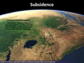
Subsidence Mapping in Harris County, Texas
200 likes | 372 Vues
Subsidence Mapping in Harris County, Texas. Taryn Tigges CE 394K – GIS in Water Resources Fall 2012. Project Background. Compaction. Methods: Water Level Mapping. Data Sources. Water Levels. Base Maps. Model. Well Types. Frequency of Water Level Meaurements.
Télécharger la présentation 
Subsidence Mapping in Harris County, Texas
An Image/Link below is provided (as is) to download presentation
Download Policy: Content on the Website is provided to you AS IS for your information and personal use and may not be sold / licensed / shared on other websites without getting consent from its author.
Content is provided to you AS IS for your information and personal use only.
Download presentation by click this link.
While downloading, if for some reason you are not able to download a presentation, the publisher may have deleted the file from their server.
During download, if you can't get a presentation, the file might be deleted by the publisher.
E N D
Presentation Transcript
Subsidence Mapping in Harris County, Texas TarynTigges CE 394K – GIS in Water Resources Fall 2012
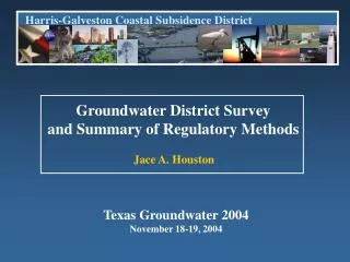
Data Sources Water Levels Base Maps
Data Sources Clay Compaction Measurements
Summary • Water management has helped Houston increase groundwater levels since 1973 • Subsidence has increased in Harris County since 1973 • More monitoring points exist for water level measurements than for clay compaction measurements • Groundwater levels and subsidence are related


More Related