Download
1 / 57
570 likes | 1k Vues
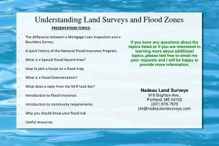
PRESENTATION TOPICS The difference between a Mortgage Loan Inspection and a Boundary Survey. A quick history of the National Flood Insurance Program. What is a Special Flood Hazard Area? How to plot a house on a flood map. What is a Flood Determination?

E N D
PRESENTATION TOPICS • The difference between a Mortgage Loan Inspection and a Boundary Survey. • A quick history of the National Flood Insurance Program. • What is a Special Flood Hazard Area? • How to plot a house on a flood map. • What is a Flood Determination? • What does a reply from the NFIP look like? • Introduction to flood insurance. • Introduction to community requirements. • Why you should know your flood risk. • Useful resources Understanding Land Surveys and Flood Zones If you have any questions about the topics listed or if you are interested in learning more about additional topics, please feel free to email me your requests and I will be happy to provide more information. Nadeau Land Surveys 918 Brighton Ave., Portland, ME 04102 (207) 878-7870 jim@nadeaulandsurveys.com
A Mortgage Loan Inspection has never been a Class D Survey. A Class D Survey pertains to Positional Accuracy of Field Measurements.
Deed overlaps • Junior/Senior rights • Easements and Rights of Way not in current deed • Any land conveyance not in current deed • Typographical errors in current deed • Encroachments • Original boundary evidence Mortgage Loan InspectionsDO NOT identify: Mortgage Loan Inspections SHOULD NOT be used for: Land Divisions/Subdivisions Land Feasibility Acreage Calculations Site Plans Building Permits
Client Representation based on a Mortgage Loan Inspection will eventually cause you liability. • Just because a municipality accepts it, does not make the use of a Mortgage Loan Inspection correct. They are not Professional Land Surveyors, and they do not understand the process required to correctly re-establish a record boundary line. • An opinion on the location of the boundary lines is only based on the current locus parcel deed and apparent evidence found in the field. • A boundary survey uses the operative deed or plan (the document which initially created the parcel or boundary line) of the locus parcel and the necessary abutting tracts to determine junior/senior rights and original called for monumentation.
Q: What is the area of a 100' x 200' parcel of land? POP QUIZ!!
Mortgage Loan Inspection v. Boundary Survey
PROBLEM: Trying to keep the water away from the people was not working.NEW STRATEGY: Keep the people away from the water. History Of The National Flood Insurance Program During The 1920's, the insurance industry concluded that flood insurance would not be profitable and the rates would be too high to attract customers.In the 1960's Congress decided the traditional methodscontinued to increase in cost.Common types of Flood Prevention, dams and levees, were not working adequately.
Transferring cost to property owners through premiums • Providing aid to property owners • Guiding development away from flood hazard areas • Requiring new or substantially improved buildings to be constructed to flood standards In 1968 Congress passed the National Flood Insurance Act which created the National Flood Insurance Program, with the purpose of:
Lending institutions cannot make, increase, extend, or renew a loan for a building located in the floodplain without NFIP flood insurance It is the responsibility of the lender to: Determine if the property is in the Special Flood Hazard Area Document the determination Ensure the insurance is maintained through the life of the loan Flood Disaster Protection Act of 1973
Increased the maximum amount of flood insurance coverage • Established a grant program for mitigation plans and projects • Enacted stricter penalties on lenders to comply • 5 year visit by FEMA to communities • Increased Cost of Compliance National Flood Insurance Reform Act of 1994
NFIP Basic Parts Insurance Maps Regulations
Base Flood Elevation (BFE): The height above sea level to which flood water would be expected to rise in a base, or 100 year flood event. Floodplain 101
100 Year Flood • 1 percent annual chance of being equaled or exceeded in any given year. • 100 year flood has a 26% chance of occurring over the life of a 30 year loan. (5% for a home fire) Many types of information are used to create the map: Old maps Topographic surveys Aerial surveys Hydrology studies Mapping
A FEMA-identified high-risk flood area where flood insurance is mandatory for properties. An area having special flood, mudflow, or flood-related erosion hazards, and shown on a Flood Hazard Boundary Map or a Flood Insurance Rate Map as Zone A, AO, A1-A30, AE, A99, AH, AR, AR/A, AR/AE, AR/AH, AR/AO, AR/A1-A30, V1-V30, VE, or V. Special Flood Hazard Areas
Types of Flood ZonesHigh Risk – Special Flood Hazard Areas AE - An area inundated by 100-year flooding, for which BFEs have been determined. A - An area inundated by 100 year flooding, for which no BFEs have been established. AH - An area inundated by 100-year flooding (usually an area of ponding), for which BFEs have been determined; flood depths range from 1 to 3 feet. AO - An area inundated by 100-year flooding (usually sheet flow on sloping terrain), for which average depths have been determined; flood depths range from 1 to 3 feet. A99 - An area inundated by 100-year flooding, for which no BFEs have been determined. This is an area to be protected from the 100-year flood by a Federal flood protection system under construction. AR - An area inundated by flooding, for which BFEs or average depths have been determined.
VE - An area inundated by 100-year flooding with velocity hazard (wave action); BFEs have been determined. V - An area inundated by 100-year flooding with velocity hazard (wave action); no BFEs have been determined. VO - An area inundated by 100-year flooding with velocity hazard (wave action); no BFEs have been determined. Types of Flood ZonesHigh Risk – Special Flood Hazard Areas
B - An area inundated by 500-year flooding; an area inundated by 100-year flooding with average depths of less than 1 foot or with drainage areas less than 1 square mile; or an area protected by levees from 100-year flooding. C - An area that is determined to be outside the 100- and 500-year floodplains. X - An area that is determined to be outside the 100- and 500-year floodplains. Types of Flood ZonesModerate to Minimal
What is a Flood Determination? An official declaration stating whether or not a property lies within a Special Flood Hazard Area Generically referred to as a “Flood Certificate” A certificate that protects investors and borrowers by ensuring flood insurance is purchased for properties in at-risk areas. Horizontal scaling only, no elevations. Who uses Flood Determinations? Any federally-regulated lender or government-sponsored enterprise is required to perform a flood zone determination for any mortgage loan they provide Flood Determinations and Types of Challenges
Any flood determination can be disputed. The property owner must prove map error using technical data. Can we dispute?
Incorrect flood determinations • Errors on Maps • Conflicting Data • Outdated Maps • Changes in watershed The National Flood Insurance Program (NFIP) understands this. Inaccuracies Exist
Voluntary and mutual agreement between the Federal Emergency Management Agency (FEMA) and a community Participating communities agree to adopt and administer appropriate regulations – in return all of their residents are eligible for federally subsidized flood insurance What is NFIP?
Letter of Determination Review (LODR) • Letter of Map Amendment (LOMA) • Letter of Map Revision (LOMR) Types of Challenges
Letter of Map Amendment Determination Document (Non-Removal)
Plotting a House • SCALE • Panel 23 of 25 • Community-Panel Number 230162 0023 E • Map Revised: July 15, 1992
Names of streets may differ • Not all streets shown • Some shown incorrectly Plotting a House
Flood insurance not available for structures newly built or substantially improved on and after October 1, 1983 in designated coastal barriers. Plotting a House
Go to municipal office to use paper maps • Use index to find correct panel • Find nearest road intersection on your panel • Do the same for Assessor's Map Go to FEMA.gov Type in address and click on that panel Find nearest road intersection on your panel Create and plot firmette to scale Find tax map online and print Steps To Plotting a Housestart with the Property Address Then • Measure distance from road intersection to your lot on tax map • Measure same distance from road intersection to your lot on flood map • Does it fall in shaded area?
Mapped “In” • Flood risk increased • More structures in floodplain • Mandatory purchase of flood insurance Mapped “Out” Flood risk reduced Risk not eliminated Low-cost preferred risk coverage available Keep coverage, Lower cost Insurance Impacts
Single Family • One Floor • No Basement • No Prior Flood Losses Putting It In Perspective
Do not cancel existing flood insurance policies at the closing table!
In 1968, full rates will be charged on buildings constructed or substantially improved on or after the effective date of the initial FIRM for the community or after December 31, 1974, whichever is later. These buildings are Post-Firm Construction. • Remember one portion of a dwelling could be Pre-Firm and another could be Post-Firm. Pre-Firm / Post-Firm
Defining Pre-FIRM and Post-FIRM Post-FIRM On or After the Initial FIRM Or After 12/31/74... whichever is LATER Pre-FIRM Built before Initial FIRM or On or before 12/31/1974 Community Status Book
How do lenders know maps have changed? Portfolio Reviews – required? Life of loan flood zone determinations Process for requiring flood insurance* Borrower notification – 45 day letter Force Placement ImplementationLender Implementation Issues *Life of loan should tell you
Grandfathering rules do not apply to the Preferred Risk Policy • Building must be located in zones B, C or X on FIRM: • At time of original application & • At each subsequent renewal If map changes to SFHA, convert to standard policy using appropriate zone (B,C, X) Implementation - Preferred Risk?
Allows a property owner to: • “Lock in” a previous Flood Zone • “Lock” in a previous Base Flood Elevation Allows premium benefits after • Changes in map zones • Changes to compliance issues Implementation - Grandfathering Lenders are not required to investigate or resolve differences between Current Flood Zone and Flood Risk/Rated Zone
Developed to address the financial burden of mandatory purchase requirements on policy holders in newly mapped areas • Buildings newly designated within SFHA due to a map revision on or after October 1, 2008, are eligible for coverage under the PRP for a period of up to 2 years* after the later of the two following dates: • The effective date of the map revision, or • January 1, 2011 • Loss history requirements must be met ImplementationTwo-Year Preferred Risk Policy Eligibility Extension *After 2 year extension the policy must be written as a standard rated policy
Buildings that are newly designated within an SFHA due to a map revision on or after January 1, 2011, will be eligible for a PRP for 2 policy years from the effective date of the map revision. ImplementationTwo-Year PRP Eligibility Extension