NCRST Centerline Extraction Technology Workshop
150 likes | 249 Vues
Explore the evolution of centerline extraction technology for transportation applications. Learn about its diverse applications, criteria for evaluation, and how different methods cater to specific needs. Join industry experts for insights and discussions.

NCRST Centerline Extraction Technology Workshop
E N D
Presentation Transcript
What is NCRST • Funded under TEA-21, 1998 • US DOT: Research & Special Programs Administration • Philosophy: rapid evolution of research into commercial products, practice • User consultation and outreach • Partnerships: industry, international
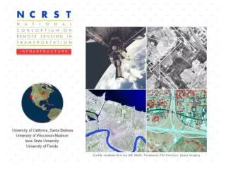
The NCRSTs • Environment — Mississippi State • Chuck O’Hara • Infrastructure — UC Santa Barbara • Raad Saleh (Wisconsin) • Flows — Ohio State • Charles Toth • Disasters — New Mexico • Demin Xiong (Oak Ridge) • 9 Technology Application Partners • Chris Chiesa (Veridian)
NCRST Interest in Centerlines • 3 of 4 consortia have centerline extraction projects • 2 of 9 TAPs are focused on centerline extraction
UCSB Interest in Centerlines • 1970-90 Tobler, Church, Goodchild, etc • Funded by Caltrans, USDOT-FHWA since early 1990s: towards IVHS/ITS models • Modeling of geometric error • GPS, wireless communication • Map rectification • NCRST: remote sensing • ESRI: essential data model for transportation
Why CLEM2001? • Centerlines widely studied • Diverse approaches, each successful in particular domain • To become common practice: • understand niche of each method • faster, cheaper, more accurate • rural vs urban areas • exposed vs canopy, etc • consolidate techniques
Some Centerline Applications • Precision snow plowing ± 0.2 m • ITS messaging … mayday ± 0.1-20 m • Toll by road/lane use ± 2 m • Highway asset management ± 15 m • Elections: right topology • Market research: who uses BrandX toothpaste: ± 500 m
Some Criteria • Cost • Timeliness • Errant counties fail to report • Disaster response • Accuracy • Scope • Neighborhood vs city vs global
Easy Street • New neighborhood • Little or no foliage overhang • Vehicles in garage/driveway
Not so easy • Repairs and surface coats • Paint stripes • Shadows • Parked vehicles • Foliage overhangs
Conclusion • One solution is not necessarily better than the others across all criteria — each has its niche • CLEM2001 is an opportunity to learn from each other
Agenda Structure — Monday • View from the data producers • Don Cooke, GDT — accuracy • Bob LaMacchia, Census — beyond TIGER • Introductory survey of techniques • Raad Saleh
Agenda Structure — Monday • Image analysis techniques • Ed Granzow, Iguana • Demin Xiong, Oak Ridge • Dar Roberts, UCSB • Chris Funk, UCSB • Chris Chiesa, Veridian • Peter Gipps, Quantm
Agenda Structure — Tuesday • GPS/ITS techniques • Christopher Bennett, Montgomery Watson • Charles Toth, Ohio State • Russ Shields, Ygomi • GPS/Photogrammetry demo • Ted Jones/Gay Hamilton Smith, Florida DOT/HSA Consulting
Agenda Structure — Tuesday • Data modeling • Kai Han, U/Manitoba • Terry Bills, GIS/Trans • Kevin Curtin, UCSB • What have we learned, where next (CLEM200x)? • Mike Goodchild, UCSB