Download
1 / 30
300 likes | 324 Vues
Learn about peak flow forecasts, climate outlook, flooding concerns, and recreational points of interest in the Colorado Basin. Get region-specific peak flow forecasts and insights for the spring of 2009.

E N D
Colorado Basin River Forecast CenterSpring 2009 Peak Flow Outlook Webinar May 12th, 2009 Ed Clark Senior Hydrologist Available for download at: http://www.cbrfc.noaa.gov/present/2009/2009may_peaks.ppt
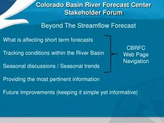
Outline What is in peak flow forecast? Climate Outlook Regional Forecast Summaries Flooding Concerns Recreational Points of Interest Web Reference: www.cbrfc.noaa.gov/gmap/gmap.php
10% 50% 90% Peak Flow: Timing and Expected Peak Flow
Expected Peak Flow • Derived from the operational model and depend upon current snowpack and soil states. • More uncertainty than volumetric forecast as peak flow values are heavily dependent upon specific weather conditions during melt. • Mean Daily Peak. Average flow over a 24 hour period. • Regulated flow. This is the flow observed in the stream.
Snowmelt Peak Vs Deterministic Forecast • Even small precipitation events during peak melt can greatly increase stream levels. • The daily updated forecasts provide the current 10 day forecast based on precipitation and temperature projections from weather models. Web Reference: www.cbrfc.noaa.gov
May 9th, Snow Pack Conditions Web Reference: http://www.cbrfc.noaa.gov/gmap/gmap.php
May 11th, Weather Projections • Strong ridge will develop over the Rockies by the weekend of the 16th, and lasting through the week of may 18th..
Upper Green Below average peak flows. Flooding due to snowmelt not anticipated. Peak Flow Forecasts by Region
Peak Flow Forecasts by Region Yampa and Little Snake Drainages • High Flows have been occurring since Late April • Remaining peaks are expected to be near normal. • Likely occurring week of May 18th.
Peak Flow Forecasts by Region Upper Colorado Main-stem • Peaks are expected to be near to above average. • Many peaks are expected to occur in the next couple of weeks. • Colorado at Cameo has a 10% chance of exceeding flood.
Peak Flow Forecasts by Region Gunnison, Dolores and San Juan • Peaks are occurring or have occurred throughout the Dolores and San Juan Basins. • Remaining peaks are not anticipated to exceed floods stage.
Peak Flow Forecasts by Region Duchesne and Lower Green • Peak flows are expected to be near or below average • No points are expected to exceed flood flow.
Peak Flow Forecasts by Region Eastern Great Basin • Peaks are expected to be near to below average • No points are expected to exceed flood flow
Spring 2009 Flooding Concerns • Colorado nr Cameo (Mesa County, CO) 10% chance of exceeding flood flow.
Points of Flooding Concern Colorado at Cameo 10% 50% 90%
CBRFC Recreation Boating Products Also available by phone 801-539-1311 Web Reference: http://www.cbrfc.noaa.gov/rec/rec.html
Recreational Boating Points Colorado at UT/CO State Line (Westwater Canyon) 10% 50% 90%
Recreational Boating Points Green at Green River, UT (Desolation/Grey Canyons) 10% 50% 90%
Recreational Boating Points Cataract Canyon 10% 50% 90%
Recreational Boating Points Animas nr Durango 10% 25%
Recreational Boating Points San Juan at Bluff 10% 50% 90%
Recreational Boating Points Logan, nr Logan abv State Dam 10% 50% 90%
Recreational Boating Points Provo nr Woodland 10% 50% 90%
Recreational Boating Points Muddy Creek nr Emery (The Chute) 10% 50% 75%
Where to find this information www.cbrfc.noaa.gov www.cbrfc.noaa.gov/product/peak/peak.cgi
Web Reference: www.cbrfc.noaa.gov/wsup/pub2/peak/peak.php?year=2009&month=5
Questions Contacts Edward.Clark@noaa.gov tel: 801-524-5130 ext 325 CBRFC URL: www.cbrfc.noaa.gov
Reservoirs Effecting San Rafael Tributaries http://www.ewcd.org/reservoirs/teacup.php/ Note: Flows in many popular paddling sections that are below reservoirs are hard to predict. However, one may gleam some information of the potential for in channel flow my looking at the current storage capacity in the upstream reservoirs. High storage indicates that more water will be available for release downstream http://www.usbr.gov/uc/water/basin/tc_wf.html
Reservoirs above the Left Hand Fork Huntington May through July Volume forecast is for 36 KAF – which should fill small reservoirs