Download
1 / 21
210 likes | 360 Vues
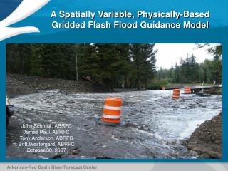
A Spatially Variable, Physically-Based Gridded Flash Flood Guidance Model. John Schmidt, ABRFC James Paul, ABRFC Tony Anderson, ABRFC Britt Westergard, ABRFC October 30, 2007. Arkansas-Red Basin River Forecast Center. What is Flash Flood Guidance?.

E N D
A Spatially Variable, Physically-Based Gridded Flash Flood Guidance Model John Schmidt, ABRFC James Paul, ABRFC Tony Anderson, ABRFC Britt Westergard, ABRFC October 30, 2007 Arkansas-Red Basin River Forecast Center
What is Flash Flood Guidance? • Flash-Flood Guidance represents the rainfall necessary to create flash-flooding on headwater channels within the area in question • It is issued by the RFC as a gridded (4 km x 4 km) data set and as a county-wide value • ABRFC issues it every 6 hours following the run of the hydrologic model. • It is issued for 1, 3, and 6 hour durations • It was a product of the RFC modeling system and had inherited its weaknesses
Legacy Basin, County and Gridded Flash Flood Guidance 60-day precipitation accumulation in Pawnee County, KS ending December 21, 2006. Arkansas-Red Basin River Forecast Center
Issues of Scale and Spatial Variability Basin/County/FFMP Arkansas-Red Basin River Forecast Center
The Gridded FFG Paradigm • Establish Soil Moisture Status at the HRAP grid. • Establish rainfall-runoff relationships that reflect the current soil moisture conditions • Estimate the size of headwater channels at the HRAP grid. • Combine into an estimate of FFG. • Fit seamlessly into the existing RFC and WFO operational flash flood warning architecture. Arkansas-Red Basin River Forecast Center
UZFWC UZTWC LZFPC LZFSC LZTWC Calculating Soil Moisture Conditions Using a Distributed Hydrologic Model National Weather Service Office of Hydrologic Development Research Distributed Hydrologic Model 4km gridded precipitation Sacramento Model Storages Upper Zone Saturation Ratio UZ Sat Dry Wet 4km gridded soil moisture products Arkansas-Red Basin River Forecast Center
NRCS Curve Number Rainfall-Runoff Model for New Orleans, LA 30m NLCD Land Use Land Cover Data + Resultant NRCS Curve Number 1000m STATSGO HSG Data Arkansas-Red Basin River Forecast Center
Varying Curve Numbers by Antecedent Soil Moisture Conditions 75% Upper Zone Saturation * Soil Moisture Adjusted Curve Number Average Curve Number Arkansas-Red Basin River Forecast Center
NRCS Curve Number Adjustment Using STATSGO estimates of saturated hydraulic conductivity to estimate NRCS initial abstraction (S) for each grid cell gives a distribution of possible “saturated” curve numbers Arkansas-Red Basin River Forecast Center
Threshold Runoff (ThreshR) Calculation ThreshR is an estimate of the amount of runoff required in a given basin area to produce flooding flows. Peak Unit Flow = 1300 cfs Flood Flow = 800 cfs ThreshR = Flood Flow / Peak Unit Flow ThreshR = 800 / 1300 = 0.62 Arkansas-Red Basin River Forecast Center
ThreshR Calculation Legacy ThreshR ThreshR Flood Flow (Qs) Qs =f (design storm, slope, curve number) . | . Peak Unit Flow (Qp) Qp =f (slope, curve number) Arkansas-Red Basin River Forecast Center
GFFG Calibration Constant • Certain Thresh-R values came out at or near 0.0. This was due to the very low values for the 2-year, 3-hour precipitation in the western regions of ABRFC. • A “calibration constant” of 0.15 was added to all Thresh-R values to mititgate the problem. • This approximates the minimum OFS Thresh-R values in the western ABRFC Arkansas-Red Basin River Forecast Center
Using NRCS Unit Hydrograph and Hourly RDMS Runoff to Estimate Variable Thresh-R - 0 .1 - tp = 2.5 D = 1.0 Qp = 600 Tb = 5.0 .2 Let Qs = 500 cfs - .3 - 310/500=0.62 Variable T-R = (1- 0.62) * T-R T-R = 500/600= 0.83 Var T-R = 0.38*0.83 = 0.32 Arkansas-Red Basin River Forecast Center
3-hour Gridded FFG Constant vs. Variable Thresh-R May 30, 2007, 12Z 6-Hour Rainfall Ending 5/30 12Z Arkansas-Red Basin River Forecast Center
3-Hour Thresh-R OFS vs. GFFG Arkansas-Red Basin River Forecast Center
LMRFC 3-hour Thresh-R NWSRFS vs. GFFG Arkansas-Red Basin River Forecast Center
GFFG Calculation S = (1000/CN)-10 Q = ThreshR Arkansas-Red Basin River Forecast Center
August 24, 2007 OFS and GFFG Gridded 3-Hour Flash Flood Guidance Arkansas-Red Basin River Forecast Center
GFFG AdjustmentsVariable Thresh-R • Initial results indicated GFFG was provided basin averaged FFG that was similar to but significantly different than Basin FFG from OFS. • Review of events and anecdotal reports from WFOs indicated GFFG was not dropping FFG as low as OFS-FFG did. Values become asymptotic well above values produced by OFS in similar situations. • A variable Thresh-R was one solution used in GFFG to mitigate this. The variable Thresh-R addresses the assumption of an empty stream channel. • The mitigating affects of the variable Thresh-R are significant primarily in the first 6 hours following an event. Arkansas-Red Basin River Forecast Center
Future Work • Verification and Evaluation • Thresh-R Customization Methods and Tools • Project Expansion • ABRFC, LMRFC Operational • SERFC Testing and observation • WGRFC Installation is planned • MBRFC, OHRFC expansion discussions underway
Questions/Contacts John Schmidt (918) 832-4109 john.schmidt@noaa.gov Tony Anderson (918) 832-4109 tony.anderson@noaa.gov James Paul (918) 832-4109 james.paul@noaa.gov Britt Westergard (918) 832-4109 Britt.westergard@noaa.gov Arkansas-Red Basin River Forecast Center