Download
1 / 39
390 likes | 418 Vues
Explore TAMDAR and AERIBAGO validation experiments conducted at Memphis Airport with TAVE data analysis and results.

E N D
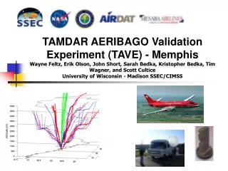
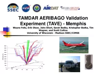
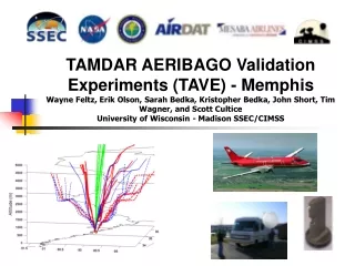
TAMDAR AERIBAGO Validation Experiments (TAVE) - MemphisWayne Feltz, Erik Olson, Sarah Bedka, Kristopher Bedka, John Short, Tim Wagner, and Scott CulticeUniversity of Wisconsin - Madison SSEC/CIMSS
TAVE OUTLINE • TAVE Experiment Description • TAVE Dataset Overview • TAVE-II Improvements • Preliminary Validation Results
TAVE Logistics TAMDAR AERIBAGO Validation Experiment (TAVE-I and TAVE-II) 22 February - 08 March 2005 16 May - 27 May 2005
TAVE-I LOGISTICS • Location: Memphis airport at Air National Guard • Dates/Timing: 23 February - 08 March 2005 (14 days) • Weather: Dry, cool, two periods of rainfall, very little in the way of high dewpoint events/convection • Data: Made available in near real-time, netcdf format from anonymous ftp server • Radiosondes - 49 total launches • 12 Tail Numbers with TAMDAR instrumentation (excluding the 3 with bad sensors) • Web site: http://cimss.ssec.wisc.edu/tamdar/
TAVE-II LOGISTICS • Location: Memphis airport at Air National Guard • Dates/Timing: 16 May - 27 May 2005 (12 days) • Weather: Ranging from dry cool to humid hot, good water vapor variance, very little precipitation • Data: ftp://ftp.ssec.wisc.edu/validation/exper/tamdar • Radiosondes - 45 total launches (dropped morning launch) • 28 Tail Numbers with TAMDAR instrumentation • Web site: http://cimss.ssec.wisc.edu/tamdar/
AERIBAGO Details • Size: 28 ft in length, Height 17 ft (tower) • Power: Full power, 3 phase, 60 Amp Hubble all weather connection, we need to contract electrician for wiring • Internet Accessibility: LAN already installed, phone line need (voice/data/cellphone), ethernet preferable but not necessary • Grounding • http://cimss.ssec.wisc.edu/aeribago/
AERIBAGO INSTRUMENTATION • Vaisala DigiCORA III RS-92 GPS Sounding System • Atmospheric Emitted Radiance Interferometer (AERI) • GPS Receiver • VAISALA Surface PTU Station • VAISALA 25K Ceilometer
Instrument Summary • Radiosondes - New system vertical temperature and water vapor, Vaisala RS-92 radiosondes, 20 preparation time, 1 1/2 hour flight time, realtime monitoring capability • Surface Station - Vaisala sensors, one minute, p, t, q, v, u, tested and calibrated for accuracy at SSEC • AERI - Vertical temperature and water vapor profiles to three kilometers at ten minute resolution within PBL • GPS - Integrated total water vapor at half hourly time resolution must be at a stationary location for at least ten days • Vaisala Ceilometer - Cloud base heights every ten seconds
Other Datasets Collected • Radiosondes, GPS, AERI, Ceilometer, Surface station • TAMDAR/ACARS Profiles from MADIS and converted to netcdf over Memphis • RUC Analysis Profiles over Memphis • Satellite, radar, and surface imagery • GOES pwv, profiles • All Available at: • ftp://ftp.ssec.wisc.edu/validation/exper/tamdar/data/
TAVE-I Radiosonde Schedule Saab 340s arrive / depart in the following groups (local time): 7:35 - 7:55 Arrive 9:20 - 9:55 Depart 12:36 - 1:15 Arrive 14:15 - 15:00 Depart 17:25 - 18:00 Arrive 19:10 - 19:50 Depart TAVE Radiosonde Launch Time Slots: 0100, 1430, 1615, 2015, 2300 UTC Up to 5 Launches per day Careful attention was paid to keep the radiosonde out of sun and allowing sensor to acclimate to outside environment for several minutes before launch
TAVE-II Radiosonde Schedule Saab 340s arrive / depart in the following groups (local time): 7:35 - 7:55 Arrive 9:20 - 9:55 Depart 12:36 - 1:15 Arrive 14:15 - 15:00 Depart 17:25 - 18:00 Arrive 19:10 - 19:50 Depart TAVE Radiosonde Launch Time Slots: 0000, 1505, 1915, 2215 Local time Up to 4 Launches per day Careful attention was paid to keep the radiosonde out of sun and allowing sensor to acclimate to outside environment for several minutes before launch
Radiosonde Ascent Rate 5,000 ft, reached 5 minutes after launch. 1000 ft/min ascent rate. 10,000 ft, reached 12 minutes after launch. 800 ft/min ascent rate. 24,000 ft, reached 30 minutes after launch. 700 ft/min ascent rate. 30,000 ft, reached 43 minutes after launch. 500 ft/min ascent rate. These balloons are smaller and lighter than the ones the NWS launches at 00Z and 12Z at numerous sites across the US.
Future Validation Improvements(From Last Workshop and New) • Validation matches should be screened in the vertical as a function of horizontal distance between sensor to help account for horizontal variability of the water vapor (Done, Sarah Bedka will present next) • Wind validation using GPS winds from radiosondes vs TAMDAR/ACARS measurements (Done, Ralph Petersen and Robert Neece) • Time criteria can be tightened with more matches from future deployment (Done) • Specific case study may be investigated • Compute radiances from radiosonde data and then difference from AERI radiance to compute residual • Peer-reviewed paper (in collaboration with Taumi Daniels)
Acknowledgements and Web Links of Interest TAMDAR Great Lakes Fleet Experiment: http://www.crh.noaa.gov/tamdar/ University of Wisconsin TAVE homepage: http://cimss.ssec.wisc.edu/tamdar/ NOAA Forecast Systems Laboratory data viewer: http://acweb.fsl.noaa.gov/java/ I would like to acknowledge the support of Taumi Daniels at NASA Langley Research Center, Lt. Norvel Atkins of the Memphis Air National Guard, and Bill Wagner of the FAA.
Web product: Real-time TAMDAR validation • TAMDAR (Tropospheric Airborne Meteorological Data Report) is part of the Great Lakes Field Experiment • Unfortunately, it is mostly lower and midtroposphere
TAMDAR Possible Satellite Turbulence Verification Resource (Currently PIREPS Below) Credit: Kristopher Bedka In colloboration with Bob Sharman NCAR