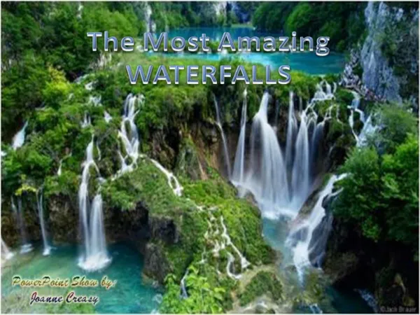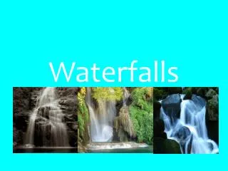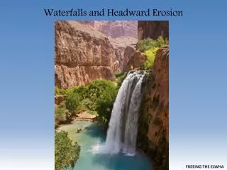
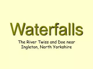
Waterfalls
Waterfalls. The River Twiss and Doe near Ingleton, North Yorkshire. Describe the environment. Vegetation density Vegetation type Relief = height and shape of the land Cross-section Geology. River Doe.

Waterfalls
E N D
Presentation Transcript
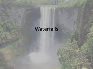
Waterfalls The River Twiss and Doe near Ingleton, North Yorkshire
Describe the environment • Vegetation density • Vegetation type • Relief • = height and shape of the land • Cross-section • Geology
River Doe • What does the colour of the water tell us about the environment upstream of this fall? • Clue - the rock type is Limestone, what is the soil type?
Features • Can you identify the features of each image? • And what is happening here?
Differential Erosion • Less resistant rock is eroded more easily than adjacent harder layers • Can you identify the bands of harder rock?
Top fall on the River Doe • What does this image suggest about the depth of the plunge pool? • Tomb stoning has been banned at Devils Bridge since a death last year!
Above the River Doe the land emerges to improved moorland - albeit enclosed. What altitude do you think it drops to the river valley? Is there any evidence of glaciation?
Geology • Was the rock formed in layers? Is it sedimentary? • Is it blocky in its structure?And grey? • Which rock do you think it is? Think back
The lower [older] rock below • The darker rock below has been folded and changed to form a less resistant metamorphic rock • Any idea what rock you think it is? • With limestone above and slate below the water spray cuts back an overhang
Rock Sequence • Harder limestone on the top • Less resistant slate underneath • Note the waterfall is free-hanging • Niagara Type
Plunge Pool The plunge pool is circular, deep and gradually moving upstream Material is deposited, gradually infilling the pool
Downstream • Gradually the pool becomes shallower and the river bed returns to a riffle. • Note the bystander ankle deep in the water. Deeper Shallower
Some of the bigger blocks which fall into the plunge pool cannot be removed as the river loses all of its energy here. • Note the blocky nature of this carboniferous limestone. • How is the area being used as a recreational resource?
Evolution • The waterfall gradually moves upstream leaving a steep sided gorge below it, often with smaller falls • The process continues
Additional Information for Teachers • This power point was based upon a family walk from Ingleton, up beside the chip shop returning via the normal footpath up and the car park. This was a sustainable alternative to parking at a honey pot location and following the route, initially across private land and paying to access public waterfalls. A payment may be necessary if you continue down into Ingleton anticlockwise. • Both rivers have conflicting names on OS maps and locally. Above Thornton Force the river Twiss is called Kingsdale Beck OS GR 7077, but in the gorge SD6974, the Twiss. The River Doe changes from Chapel Beck at 7376 to the Doe 2 km downstream. Both rivers flow independently under the access bridges to the waterfall carpark before joining before the old viaduct. Below this tributary the river is called the River Greta [6571] and this is the river that is observed from the A65 outside of Ingleton at New Bridge – an obvious metal construction. I am sure you can access all of these sites via Get-a-map or aerially via Multi map. To further confuse things the climbing Guide ‘Yorkshire Limestone’ refers to the crag dividing Kingsdale from Chapel le Dale as Twistleton rather than Twisleton [7276] so it could become the River Twist! • For information on rock types and the general orientation I used Yorkshire Dales: Limestone Country by Tony WALTHAM this is a Constable guide that was re-published in 1987 but it is excellent if you like limestone. He draws attention to the excellent terminal moraine above Thornton force and the ease of access over public land from above – this is obvious on a 1:25 000 map with Open Access information highlighted so don’t be perturbed by the need to pay. He includes three additional useful facts: That the slate was overun by the sea 330 million years ago, that the fall is 14m high and that it has retreated 60m in 14,000 years since it overtopped the terminal moraine. • The gorge on the early slides is Baxenghyll above the Snow water falls, the upper fall – with jumpers – the Beezley falls