Download
1 / 24
240 likes | 265 Vues
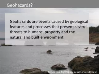
Providing scientific information on Utah's geologic environment, resources, & hazards. Responding to emergencies, mapping hazards, and educating the public on risks to reduce losses.

E N D
Box Elder County Geologic HazardsUpdateUtah Geological Survey Steve D. Bowman, Ph.D., P.E., P.G. Geologic Hazards Program Manager
Utah Geological Survey (UGS) • The Utah Geological Survey, a division of the Utah Department of Natural Resources, provides timely scientific information about Utah's geologic environment, resources, and hazards. About 65 FTE staff and the State Geologist. • Administration • Geologic Hazards Program • Geologic Mapping Program • Groundwater Program • Energy and Minerals Program • Geologic Information and Outreach Program • Offices • Salt Lake City • Cedar City
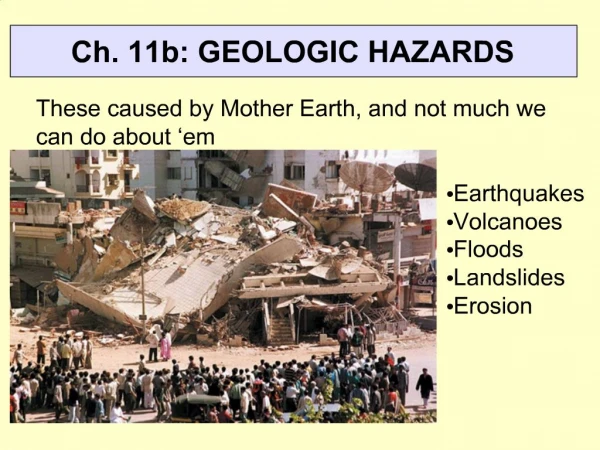
Geologic Hazards Program • Respond to geologic hazard emergencies and provide unbiased, scientific advice to local governments and incident commanders. • Investigate and map geologic hazards in urban and other areas (publish and distribute PDFs and GIS spatial data). • Provide geologic hazard related technical/educational outreach and information to inform Utah about hazards. • Focused on reducing Utah’s life safety, property, and economic risk from geologic hazards. Riverdale landslide along the north bluff of the Weber River
Geologic Hazards That May Be Found in Utah • Earthquake Hazards • Ground Shaking • Liquefaction • Surface Fault Rupture • Tectonic Subsidence • Landslide Hazards • Debris Flows • Landslide • Rockfall • Flooding Hazards • Alluvial Fan Flooding • Debris Flows • River, Lake, and Sheet Flooding • Seiche • Shallow Groundwater • Tsunami • Problem Soil and Rock Hazards • Caliche • Collapsible Soil • Corrosive Soil and Rock • Expansive Soil and Rock • Ground Subsidence & Earth Fissures • Groundwater Withdrawal • Underground Mining • Radon Gas • Karst and Sinkholes • Piping and Erosion • Salt Tectonics Deformation • Shallow Bedrock • Soluble Soil and Rock • Wind Blown Sand • Volcanic Hazards • Airborne Volcanic Ash • Eruptions and Lava Flows
Mapped Geologic Hazards in Utah • Earthquake Hazards • Ground Shaking* • Liquefaction • Surface Fault Rupture* • Landslide Hazards • Landslide* • Rockfall • Flooding Hazards • Alluvial Fan, Debris Flow, Lake, River, and Sheet Flooding • Shallow Groundwater • Problem Soil and Rock Hazards • Caliche • Collapsible Soil • Corrosive Soil and Rock • Expansive Soil and Rock • Ground Subsidence & Earth Fissures • Groundwater Withdrawal • Underground Mining • Radon Gas • Karst and Sinkholes • Piping and Erosion • Salt Tectonics Deformation • Shallow Bedrock • Soluble Soil and Rock • Wind Blown Sand
Earthquake Hazards – The Wasatch Fault Zone • About 217 miles long from near Malad City, Idaho south to near Fayette, Utah. • More than 85% of Utah’s population lives and >75% of Utah’s economy is along the Wasatch Front. • Major regional and continental-scale corridors pass over the fault: • Interstates 80, 84, and 15 (shipment of goods) • Union Pacific Railroad lines (shipment of goods) • Internet and communication trunk lines • Natural gas and petroleum pipelines • Water supply pipelines
A Damaging Earthquake in Northern Utah is Likely in the Near Future • 57% probability in the next 50 years for a magnitude (M) 6.0 earthquake (greater than one in two chance)! • 40% probability in the next 30 years! • A damaging Wasatch fault zone earthquake will significantly impact the state, the region, and the country for years afterward. • Initial damage, fatalities, and injuries. • Economic losses: businesses closed, jobs lost, etc. • Rerouting of the shipment of goods and telecommunications – routes already congested.
Estimated Losses for a Magnitude 7 Earthquake Earthquake Hazards • Includes ground shaking, surface fault rupture, liquefaction, etc. • Typically felt over a wide area. • Utah has more unreinforced masonry buildings (typically brick) than most other western states. Hazus loss-estimation modeling by UDEM Wasatch Fault Running Through Salt Lake City
2008 M6 Wells, Nevada Earthquake an Analog for Rural Utah • Unreinforced masonry (URM) brick structures common. • Rural economies very susceptible to impact. • Resources more limited than urban areas. • Damages not covered by homeowners insurance (unless extra coverage bought).
2017 Spring Creek Road Landslide, Riverdale, Utah • Four homes evacuated and condemned. • Landslide continues to slowly grow. • Damages not covered by homeowners insurance.
2002 Santaquin Debris Flow Debris Flow Hazards • Mainly associated with recently burned areas, or where vegetation has been removed on steep slopes. • Can travel very quickly for long distances, far from the source. 2012 Seeley Fire, Engineer Canyon (SR31) Debris Flow • 15 deaths from debris flows since 1923.
2012 St. George Rockfall (major injury) Rockfall Hazards • Can be present below most slopes with rock cliffs. • Rocks may roll or bounce for long distances from cliffs. • Occur quickly, and often without warning. • 20 deaths from rockfall since 1850. 2013 Rockville Rockfall (two deaths)
Box Elder County Geologic-Based Flood Hazard Mapping (Draft) • Mapped Quadrangles: • Portage • Clarkston • Cutler Dam • Thatcher Mountain • Honeyville • Bear River City • Brigham City • Willard • Plain City • North Ogden
Box Elder County Lidar Elevation Data Coverage Existing “Holes” Tremonton South: 8.9 sq mi ($1,100) Promontory Point: 178.7 sq mi ($21,500)
Preparing for Disaster • Be Ready Utah (https://www.utah.gov/beready) • Utah Seismic Safety Commission (https://ussc.utah.gov) • Utah Division of Emergency Management (https://dem.utah.gov/) • Utah Geological Survey (https://geology.utah.gov) • Plan • Prepare • Recover
Geologic Hazard Maps Critical for Informed Land-Use Decisions to Reduce Risk to Live Safety and the Economy Typically, sets of 10 different hazard maps per area. Wasatch Front Progress
UGS Updated and New Geologic Hazard Investigation and Report Guidelines Guidelines themselves are not regulatory, must be adopted by local governments in an ordinance. Included Guidelines: Conducting Engineering-Geology Investigations and Preparing Reports Surface-Fault-Rupture Hazards Landslide Hazards Debris-Flow Hazards Land Subsidence and Earth Fissure Hazards Rockfall Hazards Creating Geologic Hazard Ordinances Investigations and Reports for Public School Buildings Also includes extensive background information. Updated guidelines will include new radon gas hazard guideline.
Why are Geologic Hazard Ordinances Necessary? • To protect the health, welfare, and safety of the public. • Over 6067 fatalities from geologic hazards in Utah since 1850, and a significantly larger, but undetermined number of injuries and economic losses.
Is Talking and Dealing With Geologic Hazards a Negative, Anti-Development Message? • No, it is a smart development message and results in sustainable communities. • Reduces long-term life-safety and economic costs, including emergency responses. • All states and regions have geologic hazard impacts, some more than others; however, Utah can deal and live with these hazards. • Implement effective geologic-hazard ordinances for land-use planning and development/construction. • Investigate possible geologic hazards before planning and development. • If needed, mitigate the hazard and/or modify the project before construction. • For existing infrastructure, evaluate the hazards and risks, and prioritize mitigation.
Available Geologic Data • Utah Interactive Geologic Maps: http://geology.utah.gov/apps/intgeomap • Geologic Hazard Maps: https://geology.utah.gov/map-pub/maps/geologic-hazard-maps/ • New Utah Geologic Hazards Database and online mapping application will be released soon. • Custom map report function to be added mid-summer. • UGSGeoData Archive: https://geodata.geology.utah.gov • Utah Aerial Imagery Collection: http://geology.utah.gov/?page_id=5147 • Utah Earthquake Database: https://gis.utah.gov/data/geoscience/earthquakes/ • Utah Landslide Database: https://gis.utah.gov/data/geoscience/landslides/ • Utah Lidar Elevation Data: https://gis.utah.gov/data/elevation-and-terrain/ and http://opentopography.org (statewide over 13,000 square miles to be released in June) • Utah Quaternary Fault Database: https://geology.utah.gov/apps/qfaults/
2012 Seeley Fire Debris Flows Questions and Discussion Society can prepare for and deal with geologic hazards. 12-Mile Landslide, Sanpete County