Download
1 / 84
980 likes | 1.43k Vues
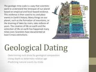
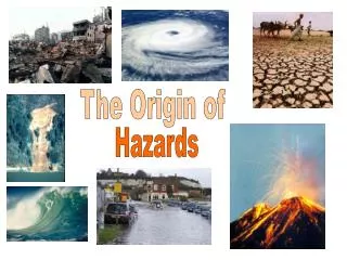
Assessing Geological Hazards. Geohazards ?. 4 of 30. Geohazards are events caused by geological features and processes that present severe threats to humans, property and the natural and built environment. . . . to develop a methodology to incorporate geology

E N D
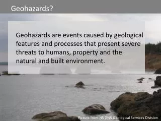
Assessing Geological Hazards Geohazards? 4 of 30 Geohazards are events caused by geological features and processes that present severe threats to humans, property and the natural and built environment. . . . to develop a methodology to incorporate geology into the land use planning process Picture from NS DNR Geological Services Division
Assessing Geological Hazards Geo-events that pose threats 4 of 30 • coastal flooding and riverine flooding • coastal erosion • land sinking – sinkholes • contamination of water from heavy metals in soil or acid rock drainage • landslides / slope failure . . . to develop a methodology to incorporate geology into the land use planning process Picture from NS DNR Geological Services Division
Assessing Geological Hazards Geo-events that pose threats 4 of 30 How do we realistically handle these geohazards in our MCCAPs? . . . to develop a methodology to incorporate geology into the land use planning process Picture from NS DNR Geological Services Division
2 climate drivers Sea level rise Changes in precipitation
BIO’s relative sea level rise estimates 0.4-0.9m on 50-year time scale 0.9-1.6 on 100-year time scale
Example from County of Colchester / Truro
MSC’s STORM SURGE MODEL Tell us the impacts you are seeing and at what water levels! Model based on OUTPUT WINDS
MSC’s STORM SURGE MODEL Map display; every hour for 48 hrs out from when model run Time series graph; point forecast for specific location. Show stage 1, 2 or 3 flooding based on past events.
MSC’s STORM SURGE MODEL Does NOT include wave run up Add 10% to surge levels if wind facing shoreline . . . . . . then add tide level
MSC’s STORM SURGE MODEL 65cm surge predicted at nearly high tide = 2.9m 75-80 cm surge experienced = so 3m + at least another 10cm for wave run up (more if wind from S/SE)
Observed sea level rise exceeded what the Intergovernmental Panel on Climate Change (IPCC) predicted by 50% for the period 1990–2006. 80% of the rise in sea level between during 2003–2008 is believed to be from ice melt
0.42 ± 0.15 0.57m upper uncertainty for relative SLR So use 0.57m
Water Surplus Water Deficit Intensity Short Period Rainfall
In a 20 year return period rainfall: • 5% more rain by 2020s • 9% more by 2050s • 16% more by 2080s
Anne Warburton awarburton@elementalsustainability.com 902 431 7168 www.elementalsustainability.ca
Geohazards? What’s the short-list of geohazards potentially relevant to my MCCAP? How are they relevant, and are they priorities? • THANK YOU! • Garth DeMont, Geoscientist with NS Department of Natural Resources • Gavin Kennedy, Hydrogeologist with NS Department of Natural Resources • John Drage, Hydrogeologist with NS Department of Natural Resources
Assessing Geological Hazards Geo-events that pose threats 4 of 30 • coastal flooding & riverine flooding • coastal erosion • land sinking – sinkholes • contamination of water from heavy metals in soil or acid rock drainage • landslides / slope failure . . . to develop a methodology to incorporate geology into the land use planning process Picture from NS DNR Geological Services Division
Assessing Geological Hazards Geohazard—Coastal erosion 4 of 30 The need to establish setbacks should be informed by geology – both bedrock and surficial . . . to develop a methodology to incorporate geology into the land use planning process Coastal erosion risk will increase with sea level rise. Picture from NS DNR Geological Services Division Picture from NS DNR Geological Services Division
Assessing Geological Hazards Geohazard—Karst 4 of 30 • Occurs in • limestone & gypsum • sinkholes • water contamination . . . to develop a methodology to incorporate geology into the land use planning process Under the Nova Scotia Treatment Standard for Municipal Surface Source Water Treatment Facilities, once designated, karst areas are subject to water treatment standards. Picture from NS DNR Geological Services Division Picture from NS DNR Geological Services Division
Assessing Geological Hazards Geohazard—Heavy Metals 4 of 30 • Toenails, Tap Water and You: The Arsenic Connection • NS DNR Report of Activities: 2009 Picture from NS DNR Geological Services Division
Assessing Geological Hazards Geohazard—Heavy Metals 4 of 30 • Toenails, Tap Water and You: The Arsenic Connection • NS DNR Report of Activities: 2009 In unstable climatic conditions where rocks and soils are saturated one week and dry the next there is a higher risk of transport into groundwater systems. Will that be our climate?
Assessing Geological Hazards Geohazard—Acid rock drainage 4 of 30 Pyrite and pyrrhotite oxidize when exposed to air, resulting in production of sulphuric acid and iron oxides. Sulphuric acid is soluble. Picture from NASA Earth Science Division
Assessing Geological Hazards Geohazard—Acid rock drainage 4 of 30 • The amount of water that will fall in a ‘20 year return period’ rainfall (i.e., an event that has a 5% chance of happening any given year) will be: • 5% more rain fall by the 2020s • 9% more rain will fall by 2050s • 16% more rain fall by the 2080s. Picture from NASA Earth Science Division
Assessing Geological Hazards Geohazard—Slope stability 4 of 30 • Slope angle? • What’s beneath our feet? On surface and underlying? • How saturated is it? • How warm is it? • different kind of assessment than coastal erosion • Slope Stability Guidelines for Development Applications Picture from NS DNR Geological Services Division
Assessing Geological Hazards • Understand how climate change can trigger certain hazards • Are any of these hazards present in my jurisdiction? • Where? • Do they impose an intolerable risk? • How urgent is the need to respond?
Anne Warburton awarburton@elementalsustainability.com 902 431 7168 www.elementalsustainability.ca
Assessing changes in precipitation . . . to develop a methodology to incorporate geology into the land use planning process
Assessing changes in precipitation . . . to develop a methodology to incorporate geology into the land use planning process
Assessing changes in precipitation Update the Draft Stormwater Management Plan Recommend BMPs so that future development won’t increase peak runoff flows . . . to develop a methodology to incorporate geology into the land use planning process
Assessing changes in precipitation Update the Draft Stormwater Management Plan Recommend BMPs so that future development won’t increase peak runoff flows Assess the effects of climate change on rainfall intensity and the effects of these changes on the storm water mgt plan
SWMM5 Stormnet
Assessing changes in precipitation New climate-wise design rainfalls Stormnet
Assessing changes in precipitation What’s the rainfall pattern during the day: sub-day durations? (used for IDF curves)
Assessing changes in precipitation • Conclusions: • Predicted magnitude of the increase in precip volume expected in 1 day is 29% • Predicted increases for 24 hr rain are higher than increases in annual rainfall • Predicted increases for shorter durations are greater than increases for longer durations . . . to develop a methodology to incorporate geology into the land use planning process
Assessing changes in precipitation Stormnet Design Storms