Download
1 / 24
240 likes | 430 Vues
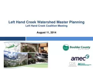
Left Hand Creek Watershed Master Planning Left Hand Creek Coalition Meeting. August 11, 2014. AGENDA. Provide project status update Debrief public meetings Refine the planning and outreach process for next and remaining phases of project

E N D
Left Hand Creek Watershed Master PlanningLeft Hand Creek Coalition Meeting August 11, 2014
AGENDA Provide project status update Debrief public meetings Refine the planning and outreach process for next and remaining phases of project Updates: funding, possible partnerships for implementation Next steps
Project Status Update • Work plan • Field work/assessments • Data analysis • Outreach • Project schedule • Refinements
Data Sources • Data sources used include: • Existing plans from James Creek Watershed Initiative, Lefthand Watershed Oversight Group, Left Hand Water District, Boulder County, and Town of Jamestown • Jamestown Stream Corridor Master Plan Technical Memorandum • Studies and data from NOAA, NWS, CWCB, CDOT, and NRCS • Boulder County Riparian Inventory • News articles for historical data • USFWS memos on endangered species • GIS data and maps • Public meeting materials from December 2013 • Data from FRPIC • Descriptions of other projects in the watershed
Project Workplan • See Handout
Project Status Update (cont.) • Refinements to work plan (including outreach) and schedule
LHMP Community Engagement/Outreach Website LHCC mtg agendas, presentations, summaries Project updates – mtg summaries, flyers, photos, description/summary for each project ‘phase’ Online survey about values/vision, plan focus areas Flood-recovery resources Email ‘blasts’ and other Key information Directing people to website for updates Business cards with project info/website distributed at public meetings, events
LHMP Community Engagement/Outreach Prior to public meetings Announcement/flyer posted on websites Flyer emailed to BoCo flood listserv Flyer emailed to LHCC to distribute Flyer emailed to project list (FRPIC contacts, Dec. ‘13 mtg attendees, quicktopic/neighborhood listservs) BoCo postcard Press release Reminder emails to project list, neighborhood leaders
LHMP emails/calls received by project team • 12 email comments/questions received and responded to • Most with questions about master plan, meetings, and for more info • 4 about site-specific issues • 3 calls received and responded to • Questions about master plan, meetings, and for more info
Lower LH public meeting Altona Grange, 7/31 • 52 signed in, 26 comment cards • Qs focused on data considered; sediment/debris; stewardship, monitoring & private property issues; two-way communication with County • 4 small groups. Values/issues : • Valueof natural/riparian setting, historical legacy of Creek, legacy of farming, wildlife habitat, flowing river • Issues: sediment/WQ, debris, flood mitigation, emergency preparedness, long-term stewardship and watershed monitoring, culverts/bridges, sustainable Ag
Upper LH public meeting Greenbriar, 8/6 • 58 signed in, 22 comment cards • Qs focused on managing sediment, debris flows, roads, water quality, USFS/CDOT involvement, culverts and bridges • 4 small groups. Values/issues: • Value of natural setting, wildlife habitat/corridor, privacy, tranquility and quality of life, recreation • Issues: flood mitigation, rebuilding roads and bridges, foot paths, mitigating debris flows, septic/WQ issues, floodplain decisions, property lines obscured, utilities problems, emergency preparedness
Debrief Public Meetings • Lower Watershed Survey Results (26 surveys) • Most important values included: • Farming/irrigation • Water quality • Natural setting/quality of life • Most important projects included: • Enhancing long-term oversight of watershed • Improving stewardship • Mitigating debris flows • Mitigating risk of private property damage from future flooding • Mitigating risks to personal safety • Ensuring/enhancing water quality • Restoring aquatic/riparian habitat • Restoring natural stream corridor
Debrief Public Meetings • Upper Watershed Survey Results (22 surveys) • Most important values included: • Ecosystem health/habitat • Water quality • Natural setting/quality of life • Most important projects included: • Ensuring/enhancing water quality • Restoring aquatic/riparian habitat • Mitigating risks to personal safety • Restoring natural stream corridor • Reducing sediment/silt transport • Mitigating risk of private property damage from future flooding • Mitigating debris flows
Funding, Partnerships, & Implementation • CWCB creek restoration awards • BoCo, Left Hand Water, and Stephen Strand • Coalition funding challenges • Possible partnerships • Trout Unlimited • Urban Drainage and Flood Control District • Do we need to contact/interview these agencies? • Implementation issues
Expected Outcomes vs Long-Term Goals • Long-term watershed coalition/network • For funding, projects and stewardship • CWCB/state focus and funding • LWOG existing/future role • Water rights and delivery issues
Next Steps • Fieldwork for Risk Assessments • 25 Identified Reaches • Hope to complete work in 1 week
Next Steps DEM of Difference • Fieldwork for Risk Assessments Right of Entry
Next Steps • Fieldwork for Risk Assessments
Next Steps • Flood Risk Assessment • Obtained interim flood surface from Varda • Sorting through issues associated with that work • Suspect hydrology • Used flows for LH at Longmont to model reaches west of 36 • Uncertain cross section geometry? • Models by Baker and NRCS showing different results but use same hydrology
Next Steps • Ecosystem The application of the SVAP2 protocol includes the evaluation of features in the stream system that affect overall stream conditions and generally encompass the following categories: • Channel stability (channel condition, bank condition) • Water quantity (hydrologic alteration) • Water quality (nutrient enrichment and manure/human waste) • Vegetation (riparian area quantity/quality and canopy cover) • Instream habitat (pools, habitat complexity, embeddedness)