Download
1 / 19
190 likes | 195 Vues
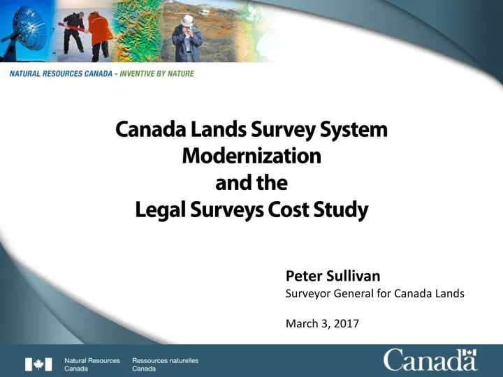
Canada Lands Survey System Modernization and the Legal Surveys Cost Study. Peter Sullivan Surveyor General for Canada Lands March 3, 2017. Legal Surveys are a professional service - Why?. $9.7 Trillion. 81.8%.

E N D
Canada Lands Survey SystemModernization and the Legal Surveys Cost Study Peter Sullivan Surveyor General for Canada Lands March 3, 2017
Legal Surveys are a professional service - Why? $9.7 Trillion. 81.8% Legal Surveys are part of the Property Rights regime that protects and adds value to these assets through secure land tenure and effective land management http://www5.statcan.gc.ca/cansim/a26?lang=eng&retrLang=eng&id=3780121&&pattern=&stByVal=1&p1=1&p2=-1&tabMode=dataTable&csid=
Canada Lands Survey System the framework that identifies, documents and protects boundaries and property rights for Canada Lands (as per the Canada Lands Surveys Act)
Context – What is being doneCanada Lands Survey System modernization • Why? • Address key priorities/ Efficiencies • Align with and benefit from technological advances • Improve service to clients • How? • Implement new National Standards • Transition to e-Environment (four parts) • Strengthen parcel data • Enhance access to products
National Standards introduced in 2014 to align with technology, requirements • Standards date back to 1871 • Technical standards for surveys under the Canada Lands Surveys Act • Constitute general instructions of the Surveyor General • Last full revision in 1997 • National Standards for the Survey of Canada Lands – 2014 • Mandatory geo-referencing • Removal of redundant content • Common national approach • Regional chapters • Maintenance Plan for Standards – 2015 • Developed with Association of Canada Lands Surveyors • Actively used to manage revisions
eEnvironment part 1Introduced MyCLSS v1 in 2011 Portion of plans reviewed within 20 days From when SGB received returns to when plans recorded in CLSR. Includes time with other agencies. • MyCLSS is a collaborative site developed with the Association of Canada Lands Surveyors (ACLS) • Provides online management of survey projects and process efficiencies • Steady improvements in review times since the introduction of MyCLSS • Key improvements with MyCLSS v1: • Surveyors request and receive Survey Instructions through MyCLSS instead of paper • Surveyors complete online checklist and submit to ACLS practice review • Critical review instead of full review of survey returns carried out by Surveyor General Branch
eEnvironment part 2 Introduced MyCLSS v2 in 2016 • Expands collaboration to include land administering agencies • Provides tools for survey plans to be managed in an eEnvironment • Key improvements with MyCLSS v2: • Streamlined, easier to use interface • Support for electronic signature by the Canada Lands Surveyor submitting plan and the Surveyor General designate ratifying plan • Enables electronic submission of plans • Provides tools for land administering agencies (e.g. INAC, territorial Land Titles Offices) to approve plans electronically
eEnvironment part 3 Began converting to eRegistry in 2015 • Canada Lands Survey Records (CLSR) consist of plans, field notes and related documents dating back to 1850 • High quality scanning of records is in progress for eRegistry • eRegistry will be authoritative online repository of these documents • Originals will be transferred to Library and Archives Canada CLSR Holdings Number of plans in CLSR continues to increase Number of plans CLSR at 615 Booth St.
eEnvironment part 4Implementation has begun Yukon LTO Nunavut LTO NWT LTO • Completion of eRegistry and establishment of Trusted Digital Repository for long term preservation targeted for late 2017 INACMB IOGC INACAB INAC BC INACON Parks West INAC QC INAC SK INAC AT • Process for other agencies to electronically approve survey plans (using MyCLSS) is currently being implemented • Can now fully proceed Canada Lands Surveyor Regulations have now been published in the Canada Gazette As of August 31, 2016
Strengthening parcel datasets Survey plans New Surveys Geospatialrepresentation Boundary and parcel datasets 2017 Improved geospatial quality by implementing ESRI Parcel Editor Linked with Indian Land Registry (via parcel identifier numbers), enhanced and expanded usage 1999 Integrated across Branch;national data model with common technology Disparate data models, technology Survey plans and boundary information brought together and represented geospatially in datasets Datasets support broad range of uses Major incremental improvements being made Once parcel editor implementation is completed (summer 2017), quality of datasets will continually improve with new data received from land surveyors
Improving client access to products Access Methods Canada Lands Survey Records Survey Project Search • Clients choose how they search, view and download survey records based on their needs • Clients can download datasets for land management • Updated datasets distributed to INAC weekly (used in Aboriginal and Treaty Rights Information System) • Moving to CLSS Web Services with Federal Geospatial Platform; first services launched in June 2016 New surveys Surveys in progress Surveyprojects Survey Plan Search (& download) Plans, documents Survey plans CLSS Map Browser Geospatial representation (datasets) Canada Lands in Google Earth Federal Geospatial Platform Web Services Parcel and boundary datasets (New 2016)
CLSS modernization – what it means • Faster and more cost effective for Canadians seeking to carry out land transactions on Canada Lands • Since more timely plan review process and online approvals so hardcopies of plans do not need to be shipped around the country • Smoother transition for territorial governments and Indigenous groups taking on new land administration roles • Since more streamlined processes and improved datasets • Stronger foundation for future generations • Since new national standards and improved accuracies of datasets
How does the Cost Study relate to modernization? The most common question I hear from stakeholders is why do legal surveys cost so much And take so long? The Cost Study was designed to: - Get feedback from First Nation users - Perform a rigorous analysis of all costs related to legal surveys - Compare the costs of legal surveys on First Nations communities with equivalent provincial surveys.
Some preliminary findings – Part A First Nations Interviews • Quick Facts • 46% of respondents manage their own survey contracts • 58% of respondents indicate land use planning initiates the need for surveys • 80% of respondents indicate that walking/reviewing the work with the surveyor • is important • 60% of surveys are submitted to respondents electronically • Success indicators • First Nations land managers who are familiar with and manage survey projects • Training in forestry, planning and GIS • Strong communication and relationships between surveyor and land manager • Knowledge of land tenure and boundaries in general is valued • Areas to improve • Conducting surveys at the appropriate time of the year • Obtaining approvals for access and to initiate and complete the work • Delivering training opportunities
Some preliminary findings – Part B Land Surveyor Interviews • Quick Facts • Approximately 3 months to go through the survey process, median is 20.5 business days • 60% of respondents indicated missing cost savings by not bundling projects • 70% indicate SGB cadastral data is useful, however only 38% use it for evidence searches • 40% used web based tools • Major cost drivers for field work are identified as mobilization/demobilization and • evidence (markers, fences and other occupation) searches • - 93% engaged with First Nations early in the procurement process • Success indicators • Clear scope and minimal changes • Consistent client liaison throughout the project • System simplification through standards and MyCLSS • Areas to improve • Land surveyor training and the development of tools to access and use SGB data • Improved legal survey fabric in communities • SGB support in the identification and resolution of critical issues • First Nations capacity development in communities
Some preliminary findings – Part C Federal – Provincial comparisons • Quick Facts • Provincial project hours were between 5% and 44% higher than the comparable • federal project • Average labor hours were 87 for the provincial and 60 for the federal • Federal projects did not have to address formal subdivision applications in provincial municipalities that are essential, but add hours • Transportation hours were on average 13.4% higher for the federal projects • Success indicators • Clear communication, scope and liaison throughout the project • Areas to improve • - Better defined and predictable land development regimes (integrated land management, surveys-tenure-planning)
What we are working on Pilot project to develop FN capacity – Wikwemikong FN Working with NALMA and the Tulo Centre of Indigenous Economics to develop curricula towards a land management program. Implementing MyCLSS 2 – complete on-line land survey processing system, with digital survey plans and approvals. Development and delivery of webinars and applications to help land surveyors better access and use SGB data.