Download
1 / 1
10 likes | 68 Vues
Study on fog water collection using Standard Fog Collectors (SFCs) in Central California to measure fog water deposition and its variations. Analysis of fog water collected from SFCs to estimate moisture flux and explore interdisciplinary research connections. Investigation into fog's role in lizard species extinctions and mercury cycling. Important insights into fog's meteorological phenomenon and ecosystem effects.

E N D
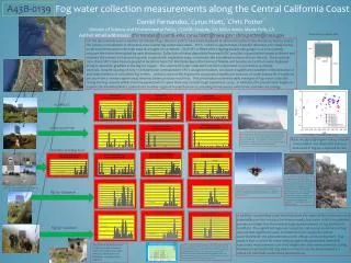
A43B-0139 Fog water collection measurements along the Central California Coast Daniel Fernandez, Cyrus Hiatt, Chris PotterDivision of Science and Environmental Policy, CSUMB; Seaside, CA; NASA Ames; Menlo Park, CAAuthor email addresses: dfernandez@csumb.edu; cyrus.hiatt@nasa.gov; chris.potter@nasa.gov 1 1, 2 2 For the past several years a number of standard fog collectors (SFC’s) have been deployed at various locations in the Monterey Area to assess the volume and variation of Monterey area coastal fog water deposition. SFC’s contain a square meter of double thickness 50% shade Coresa mesh and are mounted with their base at a height of 2.0 meters. Each SFC is fitted with a tipping bucket rain gauge so as to accurately measure the water intercepted by each instrument. Collection of water deposition from each SFC provides a quantitative means to detect and measure the presence of ground fog and, coupled with vegetation type, to estimate the associated moisture flux to the soil. Since summer 2010, three SFC’s have been deployed at locations near CSU Monterey Bay in the towns of Marina and Seaside and 3 others were deployed along an elevation gradient in the Big Sur region. The volume of water collected from each instrument is recorded at 15-minute intervals. Despite spacing of only 1-5 km between correspondent SFC’s at a given location, we observe significant variations in the presence of and characteristics of coincident fog events. Indeed, some of the fog events can produce significant amounts of water (upwards of 5 gallons per day from a 1 meter square area) whereas others produce much less. This presentation examines daily averages of fog water collected during the fog seasons within this time period (which spans from July 2009 through September 2012). In addition, this presentation begins to explore the interdisciplinary connections to other regional research projects, including lizard species extinctions and mercury cycling. The Standard Fog Collector (SFC) UC MBEST Missing data Schoonover Park A typical Monterey summer stratus event seen from about 18,000 feet. Note the southeastern portion of Monterey Bay is free of stratus due a lee clearing effect downwind of the Monterey Peninsula. This pattern of clearing tends to be recurrent throughout the summer season and the clear patch with water is considered the local “banana belt”. From Weiss –Penzias et al. 2012 Note the typically higher values of both monomethyl and elemental mercury measured in fog as compared to rain. Facilities Building Roof (http://www.californiaherps.com/lizards/pages/e.m.multicarinata.html) In collaboration with UCSC’s Barry Sinervo, we are examining the role the absence of fog plays in the extinction of lizard species. Notably, the northern alligator lizard is adversely affected by the warmer temperatures present when fog is absent and is outcompeted by its southern cousin. The lizard “temperature models” are placed near the fog collectors (photo to the right) to corroborate with observed extinctions. Photo (right) taken by Robert Cooper. (note the chard plant grown completely on fog water from the SFC) On August 13, 2012, as I fell from 18,000 feet near the MBEST site, fog was forming along the coast. I observed a pronounced temperature inversion with a warm layer at around 2000 m August 10, 2012 September 14, 2012 Big Sur Chaparral In addition to providing water that enhances the regional flora and fauna and potentially provides a source for human needs, fog water collection patterns provide an insight into the meteorological phenomenon of fog and how it manifests. The significant regional, temporal, and seasonal variation of fog ensures that significant study and attention are required to better understand both the phenomenon and its effects on the ecosystem. Fog water is also a carrier for many anthropogenically generated chemicals. Associated measurements can shed insight into their environmental cycling. Evanescent yet profound, fog and its influence on the environment is a critical yet minimally understood phenomenon. Big Sur Grassland The patch of green shown in the photo by the Grassland Site is the result of fog water released onto the ground from the 1.00 square meter collector. Note the significantly higher fog water collection amounts at the higher grassland site versus the Chaparral site (in one case at the Grassland Site, 9 gallons of water were measured in one day from a single collector!). While only separated by 2-3 km, these represent significantly different spatial fog regimes. Also note that some daily fog events appear to be correlated across various spatial scales whereas others appear not to be.