Download

1 / 15
150 likes | 317 Vues
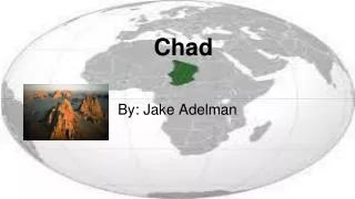
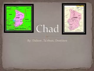
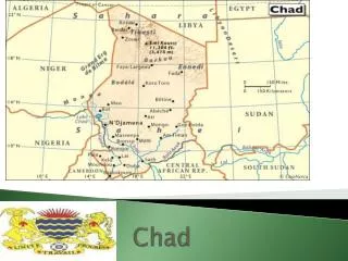
CHAD. By: Ashlynn Conder. Bordered by Niger, Libya, Sudan, Central African Republic, Cameroon, and Nigeria. Capital City: N’DJAMENA Major Cities: Moundou Sarh Abeche Kelo. Geography. Mount Koussi is the highest peak in Chad.

E N D
CHAD By: AshlynnConder
Bordered by Niger, Libya, Sudan, Central African Republic, Cameroon, and Nigeria. Capital City: N’DJAMENA Major Cities: Moundou Sarh Abeche Kelo
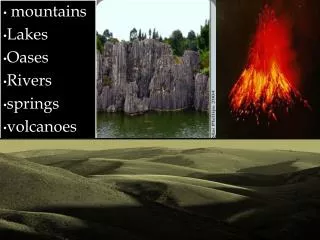
Geography Mount Koussi is the highest peak in Chad. The Tibesti mountains are said to be home to the best racing camels in the world. The Bodele Depression once served as the floor of a large lake. Lake Chad is the most significant body of water in the Sahel. The Ennedi Plateau is in one of the most inaccessible regions in Chad.
Historic Sites Ennedi Desert- contains prehistoric cave paintings; used to be underwater. Ouara- contains ruins of the Sultan Ibn Abdel-KerimDjame’s palace that date back to the 16th century. Abeche- former Ouadai sultanate; retained much of its Oriental charm, cobbled streets and interesting mosques.
Recreation and Outdoors Lake Chad- Reed boats, View hippos and crocodiles. Zakouma National Park
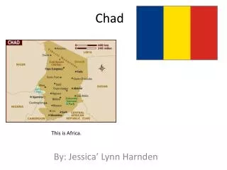
Flag of Chad The flag of Chad has 3 vertical bands of blue, yellow, and red. It combines the blue and red French colors to the red and yellow Pan-African colors. Blue=Hope and the Sky. Yellow=Sun and Desert. Red=Progress, Unity, and Sacrifice.
Weather and Climate • It is tropical in the south and desert in the north.
Transportation Airports: Main airports are located in Chad’s largest cities such as the N’Djamena International Airport. The Chari and Legone Rivers are only navigable in the wet season. There are many roadways in Chad, mostly unpaved, where minibuses and trucks are used for travel. An area that gets extremely crowded with minibuses is the Kousseri Bridge.
Arts and Culture The National Museum of N’Djamena has a great collection of the natural history and archeology of Chad. The Museum of Abeche features an ethnography collection.
Top 3 Languages Local Dialect More than 120 different dialects. • French (official) • Arabic (official) • Sara (south)
Main food dish is : Chad Millet Porridge Other Staples Include: Maize (Corn) Tea Millet Fish Carrots Onions Citrus Fruits Other various vegetables
Extra Information: • The people of Chad are often referred to as Chadians. • Chad gained independence from France on August 11, 1960. • 80% of the people in Chad live in rural areas. • Africa’s 5th largest nation. • Chad’s full name is The Republic of Chad.
Major Religion Largest Ethnic Group Sara • Muslim Life Expectancy • 48 years
Natural Hazards Droughts Locust Plagues
Imports and Exports Top 3 Imports: Top 3 Exports: Oil Cattle Cotton • Machinery • Industrial Goods • Foodstuffs