Download
1 / 19
190 likes | 215 Vues
Learn why and how to photo-document long-term climate stations to record site conditions, instrument settings, and factors impacting climate data accuracy. Capture various factors affecting readings using unbiased and systematic views.

E N D
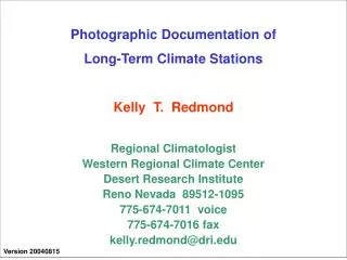
Photographic Documentation of Long-Term Climate Stations Kelly T. Redmond Regional Climatologist Western Regional Climate Center Desert Research Institute Reno Nevada 89512-1095 775-674-7011 voice 775-674-7016 fax kelly.redmond@dri.edu Version 20040815
Why photo-documentation ? • To leave a permanent archive record of site conditions • Photos can be transmitted, mental images cannot • Memories change, not always reliable • To show relationships between instrumentation and the factors that affect what they observe and record • To record the condition of instruments • To record the setting at all scales • Within a few cm to a few m of the sensors • Within a few tens of meters • Within a few hundreds of meters • Within a few kilometers to tens of kilometers • What to record, in general: • Any factor relating to site conditions that could affect the interpretation of the historical climate sequence from this station. • The main purpose is to document conditions and relationships.
What to record (1) For all stations: Systematic views of a station over all azimuths all done in same manner Systematic views from a station over all azimuths done in same manner Station dependent characteristics: Whatever is needed to record special circumstances Almost every site has a bias arising from its situation We need to record such biases for posterity Factors that can affect readings Factors that can change with time Status of vegetation Growth of vegetation Obstructions to wind, solar radiation Depth and condition of grass Height of vegetation that affects wind profile Death of vegetation from disease or fire Fire recovery
What to record (2) Factors that can affect readings and Factors that can change with time (continued) Vertical surfaces that emit infrared radiation, or bounce solar radiation Building sides Trees, forest canopy and trunks, and other vegetation Rock walls and cliffs and canyons (within a mile or two) Intermittent or seasonal wetlands Surface conditions immediately adjacent to sensors Rock, cobbles, grass, gravel, pavement, etc Health of vegetation Effects of artificial watering Nearby fields that are fallow one year, growing the next Nearby factors that change regional energy balances Large scale agriculture Pivot irrigation (operate some years, others not) Trees within a quarter mile can affect sensible/latent fluxes Growth or loss of vegetation Addition of pavement
What to record (3) Factors that can affect readings and Factors that can change with time (continued) Orientation of instruments Out of level (radiation, precipitation gages) Loose clamps Out of level temperature shielding plates Faded, discolored, darkened “white” surfaces Bird goop, dust, snow on top of transparent solar bubble Frost or condensation inside of transparent solar bubble Condition of precipitation gages Presence or absence of shielding Proximity to vegetative shielding Overhanging vegetation Insects and junk on screens Insects, nests, on interior mechanisms Evidence of rodents chewing on cables Evidence of presence and activities of large animals Scratching, tasting fluids, punctures, breakages
What to record (4) Factors that can affect readings and Factors that can change with time (continued) Topographic features that affect sensor readings Slopes (hold camera exactly horizontal to show these) Small hollows and bumps Concave and convex upward surfaces Distance to Cliff edges Water surfaces Nocturnal drainage channels (a meter is enough) Canyon walls Changes in slope above or below instruments Wind channeling influences
The primary purpose is to convey site information … Scientific content takes precedence over artistic qualities Many photographs expose for the sky at the expense of other portions of the image. Digital images do not always have the latitude (dynamic range of recorded brightness) of high quality slide film (eg, Kodachrome). A common problem: The sky is properly exposed but instruments and their circumstances are dark or barely visible. The sky is constantly varying and will be different on the next visit. Our interest is in the instruments and sensors. Whatever shows them in the best manner is the goal. A washed-out sky may not be pleasing, but if the desired object is correctly exposed, the purpose has been achieved. Showing the same picture with two different image manipulations is perfectly acceptable. Just be sure to mention this. Day-end lighting (morning/evening) shows subtle landscape variations best. However, azimuthal differences (into/away from sun) can be very pronounced. Early / late in the day, into the sun, important detail can be lost. In general, morning thru mid-day to afternoon lighting is best.
Cloudy days often have more uniform lighting. Consider using familiar objects to show scale. Friends or visitors can suffice for this, but they will be immortalized for all time. In general, use the widest angle lens setting available at all times, except for distance photos designed to compress distance and show spatial relationships. The best is the equivalent from a 35 mm film camera of a 28 mm focal length lens. These wide angles are not yet available on many digital cameras. Typically the best that is currently available is equivalent to a 35 mm focal length lens, a moderate wide angle. A 35 mm focal length lens typically requires about 12 overlapping photos to pan around the horizon and back to the starting point. The eight-point method will not yield overlaps, so it is important to keep track of directions. The best approach is to always take the photos in the same sequence, such as starting from north and working clockwise around the compass. Take notes on paper or digital device to document the documentation process, special conditions, circumstances of note, etc. Download to laptop daily, backup on second medium. It is helpful to carry a regular 35 mm film camera as backup.
Resolution: With digital cameras, typically medium resolution is a good compromise. This results in photos that are about 250-300 Kb in .jpg format that can be enlarged somewhat. High resolution can be useful for archive and further enlargement, but camera optics can become limiting, and email size. High resolution photos are often 600-1000 Kb or more, so that a full set can be 20-50 Mb. Low resolution are sufficient for some purposes, but these can also be created with software by degrading from high/medium resolution. Memory: Enough to store 300-400 medium resolution images. A day’s work will typically yield 100-200 photos. Number for a standard set: A typical site might require the basic 8 views, or 16 if two sets are taken (through and from the site), several panoramas side to side and some up-down, photos of specific instruments and their condition, ground surface and vegetation, and the overall setting. Total number is typically a minimum of about a dozen photos up to about 50 or 60, more for complex stations or settings. Time needed is 10-30 minutes.
Panoramas … a little more. The term panorama here means an overlapping sequence of photos. Although there are 8 main compass points, with typical focal length lenses (50 mm lens equivalent for 35 mm film) it generally takes about 12 pictures to make a complete 360-degree panorama. This can be done, separately from a directionally-anchored panorama, by making sure that there is overlap from one from to the next (typically 5-15 percent of the frame width), so that it is clear that this is a panorama, and so that the sections can be adequately pieced together. It is helpful that the first and last picture overlap as well, to insure that the full circuit has been completed and to be able to reconstruct what you did many weeks or months later. Panoramas can be side to side, or up and down, or both. These can later be combined to form mosaics, so that all of the main features relevant to how a sensor will respond can be shown at once. Software exists to patch together pieces into a single image. This is nice, but might need a special viewer, or be hard to email easily.
The Setting On the way in or out of the station location, find vantage points that illustrate the overall setting. Take panoramas if necessary. Use the widest angle lens available. Zoom in on the station location for one or two if this illustrates a feature of interest, or shows a spatial relation. Photos of the setting can be taken from as close as 100-200 meters, but are often taken from distances of 1-10 miles. Be sure to situate yourself so that spatial relationships speak for themselves through the image. If you are driving out a different way than you arrive, consider stopping to record the setting from that vantage point. Often, just one or two vantage points will be very useful. Try to record all relevant elements at once. For example, a river, a plowed field, a sagebrush alluvial fan, and a mountain slope, all in the same image containing the station of interest. Photos of opportunity from commercial airline windows and small private planes or helicopters in the course of other business can be very helpful.
The Setting (2) It is useful to show what can be seen from the site, in the surrounding area, and conversely, from where in the surrounding area the site can be seen. Also, there is more pressure to make sites less visible, for both aesthetics and to protect from vandalism. Use circles and arrows to point out sites that are hard to distinguish from the background. Some sensors must be visible: thermometer shielding must always be white, and anemometer cups and vanes will move and attract attention. As a generality, the setting can be just as important as the station itself.
First, use an accurate compass or GPS to ascertain the cardinal directions to within 5 or 10 degrees. North East X West Station Note landmarks on the horizon to fix the cardinal directions. South
Station in foreground. Eight pictures starting from north looking toward south, always same start and clockwise path. Why? You don’t have to remember !!! North 1 8 2 3 East X West 7 6 4 Walk in a wide circle, about 50-150 feet away from the instrument. Show position relationships. You can always get close-ups later on. 5 South
Station in background, looking outward. Eight pictures starting from north looking toward south, always same start and clockwise path. Why? You don’t have to remember !!! North 5 4 6 East 3 X 7 West 2 8 1 South
Panning. When azimuthal field of view is limited by camera. Panning. Can also pan up and down to show trees, mountains, surface texture. North Initial View Pan Right. Pan Left. East X West Panning. From fixed vantage point, sweep to left and right to record a panorama. Keep relation of instrument to horizon constant. Swivel about a point, but don’t walk. Allow Overlap Panning. Retain an overlap section to be able to reconstruct direction of pan. South
What cameras do not record, at all or very well: Your state of mind. Anything outside the field of view. What is behind, beside, above, or below you. The full brightness range routinely discerned by the human eye. Shadow details. Highly contrasty situations, such as looking toward the sun. Depth. 3 dimensions will be recorded on a 2-dimensional medium. What happened prior to, or after, the shutter is snapped. Shaded detail in bright sunlight, or with snow-covered ground. Dark areas, when brighter conditions influence the light meter. The fact that you are standing in a marsh or a mud pit or on bare rock.
Once is not enough. Things change. Memory cannot be trusted. A single set of photos is not sufficient for all time. Perform repeat photography at some practical interval. A very basic set once every year or two can be enough. Consider a full repeat every several years. More often when rapid change is present. Urbanization and sprawl nearby Land is being de-vegetated Land is going back to nature, re-vegetation. Effects of recent fire, as soon as possible, and during recovery. Record the date and time of day of a visit.
To keep the size of this file small, no examples are included. Examples can be found at: [ http://xxxxxxx or ftp://xxxxxxxxxxx ] Currently, some powerpoint files can be found at ftp.wrcc.dri.edu/aasc/photodocument Examples (actual photographs) will be added later on.