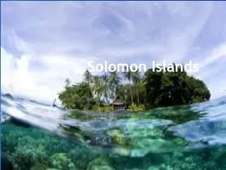
Solomon
Discover the science behind the devastating earthquake and tsunami events, their causes, impacts, and ways to mitigate future disasters. Explore the connection between plate tectonics, seismic activity, and ocean waves in this comprehensive overview. Learn how communities cope and recover from such natural calamities globally.

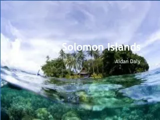
Solomon
E N D
Presentation Transcript
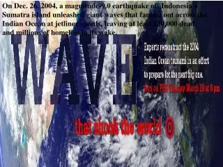
On Dec. 26, 2004, a magnitude-9.0 earthquake off Indonesia's Sumatra island unleashed giant waves that fanned out across the Indian Ocean at jetliner speeds, leaving at least 230,000 dead and millions of homeless in its wake.
A tsunami is series of traveling ocean waves of extremely long length generated primarily by earthquakes occurring below or near the ocean floor. • Tsunami waves propagate across the deep ocean with a speed exceeding 800 km/h ( 500 mph) and a wave height of only a few tens of centimeters or less. • As they reach the shallow waters of the coast, the waves slow down and their height increases up to tens of meters (30 ft) or more.
Earthquake and Tsunami Not all earthquakes generate tsunamis. An earthquake must have certain characteristics in order to generate a tsunami: 1. Epicenter is underneath or near the ocean. 2. Fault causes vertical movement of the sea floor (up to several meters) over a large area (up to 100,000 km2). 3. Large magnitude ( > 7.5 ) AND shallow focus ( < 70 km). Source: Earthquakes by Bruce A. Bolt
“The 26th December 2004 Sumatra-Andaman earthquake is the fourth largest earthquake in the world since 1900 and is the largest since the 1964 Prince William Sound, Alaska earthquake.” United States Geological Survey (USGS) “The tsunami that struck Southeast Asia on December 26, 2004 has been confirmed as the most devastating in modern history.” Guinness Book of World Records
Kuril Island, 8.1 M Earthquake Jan 13, 2007
The Jan 13, 2007, Saturday quake struck at about 1:24 p.m. local time, almost 500 kilometres east of Etorofu, the largest in a chain of four disputed islands known as the Northern Territories in Japan, and the Kuril islands in Russia.
A tsunami is generated on the Convergent Boundary at a Subduction Zone by a large seafloor earthquake, 7 M Zone Earthquakes of magnitude 7 are generally classified as major earthquakes, capable of widespread, heavy damage.
Sumatra Earthquake 9.2 magnitude on 26 December, 2004, triggered a transoceanic Indian Ocean Tsunami Tsunami 26 december
The 2004 Asian Earthquake-Magnitude 9.3 Location: OFF THE WEST COAST OF NORTHERN SUMATRA The devastating megathrust earthquake of December 26th, 2004 occurred on the interface of the India and Burma plates and was caused by the release of stresses that develop as the India plate subducts beneath the overriding Burma plate. The India plate begins its descent into the mantle at the Sunda trench which lies to the west of the earthquake's epicenter. The trench is the surface expression of the plate interface between the Australia and India plates, situated to the southwest of the trench, and the Burma and Sunda plates, situated to the northeast Distances: 250 km (155 miles) SSE of Banda Aceh, Sumatra, Indonesia310 km (195 miles) W of Medan, Sumatra, Indonesia1260 km (780 miles) SSW of BANGKOK, Thailand1605 km (990 miles) NW of JAKARTA, Java, Indonesia
Figure 2. Maximum tsunami amplitudes in meter predicted in Boussinesq model simulations for the Bay of Bengal (x-long E; y-lat. N). Maximum run-ups up to 24 m were predicted on the upper NW coast of Banda Aceh, Indonesia.
Plate Tectonics: Trying to understand how the Earth evolved is one of the fundamental problems we have in science. On Earth's crust, continental landmasses, upon which we live, may be thought of as ships drifting upon a sea (oceanic crust), propelled wherever the currents take them. This slow voyage of the continents has reshaped the face of the Earth throughout its history driven by internal heat of the core.
Indonesia At least 100,000 people are believed dead in Aceh and Northern Sumatra, while some 500,000 people are sheltering in scattered refugee camps across the province, the UN estimates. Large swathes of Banda Aceh, Meulaboh and Calang and their outlying districts are completely destroyed. To speed up aid delivery, the Australian Air Force has assisted in improving air traffic control at Banda Aceh airport. The UN is moving supplies by truck along the road from the regional capital Medan. Other agencies are shipping relief by sea to outlying islands. The ports of Belawan and Lhokseumawe are the nearest harbours undamaged by the tsunami. http://news.bbc.co.uk/1/shared/spl/hi/world/04/asia_quake/quake_maps/html/1.stm
Thailand Worst affected districts are Phang Na, Ranong, Trang, Phuket and Krabi where more than 5,000 people are believed to have died. These provinces form the heart of Thailand's tourist industry. Some 27 hotel complexes in Phuket alone have been destroyed, the Thailand government reports. At least 2,400 fishing boats have been destroyed and 54,000 farm animals killed, according to official Thai estimates. Some 6,000 houses, 50 schools and 19 government buildings are also reported to be damaged or destroyed. http://news.bbc.co.uk/1/shared/spl/hi/world/04/asia_quake/quake_maps/html/2.stm
Image acquired and processed by CRISP/National University of Singapore
Image acquired and processed by CRISP/National University of Singapore
Sri Lanka More than 30,000 people have been killed and 835,000 have been made homeless mainly in the southern and eastern coastal regions. Worst affected districts are Jaffna, Kuchaveli, Mullativu, Trincomalee, Batticaloa, Ampara, Hambantota, Matara and Galle. Some 49,000 people are living in refugee camps in Galle alone. The United Nations and other agencies are working to distribute food, shelter and supplies in these districts. Tensions between the government and Tamil Tiger rebels are hampering aid distribution to some parts of the north east of the country. http://news.bbc.co.uk/1/shared/spl/hi/world/04/asia_quake/quake_maps/html/3.stm
India Hundreds of coastal communities in India's southern states of Kerala, Tamil Nadu and Andhra Pradesh have been devastated. At least 9,000 people are believed to have died. Fishermen have been hit hard with many losing the boats on which they depend for their livelihoods. Around 140,000 people are sheltering in relief centres. The Indian government has estimated reconstruction costs at around $1.6bn and has said it will seek international aid for long term reconstruction. http://news.bbc.co.uk/1/shared/spl/hi/world/04/asia_quake/quake_maps/html/4.stm
Andaman and Nicobar Islands India's Andaman and Nicobar Islands lie close to the epicentre of the earthquake. It is unclear how many people died on these remote, partly-tribal islands but 5,600 are missing – the vast majority of India's missing total. The islands' capital Port Blair has continued to flood because of the change in the sea level and scientists said the earthquake's impact was so tremendous that the Andamans could have tilted or even shifted. Six of the 38 inhabited islands have been evacuated. http://news.bbc.co.uk/1/shared/spl/hi/world/04/asia_quake/quake_maps/html/5.stm
Burma Plate Indian Plate A. Between Earthquakes ‘Locked’ to the subducting mobile Indian plate, the overriding Burma plate gets squeezed. Its leading edge is dragged down, while an area behind bulges upward. This movement goes on for decades or centuries, slowly building up stress. The time is 250 years as the Indian Plate is mobile and its movement has thrust potential.
B. During an Earthquake An earthquake along a subduction zone happens when the leading edge of the overriding plate breaks free and springs seaward, raising the sea floor and the water above it. This uplift starts a tsunami. Meanwhile, the bulge behind the leading edge collapses, thinning the plate and lowering coastal areas.
During a serious Earthquake An earthquake along a subduction zone happens when the leading edge of the overriding plate breaks free and springs seaward, raising the sea floor and the water above it. This uplift starts a tsunami. Meanwhile, the bulge behind the leading edge collapses, thinning the plate and lowering coastal areas.


![[Solomon Westerman] [PM]](https://cdn1.slideserve.com/2812956/slide1-dt.jpg)