Download

1 / 32
320 likes | 500 Vues
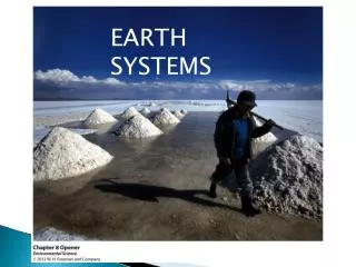
Earth Systems and Resources. A. Earth Science Concepts: Geologic Time. The geologic time scale is used to distinguish periods in Earth history. It is based on the layering that occurs in rocks due to sedimentary, metamorphic and igneous action (know how these are formed).

E N D
A. Earth Science Concepts:Geologic Time • The geologic time scale is used to distinguish periods in Earth history. • It is based on the layering that occurs in rocks due to sedimentary, metamorphic and igneous action (know how these are formed). • Layers of rocks that occur above others are generally younger than those below them. • From largest to smallest, the scale is divided into eras, periods and epochs. • Be able to name in order the eras and periods.
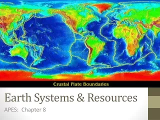
Plate Tectonics • The Earth consists of a partly liquid core overlain by a mantle and surface crust. • The outer solid mantle and crust form the lithosphere, whereas the liquid inner mantle is the asthenosphere, in which convection cells are present. • Energy transferred by the cells moves regions of crust called tectonic plates. • Convergent plate boundaries cause subduction where continental and oceanic plates collide. A trench may form at a convergent boundary. • Divergent plate boundaries yield oceanic ridges where molten magma comes to the surface. • Transform faults form where plates slide past each other.
Earthquakes • Forces from the Earth’s mantle and surface produce faults in the surface. • When movement of rocks occurs along a fault, seismic waves are generated. • Earthquakes are generated principally along the boundaries between tectonic plates. • The focus is the site of earthquake generation; the epicenter is the surface location above the focus. • The magnitude (amplitude) of seismic waves is measured by a seismograph using the Richter scale. • Weaker aftershocks may follow an earthquake. • Earthquakes on the ocean floor may cause tsunamis. • As tsunamis reach shore, the wave speed slows, the wavelenth decreases and the amplitude grows.
Seismic Waves • P-waves (primary pressure waves): are longitudinal waves that can travel through solid, liquid or gaseous media. They have the highest velocity. • S-waves (secondary shear waves): are transverse waves. They do not travel through liquids and have lower velocity.
Volcanism • Volcanoes usually develop near the boundary between plates where upwelling magma from the asthenosphere rises through the lithosphere. • They are particularly prevalent at continent-ocean subduction zones, although they also may develop over hot spots- a rising plume of magma that breaks through the crust. • Where magma breaks through to the surface, it may flow as lava. Ash and gas also may be ejected into the atmosphere when a volcano erupts. • This is Anatahan volcano before its eruption; the following is after (next slide).
Types of Volcanoes • Cinder- built from particles of lava ejected, often explosively, from a single vent. These fragments fall as cinders to form the cone. They are broad and gently sloping. • Composite- steep and symmetrical, large cones composed of alternating layers of lava, ash and cinders. • Shield-built almost entirely of fluid lava flows. Flow after flow pours out in all directions from a central summit vent, or group of vents, building a broad, gently sloping cone of flat, domical shape. The following image is of a shield volcano- Kilauea.
Seasonality • Climate varies with latitude and elevation, with increasing elevation simulating the effects of increasing latitude. • Temperate latitudes often (but not always) tend to have four distinct seasons whereas tropical latitudes often tend toward a dry season (winter) when trade winds become established and a calm wet season (summer). • Biomes are defined on the basis of temperature and rainfall patterns, which are often linked to seasonality, although soil and topography are contributing factors to biome distribution.
Solar Intensity and Latitude • The tilt of the Earth’s axis (23.5○)results in variation in the amount of solar radiation impacting the surface. • The intensity of solar radiation (measured in watts) decreases with latitude, with the highest polar latitudes receiving the least and equatorial latitudes receiving the most radiation. • 31% of radiation is reflected (due to scatter, clouds and the ground) and 69% is absorbed (due to atmospheric molecules and dust, clouds and the ground). • Glaciers and ice have the highest albedos, reflecting 90% of incident solar radiation, whereas oceans and forests have the lowest, reflecting 5%).
B. The AtmosphereComposition • Oxygen (21%) and nitrogen (78%) are the principal atmospheric gasses. • Argon, carbon dioxide, neon, helium and water vapor make up most of the remaining 1%. • Atmospheric density and pressure are highest near the Earth’s surface. • The atmosphere shields the Earth’s surface from most UV, X and cosmic rays.
Early Earth Atmosphere • First atmosphere was primarily H2 and He; formed before the planet had a differentiated core. • Second atmosphere- produced by volcanic out-gassing, consisted primarily of H2O, CO2, SO2, CO, Cl2, N2, H2 and NH3 (ammonia) and CH4 (methane). This early atmosphere was a reducing (electron gaining) environment. • Free O2 accumulated in the atmosphere after the appearance of photosynthetic organisms about 1.7 billion years ago. It converted the atmosphere from a reducing to oxidizing one. • Debate continues on the precise composition of the early atmosphere.
Structure • Troposphere- extends to 12 km up; temperature declines with altitude; weather occurs within this lowest layer. • Stratosphere- 12-50 km up; steady wind; comparatively uniform temperature; contains a layer of ozone that absorbs UV light, which increases the temperature of the layer with elevation. • Mesosphere- 50-80 km up, temperature drops to –138○C. • Thermosphere- 80-480 km up; absorbs X rays which raises temperatures to 1000○C.
Weather and Climate • Weather- the condition of the atmosphere at a given place and time. • Climate- prevailing weather of a geographic location. • Precipitation- when warm, moist air rises it cools, resulting in condensation. When atmospheric saturation is reached, clouds form and water is released as precipitation. • Air passing over warm water tends to accumulate moisture, whereas, air passing over land tends to dry. • Rain shadow effect- as moisture laden air moves from oceans toward mountains (the windward side), the air rises, cools and drops its precipitation. The air continues to the leeward side of the mountains, where conditions are dry from lack of precipitation.
Atmospheric Circulation • Geographic differences in solar energy drives atmospheric circulation. • Convection currents at equatorial latitudes drives heated air toward the poles, where it cools, sinks and flows back toward the equator. • Wind- complex horizontal air movements driven in part by the Earth’s rotation. • Coriolis effect- tendency to turn fluids right in N hemisphere, left in S hemisphere due to Earth’s rotation. • Prevailing winds- polar easterlies, westerlies (temperate latitudes), trade winds (equatorial).
Atmosphere-Ocean Interactions • Prevailing winds generate gyres (circular ocean currents)- clockwise in the N hemisphere and counterclockwise is the S hemisphere. • The Coriolis effect influences currents as it does winds. • Deep ocean currents are driven by differing water density. Cold, salty water sinks and warm, less saline water rises, leading to the ocean conveyer belt that moves cold arctic water south and warm tropical water north.
El Niño Southern Oscillation (ENSO) • Wind affects ocean currents and heat from the ocean affects atmospheric circulation. • Enso is responsible for much of the Earth’s climatic variation. • Every 3-7 years, the trade winds weaken, permitting warm water to expand from the western tropical Pacific toward S. America. • Westerly ocean currents slow, stop or reverse during these times. • The upwelling of cold, nutrient rich water in the eastern Pacific is stopped and global air currents change.
C. Global Water ResourcesFreshwater/Saltwater • 97% of the Earth’s water is salt water. • Full strength seawater averages 3.5 % (35 ppt) salts. • Even fresh water has some dissolved chemicals, notably NO3, PO4, Fe++, K+., Ca+.
Human Use • Agriculture- uses large amounts of water, often inefficiently. • Industrial- water may be used for cooling or as a constituent substance; • Domestic/municipal- household use of water can be considerable in developed countries.
Surface and Groundwater • Surface water consists of water in lakes, rivers, swamps and other bodies of water. • Runoff is water that enters surface water from precipitation. • Ground water is water that accumulates underground above an impermeable layer like rock. • Water flows slowly through permeable material until it is discharged into rivers and lakes or other wetlands. • It is replenished through rainfall, particularly through recharge areas like wetlands. • A watershed is a geographic region that supplies water to a river system. • An aquifer is a space or porous layer in the ground where ground water accumulates.
Global Problems • Development of river floodplains and placing dikes along rivers that prevents normal flow of water onto floodplains may cause catastrophic flooding downstream. • When ground water is removed via wells at a rate greater than the recharge rate, ground water levels drop. This problem is particularly acute in arid areas. • At the coast, fresh ground water may be replaced by salt water (salt water intrusion) when water is withdrawn at too great a rate. • Irrigation of crops in arid climates can lead to accumulation of salt in the soil as evaporation brings salts to the surface. • Industrial processes can yield toxic chemical pollutants that are added to water effluent. • Human and agricultural waste can also contaminate water with coliform bacteria that lead to oxygen depletion in water.
Conservation • Irrigation methods such as drip irrigation and minimal soil tillage can reduce agricultural water loss in arid climates, leading to aquifer depletion. • Treatment of agricultural, municipal and industrial waste at the primary, secondary and tertiary levels yield water that is again suitable for human uses. • Re-use of household gray water (water from dishwashers, washing machines showers and sinks can be recycled to flush toilets. • Human and agricultural wastes in water can be used to make fertilizer. • Desalination of sea water using reverse osmosis (movement of water through a membrane permeable to water but not salt) can be used to make fresh water.
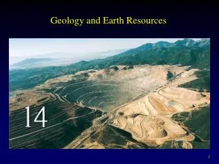
D. Soil and Soil DynamicsRock cycle • Rocks are continually formed, broken down and re-formed. • Magma cools and solidifies, developing into various types of igneous rocks depending upon factors like the rate of cooling. • Igneous rock may weather and re-form as sedimentary rock or be altered through high temperature and pressure into metamorphic rock. • Basalt, pegmatite and granite are typical igneous rocks, the most abundant rocks, whereas shales, limestone and sandstones are common sedimentary rocks. Schist, slate marble and gneiss are metamorphic. • Among the most abundant elements in these rocks are oxygen, silicon and aluminum.
Coal • Coal- the product of time, pressure, heat and dehydration on the decomposing remains of plant material. • Coal begins as peat, which is transformed to lignite, bituminous coal and ultimately anthracite. • A contaminant in coal is sulfur, particularly in bituminous coal. • Major coal deposits are present in the Appalachian region.
Physical Properties of Soils • The properties of soils are inherited mostly from the properties of the inorganic parent material (lower portions of photo). • In time, organic matter from the decay of plants is mixed with the soil to improve the soil’s properties (note the darker soil region just below plant growth).
Soil Texture • Texture depends on particle size: • Coarse sand, >200 microns. • Sand- 20-200 microns. • Silt- 2-20 microns. • Clay- <2 microns. • Soils with differing textures have differing physical and chemical properties, and thus influence the growth of plants.
Soil Nutrients • Soil nutrients are those essential chemicals necessary for plant growth. They consist of: • Macronutrients- nutrients required in large quantities: K, Mg, Ca, N, P, S. • Micronutrients- nutrients required in small quantities: Fe, Mn, Zn, Cu, Cl, Bo, Md, Na.
Functions of Nutrients • Serve as catalysts for chemical reactions. • Serve to transport electrons in metabolic reactions. Example: Fe++ in electron transport system. • Serve as structural components of molecules. Example: Ca++ in cell wall. • Influence the permeability of cell membranes. Example: Ca++ in cell walls.
Cation Exchange • Cations- positively charged chemicals, such as K+, Ca++, Na+. • Cation exchange capacity- refers to a soil’s ability to hold and give up nutrients. • Silts and especially clays are higher in cation exchange capacity, whereas sands are poor at holding nutrients.
Soil Water • Pores- the spaces in the soil between particles. • Soil with large pores, such as dune sands (upper photo), drain of water rapidly and are prone to dryness. • Soils with small pores like the clays of floodplains (lower photo) hold water tightly and tend to be waterlogged. They may hold water so tightly that not all of it is available to plants. • Field capacity- the amount of water that a soil can retain against the action of gravity. • Wilting point- When too little water is held in the soil, plants can’t obtain enough to offset the effects of evaporation. This is the point at which leaves wilt.
Soil Types • Spodosols- develop in colder climates usually under conifer forests; acidic and nutrient poor. • Alfisols- develop in temperate climates under deciduous forests; nutrients maintained by recycling leaf litter. • Mollisols- develop in temperate semi-arid grasslands; high in organic matter and nutrients because precipitation is insufficient for nutrient leaching. • Aridosols- develop in arid regions; precipitation is insufficient for nutrient leaching. • Oxisols- develop in wet tropical climates; nutrient poor and with little organic matter due to high rates of decomposition. Available nutrients are rapidly recycled through living plants.