Performance of New Tornado Detection Algorithm
This paper discusses the performance of newly developed tornado detection algorithms, featured during significant tornado events in Stoughton, Wisconsin, and Cleveland, Ohio. Utilizing advanced technologies like neural networks, the algorithms assess tornado probabilities and strengths. Key metrics like the Tornado Strength Index (TSI) and Meso Strength Index (MSI) are analyzed, alongside actual event data. This study aims to improve warning systems and enhance public safety by accurately predicting tornado occurrence and intensity based on real-time weather data.

Performance of New Tornado Detection Algorithm
E N D
Presentation Transcript
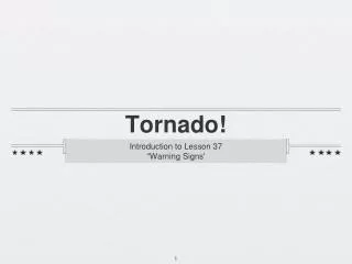
Performance of New Tornado Detection Algorithm [18 August 2005 – Stoughton, Wisconsin Tornado] NWA 2006 – Cleveland, OH
Tornado Path Begin Time: 6:15 p.m. End Time: 7:08 p.m. Path Length: 20 miles Max Width: ½ mile F-scale: F3 Deaths: 1 Injuries: 21 Courtesy: NWS Milwaukee/Sullivan
TelePATH Data • Algorithms created jointly by Weather • Decision Technologies (WDT) • and the NSSL • Algorithms available for display in • ESP:LIVE from Weather Central
TelePATH Data • FunnelPATH Key Variables • “Prob of Tornado” – indicates Probability • of Tornado • >30% is a significant concern • Most common range 20% - 60% • Utilizes “Neural Network”
TelePATH Data • FunnelPATH Key Variables • “Tornado Strength Index” – • dimensionless strength index for • tornadic circulation • >5000 indicates a significant • tornado threat
TelePATH Data • MesoPATH Key Variables • “Meso Strength Index” – indicates • dimensionless strength index for a • mesocylcone • >3000 is a moderate mesocyclone • >3500 is a significant mesocyclone • “Meso Base” – mesocyclone base height • “Meso Depth” – mesocyclone depth
Level II NexRad Base Reflectivity and Base Velocity at Tornado Touchdown 2315 UTC
Mesocyclone Locations Associated with SuperCell 2315 2254 2205
Mesocyclone Locations Associated with SuperCell 0015 2315 2254
Performance of New Tornado Detection Algorithm [18 August 2005 – Stoughton, Wisconsin Tornado] NWA 2006 – Cleveland,OH