Download
1 / 9
90 likes | 221 Vues
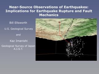
The NLfB staff currently does not utilize digital instruments as standard tools for fieldwork. This presentation details our methods for capturing geological data in the field, including raw data descriptions and the processing pathway through to mapping products like maps, models, and reports. We examine the diverse landscapes of Lower Saxony, including low mountains, lowlands, and coastal areas, where various drilling techniques and equipment, such as augers and vibrocorers, are employed. The output includes borehole logs and profiles, highlighting our evaluation methods and challenges faced with digital data capture.

E N D
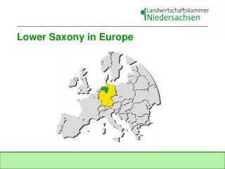
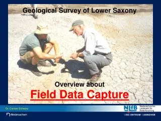
Geological Survey of Lower Saxony Overview about Field Data Capture
Situation today • NLfB-staff is NOT using digital instruments for field work as standard tools • This Presentation will show • how we capture geological data in the field, • how geological informations are described in the field (raw data), • the way: raw data processing and evaluation mapping products (maps, models, reports)
Landscape and Geol. Situation in Lower Saxony • 3 Major Types of Landscape • Low Mountains (up to 1000 m) Mesozoic and Paleozoic hardrocks • Lowlands Quaternary and Tertiary sediments (mainly softrock, peat) • Coastal Areas, Border Islands, North Sea Shelf Quaternary, mainly Holocene sediments (Tidal flat areas, marshlands, very soft material with intercalations of peat)
Drilling by hand • Equipment for Fieldwork • Auger drilling( ... and other heavy equipment) Examples only! • Drilling platform • Vibrocorer(... and other special equipment)
Fieldwork (per map sheet 1 : 25,000) • Drillings by Hand (down to 2 m depth) Results: 2000 - 5000 shallow borehole informations • Auger Drillings (down to 50 m depth) Results: ca. 50 own auger drillings • Evaluation of Borehole Descriptions from archives, provided by internal and external sources Results: 50 - 100 borehole descriptions • Recording of Raw Data
Application of Raw Data • All describtions of geological material in NLfB are following one key • Software in „SEP3-format“ (Programm for the standarized describtion of geological layers and their lithology) (deth / stratigraphy / petrography (main; others) / genesis / colour / samples) Geological informations of borehole Head informations of borehole
Data Set in „SEP3 - format“ • ... is base for all further working steps with different software. • NLfB is using the following software for processing the raw data: ArcInfo / ArcView GeODin GeoObject2 / Virgil (OpenGeo) MeMaS ... other GIS - software
Maps 3-D-Models • Resulting Products • Based on SEP - data the mentioned softwares are used as standard tools for the contructinon of Borehole Logs Fenced Diagramms Profiles
Summary • Reasons why we stopped our own testings with „field pc‘s“ - to heavy (esp. with extra battery packs) - weak protection against water, dust ... - display to small - display not readable in sunny conditions - memory to small - fear for loss of data • Decision - no digital data capture yet - watch the market - participate from neighbours experiences