Download
1 / 35

E N D
Modernizing U.S. National Standards for the Classification and Mapping of WetlandsJane Awl (WMC), Bill O. Wilen(USFWS), Lawrence R. Handley (USGS), and John M. Galbraith (Virginia Tech)Session: (48) Wetlands: Extension/OutreachJune 5, 20129th INTECOL International Wetlands Conference: Wetlands in a Complex World, June 3-8, 2012, in Orlando, Florida
Status of the NSDI Wetlands Layer USFWS Wetlands Geodatabase contains over 35,600 7.5-minute map areas in a seamless ArcSDEgeodatabase. • 73% of the conterminous U.S. • 32% of Alaska • 100% of the windward islands of Hawaii • 76% of Puerto Rico and the U.S. Virgin Islands • 100% of Guam and Saipan in the Pacific Trust Territories http://www.fws.gov/wetlands/Layer/Status-Information.html
Wetland Mapping Consortium (WMC) Enhancing Wetland Conservation through Improved Mapping and Monitoring
Wetland Mapping Consortium (WMC) • The WMC is an interdisciplinary group of wetland scientists and managers interested in mapping and monitoring wetlands with remotely sensed images and/or using the resultant products to best manage wetland resources. • Goal is to improve the management of wetland resources through enhanced wetland mapping and monitoring and dissemination of this information.
WMC Collaborative Projects • WMC Scholar Site –Online Collaborative Resources • WMC Monthly Webinar Series • SSURGO Data Package for Wetland Mappers • Technical support for Wetlands Mapping and Classification Standards Working Groups • Wetlands Classification Image Gallery –Online image collection • (with CNL World-- Larry Handley and Catherine Lockw0od will present later in this session ) • Technical Guidance on developing national conventions for WetlandNames and Stable Unique Identifier Codes
Training & Collaboration Resources Wetland Mapping Consortium (WMC) http://clic.cses.vt.edu/WMC/ Association of State Wetland Managers (ASWM) http://aswm.org/ U.S. Fish and Wildlife Service (USFWS) Wetland Mapping Training http://www.fws.gov/habitatconservation/nwi/wetlands_mapping_training/index.html
http://www.fws.gov/habitatconservation/nwi/wetlands_mapping_training/index.htmlhttp://www.fws.gov/habitatconservation/nwi/wetlands_mapping_training/index.html
SSURGO Package for Wetland Mappers Soil Survey Geographic (SSURGO) Database NRCS Soils http://soils.usda.gov/survey/geography/ssurgo/ • Hydric Soils conveniently extracted • Seamless national coverage • Data to be refreshed annually
U.S. National Standards for Mapping Wetlands: Federal Geographic Data Committee (FGDC) • FGDC is an interagency committee that promotes the coordinated development, use, sharing, and dissemination of geospatial data on a national basis. • The nationwide data publishing effort is known as the National Spatial Data Infrastructure (NSDI). • FGDC standards specify the minimum quality of data necessary to allow inclusion of the data into the National Spatial Data Infrastructure (NSDI) and the National Map (USGS). • The national standards for wetland mapping must be used in all wetland inventory mapping projects that receive any Federal funding (direct or indirect). Alternatively-funded wetland mapping projects are encouraged to comply with the standard. • Site-specific and jurisdictional boundary mapping are EXEMPT.
What are the FGDC National Standards for Wetlands? Wetlands Classification Standard Classification of Wetlands and Deepwater Habitats of the United States (Cowardin et al, 1979) endorsed by FGDC in 1996 http://www.fgdc.gov/standards/projects/FGDC-standards-projects/wetlands/index_html Wetlands Mapping Standard endorsed by FGDC in 2009 (FGDC-STD-015-2009) http://www.fgdc.gov/standards/projects/FGDC-standards-projects/wetlands-mapping/2009-08%20FGDC%20Wetlands%20Mapping%20Standard_final.pdf)
Maintenance Review of the FGDC National Wetlands Classification Standard (Cowardin et al 1979) • FGDC Standards are reviewed and updated on 5 year cycles [FGDC Directive # 9 Maintenance and Support] • Development of the Wetlands Mapping Standard lead to specific recommendations for corresponding updates to the Wetlands Classification Standard on which it relies. • See more information online at FGDC.gov http://www.fgdc.gov/standards/projects/FGDC-standards-projects/maintenance-review-wetlands-classification-std
Revised Wetlands Classification Standard • Newly edited and updated version formatted to be consistent with recently endorsed standards • Reflects advances in the science • Incorporates recommendations endorsed as part of the mapping standard development and supported by the National Wetlands Inventory’s Data Collection Requirements and Procedures for Mapping Wetland, Deepwater, and Related Habitats of the United States (http://www.fws.gov/wetlands/_documents/gNSDI/DataCollectionRequirementsProcedures.pdf) • Same hierarchical structure of the classification system at the top three levels (System, Subsystem, and Class).Most of the updates in classification are to Modifiers.
Proposed Update to Reference Images Wetland Image Gallery The Wetland Image Gallery is a compilation of wetland images and corresponding information for the FGDC maintenance review of the current Wetland Classification Standard. The gallery provides an image framework for the classification of various possible wetland and deepwater habitats. The intent is to support, update, and add new images as examples to complement the classification scheme within the Classification of Wetlands and Deepwater Habitats of the United States. http://www.wetlandgallery.cnlworld.org
Proposed Update to Deepwater Limit • As noted in Section 2.2, we have placed the boundary between wetlands and deepwater habitats in the Riverine and Lacustrine Systems at a depth of 2.5 m (8.2 ft) below low water because this represents the approximate limit of soil as defined in Soil Taxonomy (Soil Survey Staff 1999) and the approximate maximum depth to which emergent plants normally grow (Welch 1952, Zhadin and Gerd 1963, Sculthorpe 1967). • Thus, according to our definitions, inland wetlands may have soil, but inland deepwater habitats do not. All Palustrine waters are less than 2.5-m deep; therefore, potentially all Palustrine habitats have soil. • In the Marine and Estuarine Systems, the deep limit of soil lies at a depth of 2.5 m below extreme low water; however, we separate wetlands from deepwater habitats precisely at the extreme low water mark in those Systems. • So, according to our definitions, Marine and Estuarine wetlands may have soil, and deepwater habitats also may have soil out to the 2.5-m depth limit.
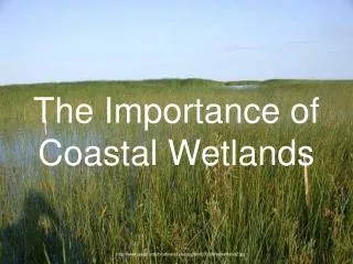
Tate's Hell State Forest Local legend has it that a farmer by the name of Cebe Tate, armed with only a shotgun and accompanied by his hunting dogs, journeyed into the swamp. Although there are several versions of this story, the most common describes Tate as being lost in the swamp for seven days and nights, bitten by a snake, and drinking from the murky waters to curb his thirst. Finally he came to a clearing near Carrabelle, living only long enough to murmur the words, "My name is Cebe Tate, and I just came from Hell!" Cebe Tate's adventure took place in 1875 and ever since, the area has been known as Tate's Hell, These cypress trees are documented to be over 150 years old but only reach a mature height of approximately 15 feet, hence the name "dwarf cypress". http://www.floridaforestservice.com/state_forests/tates_hell.html
Traditional Wetland Names • Historic • Mapper/Surveyor (e.g., Everglades, Great Dismal Swamp) • Associated People and Stories (e.g., Tate’s Hell, Purgatory Swamp) • Native (e.g., Okefenokee from Okefenoka, meaning “Land of the Trembling Earth”, Congaree, Cheyenne Bottoms & Quivira) • Landowner Names (e.g., Gowing’s Swamp) – they change over time. • Natural Features • Hydrologic Features (e.g., Great Kankakee Swamp for the Kankakee River, Beaver Creek Marsh) • Landscape features (e.g., Cheyenne Bottoms, Prairie Potholes) • Biologic features (e.g., Cranberry Glades) • Landmarks • Geo-Political (e.g., Boundary Waters Canoe Area, Arcata Marsh for the City Arcata, CA)
Problems to be Addressed Currently there are no nationally-accepted standards, conventions, protocols, or tools for creating wetland site names and other stable (not likely to change within a defined set) unique identifiers. Allow individual wetland sites and corresponding geographic features (e.g., points, polygons) to be more effectively tracked, monitored and reported on over time. Associate wetland geographic data with other data sets (such as water quality and monitoring data) to expand analytic capabilities. Enhance system interoperability between federal agencies, states, tribes, and contracted partners. Facilitate data sharing at a national scale.
Unique Identifiers “With reference to a given (possibly implicit) set of objects, a unique identifier (UID) is any identifier which is guaranteed to be unique among all identifiers used for those objects and for a specific purpose” (from Wikipedia 04-20-2011). Identifiers generally include numbers, codes and names. Identifiers in this sense does NOT refer to the 3 parameters for wetland identification. It means names and codes for use in a database. Unique in this sense does NOT refer to “Special” Wetlands. Unique Identifiers means the names and codes are Non-Repeated, Not Redundant within the database.
Coordination with FGDC Standards The need for stable unique identifier codes for tracking wetlands was identified in the Implementation Plan for the FGDC Wetlands Mapping Standard. http://www.fws.gov/wetlands/Documents/Implementation-Plan-for-the-FGDC-Wetlands-Mapping-Standard-Version-1.pdf This technical challenge is being investigated in coordination with the maintenance review of the Wetlands Classification Standard and prior to the next maintenance review cycle for the Wetlands Mapping Standard (so more information maybe available when the Mapping Standard is updated).
Outcomes The development of nationally-applicable technical guidance on stable unique identifiers for wetlands may enhance capabilities for associating wetland mapping data with other data sets (such as water quality and monitoring data) expanding the possibilities for analysis. Increased availability of such wetland information could better aid in identifying solutions for management, conservation and protection issues for wetlands and other water resources.
Stable Unique Identifiers:State Projects Numeric Codes for the Identification of Basins in Minnesota http://mn.gov/oet/policies-and-standards/geospatial/gis-pages/mn-basin-identification-codes.jsp--This standard has been developed to improve the sharing and exchange of information about lake and wetland basins. Generation of unique identifiers for complexes of NWI polygons based on the updated New Hampshire Method http://nhmethod.org/index.htm. See “NHWetlands Base Map” at http://www.granit.unh.edu/data/downloadfreedata/category/databycategory.html.
Stable Unique Identifiers:Key Issues Codes must function within a relational database context to support robust analysis. The national level is the missing puzzle piece to putting state and regional databases together for analysis. Codes need to reflect wetland dynamism: expansion/contraction, disappearance/reappearance, and fragmentation over time. What will be the base polygon for coding? (Wetland Complex, HGM, LLWW, NWI, other?) Will there be a target minimum or maximum wetland size for coding? The wetland Mapping Standard specifies a target mapping unit of 0.5 acres. Some smaller wetlands have significant biological functions which there may be need to monitor. How will the code be assigned? Can the process be automated? What will be the code structure? (Information-rich and scalable or Geographic Coodinate-based “Locator Point”) Length of code may become unwieldy. Multiple fields may be required to store components of code and to aid in scalability and analysis.
LANDSCAPE, LANDFORM, WATER FLOW PATH, AND WATERBODY TYPE (LLWW)
LLWW Advantages for Base Polygons • Greater temporal stability of the landscape setting relative to the vegetation. • Some level of LLWW could potentially be mapped for sites of interest which are not currently wetlands (including historic, restorable, and riparian sites).
Hydrologic Unit Codes (HUC)8-digit, 10-digit, and 12-digit Codes
Stable Unique Identifiers:Recommendations: Use of only these codes and names would NOT be mandated, states and others would still be free to use their own systems. The intent is to build methods that will solve fundamental problems and be so useful that everybody will want to use it as a complement to their data set. The names and codes should remain separate from any wetland/upland determination(even currently drained wetlands or planned/future wetlands could be issued national wetland names and identifier codes. Utilize multiple approaches and relational tables for robust usage possibilities. Code(s) should be informationally robust enough to allow for multiple levels of aggregation and splitting. Stable Unique Identifier Code assignment by online web-based tool and database lookup. Develop a national pilot project. Develop a new FGDC standard and National Coverage for Wetland Names and Stable Unique Identifier Codes (work towards grants and funding to develop)
NSDI CAP 2011 Project Description Technical Guidance on Unique Identifiers for Wetland Mapping Standard Implementation, Outreach and Training Materials http://www.fgdc.gov/grants/2011CAP/projects/G11AC20060
Partner Organizations • FGDC Wetlands Subcommittee including: • U.S. Fish and Wildlife Service • U.S. Environmental Protection Agency • U.S. Army Corps of Engineers • U.S. Geological Survey • National Wetlands Monitoring and Assessment Working Group (NWMAWG) • Association of State Wetland Managers (ASWM) • Wetlands Mapping Consortium (WMC) • Ducks Unlimited (DU) • Kentucky Division of Water
Can the WMC help your project move forward? Wetland professionals, academic researchers, and students who are interested in the mapping and monitoring of wetlands and related resources may join the WMC and utilize our communication tools and resources to foster collaboration. Resource areas and member lists for project working groups can be set up within the WMC.
Join the WMC Wetland Mapping Consortium (WMC) membership is FREE. Members have access to email updates, online collaboration tools, as well as the monthly Webinar Series (3rd Wednesdays at 3pm Eastern). For registration information see http://clic.cses.vt.edu/WMC/WMC_Organizers.htm If you are interested in joining the Wetland Names Working Group (WNWG) or being notified of our future activities, please send an email to wetlandmappingconsortium@gmail.com with the subject line "Join WNWG".
QUESTIONS or COMMENTS? • Wetland Mapping Consortium (WMC) • Wetland Names Working Group (WNWG) • Stable Unique Identifier Codes for Wetlands • SSURGO Package for Wetland Mappers • Wetland Mapping Training For more information please contact: Jane Awl wmc.jane.awl@gmail.com