Download
1 / 30
300 likes | 408 Vues
Climate and Forests: The Case for Action Now. UNFCCC COP-12 15th November 2006. Envirosecurity Assessments Protecting and Managing the Natural Resource Base The role of remote sensing earth observation. www.sarvision.nl. www.envirosecurity.org. Systematic monitoring.

E N D
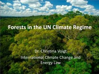
Climate and Forests: The Case for Action Now UNFCCC COP-12 15th November 2006
Envirosecurity Assessments Protecting and Managing the Natural Resource Base The role of remote sensing earth observation www.sarvision.nl www.envirosecurity.org
Systematic monitoring Advancement in satellite data availability and computing power now enables systematic dynamic ecosystem monitoring
Systematic monitoring IES approach proactive ecosystem monitoring: From global regional satellite imaging (250 – 1000 m detail)… … to local satellite imaging (10 – 60 m detail) In support of action on the ground by local agencies and communities
Systematic monitoring 1. Regional coverage Covering South America, Africa, Southern Asia Purpose: - Identify potential problem areas (hotspots of land use/cover change) - Identify extent of problems -> influence policy making and management -> raise awareness public at large Example peat forests Insular SE Asia…
Static map... Example insular SE Asia 50 km EU JRC GLC2000 best map but outdated! Forest: dark green
Dynamic map series Example insular SE Asia 50 km SarVision 1999-00 Peat forest: in brown areas
Dynamic map series Example insular SE Asia 50 km SarVision 1999-12 Deforestation: red | Peat forest: in brown areas
Dynamic map series Example insular SE Asia 50 km SarVision 2000-12 Deforestation: red | Peat forest: in brown areas
Dynamic map series Example insular SE Asia 50 km SarVision 2001-12 Deforestation: red | Peat forest: in brown areas
Dynamic map series Example insular SE Asia 50 km SarVision 2002-12 Deforestation: red | Peat forest: in brown areas
Dynamic map series Example insular SE Asia 50 km SarVision 2003-12 Deforestation: red | Peat forest: in brown areas
Dynamic map series Example insular SE Asia 50 km SarVision 2004-12 Deforestation: red | Peat forest: in brown areas
Dynamic map series Example insular SE Asia 50 km SarVision 2005-12 Deforestation: red | Peat forest: in brown areas
Dynamic map series Example insular SE Asia 50 km SarVision 2006-06 Deforestation: red | Peat forest: in brown areas
Fires on peat swamp forest Severe fires on (converted) peatlands occur yearly, result in smoke and haze a.o. endangering traffic on one of world’s key sea straits Red: deforestation 1998 - June 2005
Fires on peat swamp forest Severe fires on (converted) peatlands occur yearly, result in smoke and haze a.o. endangering traffic on one of world’s key sea straits MODIS image June 2005 - Red dots: fires Courtesy MODIS Rapid Response Team
Regional - Deforestation Peat swamp deforestation rate might now be 3-4 times higher than in non-peat areas and is still accelerating, having huge implications for global climate: Degradation and deforestation of peat lands leads to massive CO2 emissions that have so far been overlooked! (Wetlands International and Delft Hydraulics)
Systematic monitoring 2. Local coverage Zoom in to hotspot areas a) with higher detail radar, b) follow up on ground Purpose: - support local government and communities to take targeted action where needed: e.g. providing independent proof of illegal logging and forest conversion, support fire fighting - provide the accountability and transparency required by investors for payments for ecosystem services, monitor contract implementation
Targeted field response Check on the ground on foot by car or by ultra-light aircraft: large area, poor access Kalimantan: Local surveillance (fires, illegal logging etc.) carried out by local community members using ultra-light aircraft equipped with Global Positioning System and digital video camera. GPS: pilot can refly transects in unmarked terrain
Local monitoring Traditional satellites suffer from clouds
Local monitoring Radar sees through clouds Recent canopy damage.. Forest conversion New road constructed
Local monitoring Radar sees through clouds …due to fire
Targeted field response Fire fighting and prevention
Targeted field response Illegal logging response (Illegal logging by outsiders!) -> Targeted law enforcement park managers and local police
Targeted field response Park management support Envisat ASAR radar image May 2006 New road developed Fires National Park Park boundary Illegal according to Law Act of Forestry Nr. 41/99 and Biodiversity Nr 5/90
Internet-interface Dissemination of map series and information at IES Internet portal: Awareness raising Informed decision making Transparency and accountability to all stakeholders
Internet-interface What is happening where each month? Everyone can log in on Internet to watch.. Deforestation in reserve last month Make data available
Concluding remarks Systematic dynamic satellite monitoring can help: • identify trends and raise awareness on the extent of • problems (e.g. peat deforestation) with policy makers, • managers and public at large • support local government and communities to monitor • and manage their forests • - foster viable climate for forest sector investments: • independent proof the forest is still there, it is managed • well
THANK YOU! More information: info@sarvision.nl http://www.sarvision.nl/vision/ies.html