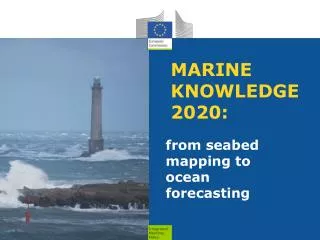
marine knowledge 2020
220 likes | 388 Vues
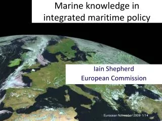
MARITIME AFFAIRS. marine knowledge 2020. Planning 2011-2013. DG MARE EMODnet chemistry. 31 March 2010. objectives. reduce operational costs and delays for those who use marine data and therefore: help private industry improve the quality of public decision-making at all levels;

marine knowledge 2020
E N D
Presentation Transcript
MARITIMEAFFAIRS marine knowledge 2020 Planning 2011-2013 DG MARE EMODnet chemistry 31 March 2010
objectives • reduce operational costs and delays for those who use marine data and therefore: • help private industry • improve the quality of public decision-making at all levels; • strengthen marine scientific research • increase competition and innovation amongst users; • reduce uncertainty in knowledge of the oceans
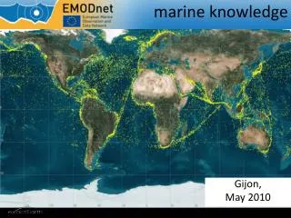
shipping, ports coastal protection renewable energy Marine Strategy Framework Directive, protected areas 2008-2010 preparatory actions • set up prototype European Marine Observation and Data Network (ur-ENODnet) to provide access to observations and highlight gaps • hydrography (water depth, coastlines .. • physics (temperature, currents waves .. • chemistry (concentrations in water, sediments, sea-life .. • biology (abundance and diversity .., • geology (sediments, hazards, erosion .. • habitats (common classification for European waters .. • 52 organisations from 24 countries • Flanders Marine Institute/Vlaams Instituut voor de Zee(VLIZ), Royal Belgian Institute of Natural Sciences, University of Liege - GeoHydrodynamics and Environment Research (ULG) Belgium;, Institute of Oceanology Bulgarian Academy of Science (IO-BAS), University of Cyprus-Oceanography Centre (OC) , Danish Environmental and Planning Agency (BLST), Danish Hydraulic Institute (DHI), Geological Survey of Denmark and Greenland, National Environmental Research Institute (NERI-MAR), Geological Survey of Estonia, Geological Survey of Finland,, Bureau de recherches géologiques et minières, Collecte Localisation Satellites (CLS), Institut Français de Recherche pour l'Exploitation de la Mer (Ifremer), Service Hydrographique et Oceanographique de la Marine (SHOM)., Iv. Javakhishvili Tbilisi State University (TSU-DNA), Alfred Wegener Institute for Polar and Marine Research (AWI), Bundesamt für Seeschiffahrt und Hydrographie (BSH-DOD),, Federal Institute for Geosciences and Natural Resources, University of Bremen (UniHB), Hellenic Centre for Marine Research (HCMR), Geological Survey of Ireland, Marine Institute (MI), Istituto Nazionale di Oceanografia e di Geofísica Sperimentale (OGS), Istituto Superiore per la Protezione e la Ricerca Ambientale (ISPRA), Latvian Environment, Geology and Meteorology Agency, Lithuania institute of Geology and Geography, ATLIS, Deltares, Mariene Informatie Service 'MARIS' BV, NIOZ Royal Netherlands Institute for Sea Research (NIOZ), etherlands Institute of Ecology; Centre for Estuarine and Marine Ecology (NIOO-CEME), Geological Survey of Norway, Norwegian Marine Data Centre - Institute of Marine Research (IMR),, Polish Geological Institute, National Institute for Marine Research and Development "Grigore Antipa" (NIMRD), All Russian Research Institute of Hydro-meteorological Information -(RIHMI-WDC), P.P. Shirshov Institute of Oceanology Russian Academy of Science (SIO-RAS), Instituto Español de Oceanografía (IEO), Geological Survey of Sweden, Sveriges Meteorologiska Och Hydrologiska Institut (SMHI), Swedish Environmental Protection Agency, Institute of Biology of the Southern Seas, National Academy of Sciences of Ukraine (IBSS NASU, Marine Hydro-physical Institute (MHI), Joint Nature Conservation Committee Support Co, NERC, National Oceanography Centre Southampton (NOC), NERC, British Geological Survey, Edinburgh (BGS), NERC British Océanographie Data Centre, Liverpool (BODC), Rutgers University; Institute for Marine and Coastal Sciences (IMCS), International Council for the Exploration of the Sea (ICES), The Global Biodiversity Information Facility (GBIF), UNEP/GRID-Arendal, €6,450,000 €6,450,000
thematic assembly groups observation and data collection archiving at national data centres sea basincheckpoints application a common architecture €3,050,000 €18,200.000 contribution of proposed financial regulation for maritime policy €22,500,000 for 2011-2013
thematic assembly groups • Developed 6 portals • Provide access to data • Highlight gaps • Indicate quality • Data is free
hydrography/bathymetry • ¼ minute resolution • coverage – all except Baltic and Outermost Regions • portals ready June 2012 • inventory of surveys • includes estimates of precision
hydrography/bathymetry • next steps 2011-2013 • complete coverage at ¼ minute resolution • engage national hydrographic offices • map two basins at higher resolution
geology • Baltic, Celtic Seas, North Sea • Sediments, underlying strata, hazards, minerals • 1: 1 million resolution • Compatible with OneGeology Europe
geology • Next steps 2011-2013 • Complete coverage European waters • Engage with innovation partnership on raw materials
physics • New project started December 2010 • complete European coverage • current, temperature, waves, turbidity, salinity, sea level • real-time and archives • linked to GMES and SEADATANET
physics • 2011-2013 • Follow-up based on results of first phase
chemistry • Parameters chosen to meet needs of Marine Strategy Framework Directive • Phramaceuticals, antifoulants, fertilisers, sewage, metals, radionuclides, hydrocarbons • Water column, sediments, biota • Heterogeneous measurements make interpolation in time and space extremely challenging
chemistry • 2011-2013 • complete coverage of EU waters • enlarge list of parameters requested
biology • Based on Census of Marine Life • Challenging to determine abundance and diversity from separate surveys
biology • 2011-2013 • facilitate abundance estimates • align with Data Collection on fisheries and INSPIRE Directive
physical habitats • first physical habitat mapping of EU waters using consistent classification • already being used in assessment for Marine Framework Strategy Directive
physical habitats • 2011-2013 • increase coverage using regional cooperation projects • maintain and update
human activity • 2011-2013 • aquaculture sites, windmill zones, pipelines, gravel extraction sites etc
sea-basin checkpoints • Integrated viewpoint of sea-basins • Fitness for purpose of data • identification of critical gaps • priorities for monitoring • Stakholder opinion • Contributions from existing organisations • Regional Sea Convention • Regional Advisory Councils for fisheries • EuroGOOS • 2011-2013 • €3,050,000 • North Sea • Mediterranean • Baltic
timing • Launch 2011 calls as soon as Financial Regulation adopted (autumn 2011)
more information • http://ec.europa.eu/maritimeaffairs/index_en.html • https://webgate.ec.europa.eu/maritimeforum/node/1305