marine knowledge 2020
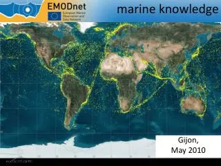
The integration of ocean observation data is crucial for innovation and knowledge generation in the EU. Maria Damanaki, Commissioner for Maritime Affairs and Fisheries, stresses the importance of efficient access to marine data collected through various observations. Current limitations in the data handling process hinder effective application. This initiative aims to establish the European Marine Observation and Data Network (EMODnet), enhancing collaboration among 52 organizations across 19 Member States, to improve data access, support scientific research, and bolster public decision-making in maritime affairs.

marine knowledge 2020
E N D
Presentation Transcript
MARITIMEAFFAIRS marine knowledge 2020 DG MARE Iain Shepherd 25 October 2010
Maria Damanaki, Commissioner for Maritime Affairs and Fisheries MARITIMEAFFAIRS (..) the data collected through these observations can only generate knowledge and innovation if Europe's engineers and scientists are able to find, access, assemble and apply them efficiently and rapidly. At present this is often not the case.
shipping, ports coastal protection renewable energy Marine Strategy Framework Directive, protected areas 2008-2010 preparatory actions • set up prototype European Marine Observation and Data Network (ur-ENODnet) to provide access to observations and highlight gaps • hydrography (water depth, coastlines .. • physics (temperature, currents waves .. • chemistry (concentrations in water, sediments, sea-life .. • biology (abundance and diversity .., • geology (sediments, hazards, erosion .. • habitats (common classification for European waters .. • 52 organisations from 19 Member States • Flanders Marine Institute/Vlaams Instituut voor de Zee(VLIZ), Royal Belgian Institute of Natural Sciences, University of Liege - GeoHydrodynamics and Environment Research (ULG) Belgium;, Institute of Oceanology Bulgarian Academy of Science (IO-BAS), University of Cyprus-Oceanography Centre (OC) , Danish Environmental and Planning Agency (BLST), Danish Hydraulic Institute (DHI), Geological Survey of Denmark and Greenland, National Environmental Research Institute (NERI-MAR), Geological Survey of Estonia, Geological Survey of Finland,, Bureau de recherches géologiques et minières, Collecte Localisation Satellites (CLS), Institut Français de Recherche pour l'Exploitation de la Mer (Ifremer), Service Hydrographique et Oceanographique de la Marine (SHOM)., Iv. Javakhishvili Tbilisi State University (TSU-DNA), Alfred Wegener Institute for Polar and Marine Research (AWI), Bundesamt für Seeschiffahrt und Hydrographie (BSH-DOD),, Federal Institute for Geosciences and Natural Resources, University of Bremen (UniHB), Hellenic Centre for Marine Research (HCMR), Geological Survey of Ireland, Marine Institute (MI), Istituto Nazionale di Oceanografia e di Geofísica Sperimentale (OGS), Istituto Superiore per la Protezione e la Ricerca Ambientale (ISPRA), Latvian Environment, Geology and Meteorology Agency, Lithuania institute of Geology and Geography, ATLIS, Deltares, Mariene Informatie Service 'MARIS' BV, NIOZ Royal Netherlands Institute for Sea Research (NIOZ), etherlands Institute of Ecology; Centre for Estuarine and Marine Ecology (NIOO-CEME), Geological Survey of Norway, Norwegian Marine Data Centre - Institute of Marine Research (IMR),, Polish Geological Institute, National Institute for Marine Research and Development "Grigore Antipa" (NIMRD), All Russian Research Institute of Hydro-meteorological Information -(RIHMI-WDC), P.P. Shirshov Institute of Oceanology Russian Academy of Science (SIO-RAS), Instituto Español de Oceanografía (IEO), Geological Survey of Sweden, Sveriges Meteorologiska Och Hydrologiska Institut (SMHI), Swedish Environmental Protection Agency, Institute of Biology of the Southern Seas, National Academy of Sciences of Ukraine (IBSS NASU, Marine Hydro-physical Institute (MHI), Joint Nature Conservation Committee Support Co, NERC, National Oceanography Centre Southampton (NOC), NERC, British Geological Survey, Edinburgh (BGS), NERC British Océanographie Data Centre, Liverpool (BODC), Rutgers University; Institute for Marine and Coastal Sciences (IMCS), International Council for the Exploration of the Sea (ICES), The Global Biodiversity Information Facility (GBIF), UNEP/GRID-Arendal, €6,450,000
preparatory actions chemistry nitrates in water column
European Marine and Observation Network Data Collection Framework in fisheries Global Monitoring for Environment and Security INSPIRE Directive Public Sector Information Directive Integrates EU initiatives into coherent whole
objectives • reduce operational costs and delays for those who use marine data and therefore: • help private industry • improve the quality of public decision-making at all levels; • strengthen marine scientific research • increase competition and innovation amongst users; • reduce uncertainty in knowledge of the oceans
thematic assembly groups observation and data collection archiving at national data centres sea basincheckpoints application a common architecture contribution of proposed financial regulation for maritime policy €22,500,000 for 2011-2013
a common architecture thematic assembly groups observation and data collection archiving at national data centres sea basincheckpoints application communication amongst national data centres to promote good practice in data curation and dissemination
thematic assembly groups observation and data collection archiving at national data centres sea basincheckpoints application a common architecture €18,200.000 consortia of organizations that assemble data from all data centres on specific themes - marine sediments, or chemical contaminants for instance
a common architecture thematic assembly groups observation and data collection archiving at national data centres sea basincheckpoints application 2011-2013 North Sea, Mediterranean, Baltic €3,050,000 check data layers, ensure that the data from different groups are mutually compatible and define priorities for further observations
Governance 2011-2013 • Priorities • Commission advised by • Marine Observation and Data Expert Group (independent, already met 10 times, renewed membership 2010) • Member States Expert Group (to be set-up) • Technical support • Prototype secretariat (€950,000) • prepare meetings, • assess the output of thematic assembly groups and sea-basin checkpoints, • prepare an annual report of activity • launch portal providing access to data from the thematic assembly groups • Assessment and Evaluation • €300,000
Chemistry • Increase coverage to entire European waters. • The main chemical substances relevant to the Marine Strategy Framework Directive are included in the first version. • It is not feasible to significantly expand the number of substances treated. • Unless feedback from the first version reveals any obvious shortcomings, the group will assemble the same species. This could start from 2011 onwards
Human activity • This includes aquaculture sites, windmill zones, pipelines, gravel extraction sites - anything except fishing which is dealt with separately under the data Collection Framework. • These were not dealt with in the preparatory action ur-EMODNET but are an essential input for assessments under the Marine Framework Strategy Directive and for Marine Spatial Planning. • It would be useful to start as soon as possible in order to provide early input for these initiatives. We will ask for complete European coverage
Biology • The present project is based on EUROBIS so already has coverage beyond the sea-basins required in the tender. • A continuation would require some thought as to how abundance and biodiversity can be extracted from the observations. The budget indicated is indicative and for maintenance of current approach. • To do a thorough job for biological parameters is beyond the scope of the available budget so we may need to wait till after 2013.
Bathymetry/hydrography • We now have coverage of all sea basins except Baltic, Black Sea and Macronesia on a ¼’ (or 500 metre) grid. • We need to complete the coverage in the first phase and move to higher resolution in selected sea-basins in the second. • The sea basins selected will depend on availability of data and extent of surveys. We will learn this from ongoing projects so cannot prepare specifications till 2012 at the earliest.
Geology • With the available budget we can complete coverage of European seas at 1 to 1 million scale. This could be started immediately and would only be delayed due to lack of budget. The work is relatively straightforward as the national geological surveys can access the data and have the expertise to process them. • By complete coverage, we mean that all sea-basins will be covered. There will certainly be gaps where no data is available.
Physics • The call for tender for a thematic assembly group for physical data is being evaluated. • We cannot expect results till 2012 so a follow-up project is not needed till 2013. • On the face of it, assembling physical data is less complex than for geological, chemical or biological data although we cannot be sure till the results of the first project are available.
Physical habitats • Other sea-basins are being covered through territorial cooperation projects. • A contribution from maritime policy budget could cover maintenance.
Sea-basin checkpoints • These are a new feature of EMODnet. • The work involves assembling data from thematic assembly groups as well as GMES and the fisheries Data Collection Regulation and determining how well they meet the needs of stakeholders. • They will identify gaps in the monitoring network. Covering 3 out of the 5 basins – Atlantic, Baltic, Black Sea, North Sea, Mediterranean – in the 3 years might be feasible. • North Sea should be first because this is where we have most data. • The Mediterranean then the Baltic could follow. We can assume €750,000 for the smaller seas and €1,500,000 for the Mediterranean
secretariat • The work requires: • expertise in the subject matter – to assess the quality of the preparatory actions • limited secretarial support to arrange the meetings (DG-MARE would still pay the expenses) • IT skills to prepare a data portal. • It could be handled by two full time equivalents and start in 2012 (in second year of project) and last for 3 years (the final year would be in the new financial framework). It could also be a Framework contract with the work chosen each year.
evaluation and assessment • assess outcome of preparatory action and • revisit the calculations and assumption made in the 2009 impact assessment