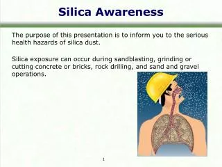
Silica Sand Mining For Use in “ FracKing ”
830 likes | 1.1k Vues
Silica Sand Mining For Use in “ FracKing ”. A Review of the land use, impacts and regulation in Allamakee County. What is Fracking ?. “Fracking” is slang for hydraulic fracturing. Developed in 1947, hydraulic fracturing is a method used to increase the production of a well.

Silica Sand Mining For Use in “ FracKing ”
E N D
Presentation Transcript
Silica Sand MiningFor Use in “FracKing” A Review of the land use, impacts and regulation in Allamakee County
What is Fracking? • “Fracking” is slang for hydraulic fracturing. • Developed in 1947, hydraulic fracturing is a method used to increase the production of a well. • The hydraulic fracturing process for oil and gas takes a mixture of proppant (usually frac sand), water, and chemicals and injects this mixture into a well under very high pressures.
What is Fracking? • Small cracks form in the bedrock, frac sand “props” open the fissures, and conduits form that increase the flow of fluids and gas within a well. • The average depth of an hydraulically fractured oil/gas well is between 6000-9000 feet below the surface.
What is Industrial Silica Sand? • Industrial silica sand refers to sand having the composition and grain-size distribution required for industrial applications. • Industrial silica sand consists of well-rounded sand composed of almost pure quartz grains. • The value of industrial silica sand is significantly higher than sand and gravel used in the construction industry.
Why Here? • Even though sand is found all over the world, the sandstones of the Upper Midwest have several unique physical properties. • Composition: Sand usually contains many different rock types; however, silica sand consists of nearly 95% quartz. • Strength: Quartz is a very hard mineral and able to withstand high pressures produced during the hydraulic fracturing process without breaking. • Shape: The sand grains are shaped like little ball bearings allowing for oil and gas to flow between individual grains without clogging the fractured rock. It is very important that the round, unbroken grain shape is preserved throughout mining, processing, and transporting the sand to the market. • Size: The sand grains are fairly uniform in size. When washed and screened, the sands meet a precise grain-size distribution required for frac sand (specified by the American Petroleum Institute, Recommended Practice 56): • It is one of a few known places on Earth where this resource occurs, making it a globally desired commodity.
When Mining Comes to Allamakee County • What will the impacts be? • To the economy? • To the land owner? • To neighbors? • To infrastructure? • To taxpayers? • To other industries? • Public • Schools • Hospitals • Etc. • Private
Aesthetic and Environmental Impacts as well as economic investment
Winona, MN Images Byron, WI
What is in your regulations? • Before 2008, Allamakee County listed Mines and Quarries as a permitted use, without any required reviews or site plans. • This is very likely how most county ordinances are structured if they have not been recently modified. • 2008 zoning ordinance classified the use as an extraction pit, a conditional use. • Conditional uses provide for public input, site plans, no negative impacts to neighbors, etc.
Conditional Use Process • Review and Approval by Board of Adjustment • Review process encourages compatibility of the proposed development with the environment and the existing and future land uses in the area. • Board sets public hearing and provides notice to neighboring land owners. • If application meets standards, the Board must approve the conditional use.
Conditional Use Standards • Compatibility • The proposed structures/use shall be arranged and operated so as to be compatible with the character of the zoning district and immediate vicinity. • They shall not interfere with the development or use of adjacent property. • They shall not be unsightly, obnoxious or offensive in appearance to abutting or nearby properties.
Conditional Use Standards • Transition: • Development shall provide for a suitable transition and/or buffer between the proposed use/buildings and surrounding properties. • Traffic: • Shall provide for adequate ingress/egress. • Particular attention given to pedestrian and vehicular safety and convenience, traffic flow and control and emergency access. • In the Mitchell application, it was felt the road was not able to support existing traffic plus the additional needed for the mine use.
Conditional Use Standards • Environmental Protection: • Development shall safeguard environmental and visual resources. • Development shall not generate excessive noise, dust, smoke, fumes, odor, glare, pollution, or, other, undesirable, hazardous, or nuisance conditions. • If all standards met: • The Board shall approve the application and plans.
Conditional Use Standards • The Board shall not approve the application if they find the development will: • Not adequately safeguard the health, safety, and general welfare of persons residing or working in adjoining or surrounding property. • Impair an adequate supply of light and air to surrounding property. • Unduly increase congestion in the roads, hazards from fire, flood or similar dangers. • Diminish property values. • Not be in accord with the intent, purpose or spirit of the zoning ordinance or Land Use policies.
What are Land Use Policies? • Land Use Policies can be found in the County Comprehensive Plan. • Zoning Ordinances are supposed to be based on the Land Use Plan, or Comprehensive Plan, of the county. • However, in Iowa, a Comprehensive Plan is not required before adoption of a Zoning Ordinance. • It is recommended that this planning step be done prior to establishing districts and allowed uses in those districts.
How did the Conditional Use Process work? • Application and Site Plan were submitted to Zoning Administrator. • Forwarded to County Engineer and County Environmental Health for comments/review. • Staff review ultimately recommended that a Traffic Impact Study, Environmental Impact Study and a Cultural Resources Study be completed to fully assess impacts and possible mitigation. • After consultation with staff, the application was withdrawn. • Consultant indicated that they wanted to expand the scope of the project and re-submit.
Images New Albin, IA Mitchell had proposed a small sand mine for this site. Proposed 13 acre mine. Depths of approximately 180 feet. Application withdrawn when staff recommended a traffic impact study, among other things.
Staff Review/RecommendationsMitchell Extraction Pit Application • County Staff involved • Engineer • Zoning • Environmental Health • Traffic Impact Study • Cultural Resources Study • Environmental Impact Study • And other, miscellaneous, reviews
Resulting Public Input • Establishing the public hearing and notices to neighbors resulted in formation of “Allamakee County Protectors”. • Grass roots organization established to ensure that concerns regarding this proposal were heard by the Board of Supervisors and Board of Adjustment. • Protectors put forth the goals of informing the County leaders and public. • Established a list of concerns.
Protectors lists of concerns • Effects on water aquifers. • Chemicals used and possible pollution. • Effect on air quality. • Effect on transportation system. • Effect on property values. • Effect on economy of area. • Reclamation of area. • Oversight of activity. • Sustainability of Use. • Impacts of related uses. • Effects on residents’ health.
What can Zoning Do? • The objective of Zoning is to allow a use to occur, under conditions: • Zoning should not be used to ban an activity. • Zoning should be used to regulate an activity. • Provide a place for it to occur • Provide ‘conditions’ so that the use does not negatively impact the general welfare of the County. • County regulations cannot ‘over-ride’ State or Federal regulations.
What is Needed? State Legislation is needed to support the County when funding is needed to support traffic infrastructure and other infrastructure. Conditional Use Agreements to provide this funding can be challenged in court and, in the current legal environment, may be difficult to defend. Counties can then enact tax or fee ordinances, providing necessary funding to maintain the roads and bridges.
Contact Information Tom Blake, Zoning Administrator tblake@co.allamakee.ia.us 563-568-3014
Resources • Dustman, J.E., Gulbranson, B., Bell, P., Gregg, W., 2011: Characteristics of high quality frac sand, and where to find it in the upper Midwest., Geological Society of America Abstracts with Programs, Vol. 43, No 5. • www.dnr.state.mn.us/lands_minerals/silicasand.html#1 • Allamakee County Protectors flyer.
FRAC SAND MININGROADWAY IMPACTS Presented by Allamakee county, IOWA
“You have brains in your head. • You have feet in your shoes. • You can steer yourself, any • direction you choose.” • - Dr. Seuss
POTENTIAL ROADWAY IMPACTS DUE TO FRAC SAND MINING Order of Operation: 1. Mine Site 2. Processing Site 3. Bulk Load Out Site
POTENTIAL ROADWAY IMPACTS DUE TO FRAC SAND MINING IMPACTS • Most mines originate on a local road • Heavy truck & vehicle traffic • Consistent daily traffic six days a week • Mining operations generally at least eight months per year • Pavement Deterioration & Gravel Road Deterioration due to Heavy Truck traffic & Heavy Legal Loadings
POTENTIAL ROADWAY IMPACTS DUE TO FRAC SAND MINING • Increase in Construction Projects & Maintenance • Fugitive Dust & Other Sight Visibility Issues • Heavier Intersection & entrance access turning movements • Increase in Accidents causing property damage, injury, or even death • How do we Fund the Roadway Impacts due to Frac Sand Hauling?
SECONDARY ROAD REVENUE SOURCES EXISTING OPTIONS • ROAD USE TAX FUND (RUTF) • FUEL, REGISTRATION, DRIVERS LICENSE FEE • LOCAL PROPERTY TAXES • LOCAL OPTION SALES TAX (LOST) • FEDERAL AID (STP, BRIDGES, RR XINGS) • STATE GRANTS (RISE, SAFETY)
SECONDARY ROAD REVENUE SOURCES • GENERAL OBLIGATION BONDS • IAC 331.441 • TAX INCREMENT FINANCING (TIF) • IAC 403.19 • SPECIAL ASSESSMENTS • IAC 311 • PRIVATE FUNDING • FEE FOR SERVICES (PERMITS)
SECONDARY ROAD REVENUE SOURCES PROPOSED OPTIONS • DEVELOPMENT IMPACT FEE • AGGREGATE REMOVAL TAX • MN STATUTE 298.75 • COUNTY ORDINANCE ADDRESSING IMPACT FEES • ROADWAY IMPACT FEE AGREEMENT WITH DEVELOPER • OPTIONAL, NOT MANDATORY, FOR COUNTIES TO CHARGE IMPACT FEES
Traffic impact studies What is a Traffic Impact Study? • A study that compares the existing to the projected road and traffic conditions to determine if additional maintenance and/or construction improvements are necessary due to the development’s impact. • A Traffic Impact Study may be part of an Environmental Impact Statement (EIS). • The Initial Traffic Impact Studies are generally paid for by the Developer and done by an independent, licensed, professional engineer. • A Traffic Impact Study done for Winona County, MN, near St Charles proposed 1,200 semis a day for the Yoder & Dabelstein frac sand mines.
TRAFFIC IMPACT STUDy Guidelines Statewide Urban Design and Specifications (SUDAS) • Design Manual Chapter 5J Institute of Transportation Engineers (ITE) • Trip Generation Manual • Transportation Impact Analyses for Site Development • Manual of Transportation Engineering Studies Transportation Research Board (TRB) • Highway Capacity Manual
Traffic impact studies 1. Existing Data Collection • Traffic Volumes & Vehicle Loadings • Intersection movements • Crash History • Roadway Level of Service • Signage • Roadway Surface & Bases • Access Control • Turn Lanes • Visibility (Sight Distance) • Deficiencies • Traffic Signalization
Traffic IMPACT STUDIES 2. Projected Traffic Volumes & Loading Types • Designated Haul Routes, including other Counties & States • Peak Hour Traffic • Traffic Control Needs • Vehicle queuing • Added maintenance needs • Added width & thicknesses needs for pavements • Access Control • Turn Lanes
Traffic impact studies Continued • Climbing Lanes • Runaway Deceleration Exits • Traffic Signals • Dust Control • Right of Way Needs • Engineering Needs • Future expansion Needs
Traffic impact studies 3. Findings & Recommendations • Summary of existing deficiencies for existing traffic. • Recommended Improvements and associated costs for entire roadway project length. • Estimate of any future proportionate impact.
Road impact fee agreement • Between Developer (miner) and the County or City • Agreement made before permits are issued by County or City • Typically 15 to 23 cents per ton per loaded mile on county roads paid by miner to County • May want to consider credits to the miner, e.g. if rezoned, reassessed, then the miner is already paying more property taxes. • May want to consider salvage values of road if miner is finished mining or added cost to remove a deteriorated pavement and put back to gravel if graded previously.
ESAL – EQUIVALENT SINGLE AXLE LOAD ESAL Defined: One ESAL represents a single standardized load application. Each ESAL is known to cause a quantifiable and standardized amount of damage to the pavement structure equivalent to one pass of a single 18,000 pound, dual-tire axle with all four tires inflated to 110 psi.
ESAL – EQUIVALENT SINGLE AXLE LOAD ESALs: 18,000 lb. truck axle = 1.0 ESAL 24,000 lb. truck axle = 3.0 ESAL Typical car axle = 0.0002 ESAL SOURCE: Alaska Flexible Pavement Design Manual.
ESAL – EQUIVALENT SINGLE AXLE LOAD Pavement Impact: 1 Legal Truck is equivalent to 9,600 cars 1 Truck Overloaded 20% is equivalent to 19,000 cars SOURCE: Minnesota Truck Weight Education Program
ESAL – EQUIVALENT SINGLE AXLE LOAD Estimating ESALs (Basic Method): A basic element in pavement design is estimating the ESALs a specific pavement will encounter over its design life. This helps determine the pavement structural design (as well as the HMA mix design in the case of Superpave). This is done by forecasting the traffic the pavement will be subjected to over its design life, then converting the traffic to a specific number of ESALs based on its makeup. A typical ESAL estimate consists of: