Download
1 / 15
150 likes | 296 Vues
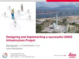
Designing and Implementing a successful GNSS Infrastructure Project. Neil Ashcroft , J v Cranenbroeck, V Lui Leica Geosystems. Traditional Geodetic Networks. Traditional Geodetic Networks Economic Justification.

E N D
Designing and Implementing a successful GNSS Infrastructure Project Neil Ashcroft, J v Cranenbroeck, V Lui Leica Geosystems
Traditional Geodetic NetworksEconomic Justification Most of the GNSS Network RTK projects have been developed by the economical justification that an active geodetic network would reduce the cost of maintaining a traditional geodetic network where the maintenance of the benchmarks and the control survey were a significant part of the owner’s budget. Active GNSS Positioning Reference Network in Hong Kong
GNSS Reference NetworksSingapore Reference Network Singapore's cadastral survey modernisation initiative led to SiReNT. However multiple applications are supported… • Cadastre • Engineering • Mapping / Terrestrial and Aerial • Monitoring • Hydrographical survey • Transportation • Emergency services • Scientific studies • Etc…
Site Recommendations by ICSM http://www.icsm.gov.au
Steps to consider… Pre-analysis, investigation and market research. Consider users needs for : • Positioning • Accuracy • Reliability • Availability Estimate number of users in each market and therefore required functions Develop • Business plan • Financial plan • Business model • Cost • Charging Mechanism • Delivery Mechanism
Specify Stations Network Process Deliver • Specify System • Target Density, Coverage, Accuracy, Reliability and Availability • Site Quality • Equipment Quality • Geodetic Reference Frame • Data Services Produced • Data Access Policy • Own Stations • Site Selection • Site Construction • Equipment Purchasing • Station Data Comms • Site Maintenance • Equipment Replacement Cycle • Network the Data • Data Comms from Network Stations • Control Centre • Quality Control of Raw Data • Data Archive • Process Network • Copy of Network • Data Processing • Production of Data Streams • Data Wholesaling • Retailer Support • Deliver Service • Retail Sale of Data Products • Marketing • Rover Equipment Support • End User Support • Liaison with User Comms Providers Sample Business Model : The “Higgins” Model Governance Courtesy of M.Higgins, DERM, QLD, Australia
Some reasons to fail… • The most important is to remind the sentence that “how a project starts, a project ends”. • If a GNSS Network starts without serious investigation on user’s needs and expected services delivered in term of accuracy and availability, reliability and format, it will fail. • If a GNSS Network starts without reviewing and consulting with all the potential users, it will fail. • Workshop, training, documentation, access to the network services, website, user’s day, … and … publicity ! • Marketing is certainly important and no one will be surprised to assist a failure when few people were aware about the proposed services.
Some more reasons to fail… • Communications is one of the major reasons to fail as no data, no correction. • Improper coordinates is another reason to fail. • If the organisation in charge of delivering the associated services of a GNSS Network RTK infrastructure doesn’t have 24/7 a call centre with an expert reaction to address the user’s issues or to repair the system in case of down operations, the project will fail. • “Charging too much” or “Just for free”. Organisations that have NO confidencein the deliveries or don’t want to take responsibility, will offer the service for free with the net result that if something is going wrong, after all no one is paying for the service when it works. On the other side, charging too much will prevent people to consider the costs if they exceed what they can manage themselves by using a local GNSS Reference Station setup.
The Reasons to succeed… • Identify the future customer’s needs ! • Carefully design and planning of deployment (hotspot strategy vs full coverage) • Consider “more” value added services than only “corrections” • No concession about the coordinates (must match !) • 24/7 … not for surveyors … but for farmers / emergency service / structural monitoring, etc ! • Be innovative in charging for products and services • No rover RTK = No business … Rental proposal ? Rover bundle with data product ? • Cooperation with third party for generating profits out of the services • Remember : customer always has the choice … to setup his own GNSS Base Station …
Thank you very muchAny Questions ? Neil Ashcroft Monitoring & Control Segment Manager Leica Geosystems Singapore Neil.Ashcroft@leica-geosystems.com Joel van Cranenbroeck Business Technology Manager Leica Geosystems , Heerbrugg, Switzerland Joel.vanCranenbroeck@leica-geosystems.com Vincent Lui GNSS & Solution Business Specialist Leica Geosystems Ltd Hong Kong Vincent.Lui@leica-geosystems.com.hk