Download
1 / 31
380 likes | 765 Vues
Ethics in Geographic Information Science ( GISc ). Jacqueline W. Mills, Ph.D. Assistant Professor Department of Geography California State University Long Beach jmills@csulb.edu. Module Overview:.

E N D
Ethics in Geographic Information Science (GISc) Jacqueline W. Mills, Ph.D. Assistant Professor Department of Geography California State University Long Beach jmills@csulb.edu
Module Overview: • This module is designed to be scalable to undergraduate and graduate courses. Instructors may select only those sections which are applicable to the particular level of GISc being taught. • This module is divided into the following sections: • Introduction to Geographic Information Science • Existing Ethics Guidelines for Users of GIS and Geospatial Technologies • Ethical Issues in Data Collection • Ethical Issues in Data Use • Ethical Issues in Data Display • Georegistering Exercise • Map Analysis Exercise
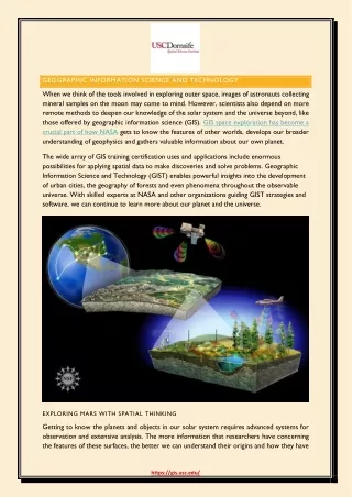
Introduction: • Geographic Information Science (GISc) is the study of the development and application of Geographic Information Systems (GIS) and geospatial technologies. • GIS is a computerized approach to collecting, manipulating, visualizing, and displaying spatial data. • It is most commonly thought of as mapping software, such as ESRI’s ArcGIS or Intergraph’s GeoMedia. • GIS and allied geospatial technologies, such as satellite remote sensing and Global Positioning Systems (GPS) are used in a wide variety of disciplines (e.g., geology, geography, public health, anthropology, business, psychology, environmental science, sociology, political science, journalism, etc.).
Introduction (cont’d): • However, regardless of the field in which it is applied, common ethical concerns surround GISc. • GIS and geospatial technologies have enabled powerful insight into human and physical processes, but these powers have also raised ethical concerns, particularly the ways in which spatial data are acquired, utilized, and then displayed in publicly accessible formats.
EXISTING ETHICS GUIDELINES FOR USERS OF GIS AND GEOSPATIAL TECHNOLOGIES
Existing Ethics Guidelines for Users of GIS and Geospatial Technologies: • Ethics in GISc is a topic that, though widely acknowledged to exist, is not comprehensively addressed in textbooks for undergraduate or graduate students. As a result, this topic is an overlooked component in the GISc curriculum. • This module will address the three areas that raise ethical questions regarding the use of Geographic Information Systems and geospatial technologies: 1) data collection, 2) data use, and 3) data display. • In essence, these topics address what we map, how we map it, and how our maps may be used. • We will now look at a main source for ethical guidelines and then discuss specific issues regarding data collection, data use, and data display.
Existing Ethics Guidelines for User s of GIS and Geospatial Technologies (cont’d): • As users of GIS and geospatial technologies, one main sources exist to guide use of geographic data: • The GIS Code of Ethics (suggestions, not law)
The GIS Code of Ethics: • The GIS Code of Ethics is available online: • http://www.urisa.org/about/ethics/ • http://www.gisci.org/Ethics_and_Conduct/CodeOfEthics_PR.pdf Obligations to Society Obligations to Employers and Funders Obligations to Colleagues and the Profession Obligations to Individuals in Society
Obligations to Society: • Do the Best Work Possible • Contribute to the Community to the Extent Possible, Feasible, and Advisable • Speak Out About Issues
Obligations to Employers and Funders: • Deliver Quality Work • Have a Professional Relationship • Be Honest in Representations
Obligations to Colleagues and the Profession: • Respect the Work of Others • Contribute to the Discipline to the Extent Possible
Obligations to Individuals in Society: • Respect Privacy • Respect Individuals
1a) GPS as a Surveillance Tool • With decreasing cost, decreasing size, and increasing accuracy, GPS is becoming a popular data collection tool http://www.ij-healthgeographics.com/content/8/1/68
1b) GPS-enabled Biosensors • GPS can now easily be converged with other technologies, such as accelerometers (physical activity), galvanic skin response monitor (stress), etc. http://emotionmap.net/
1c) GPS-enabled video • Geospatial video is composed of video cameras mounted on vehicle windows, and a GPS receiver that places a stream of coordinates on the audio track of the video. The result is that each image in the video is linked to its real-world location. • In this example, the geospatial video was used to collect damage in the Lower Ninth Ward after Hurricane Katrina. What you see in this image is, of course, no longer there. • Debris has been cleared and, in this particular block, vegetation has become overgrown to the point where it is now difficult to remember that this was once a populated neighborhood. • In this respect, geospatial video also serves as a method for archiving field data within a geographical context.
An Example: Recovery Score 1: damaged structure/ remains 2: cleared lot 3: structure under construction 4: complete structure A recovery score can be coded using spatial video. From these images we can see the stage of rebuilding after a disaster, but what else can we see…people? License plates?
In this case, data from the spatial video is used to code locations where houses burned and then where they are in various stages of rebuilding. Though there are ethical questions about the use of such technology, these must be balanced with the power of new data sets that can also be provided. Rancho Bernardo (San Diego County 2007) Burned homes Recovery 2/2008 *Damage status obtained from SanGIS, the SanDiego Union Tribune, and aerial imagery
2a) Liability for specific data uses and repurposing datasets • Often you will be given data sets to use for specific projects, but only for use in that case alone. • Data may only be used for the intended purpose. • In this figure, we are looking at a map of the homeless population in Los Angeles. This is a density map, but the GIS analyst has used individual point data of actual locations of homeless people to create this map. • The intent of this map is to help understand the pattern, but how could the individual data be misused?
2b) Appropriate representation of data quality through metadata http://www.fgdc.gov/metadata
2c) Availability to marginalized populations • One ethical issue is who data are released to and in what format, with the concern being protection of sensitive data and/or people. However, what rights do people have to data that impacts them? • Therefore, another ethical concern is making sure that data are made available in accessible formats, particularly for educational and decision-making purposes. Rather than using GIS data, you can convert these to Google Earth or other formats. http://www.esri.com/software/arcgis/arcreader/index.html http://www.google.com/gadgets/directory?synd=earth&preview=on&cat=outreach
3a) Guidelines provided by the Health Insurance Portability and Privacy Act (HIPPA) http://www.hhs.gov/ocr/privacy/hipaa/understanding/summary/index.html
3b) Methods for Masking Spatial Data and subsequent concerns Examples of masking methods from: Armstrong, M.P., G. Rushton, and D.L. Zimmerman. 1999. Geographically Maksing Health Data to Preserve Confidentiality. Statistics in Medicine 18: 497-525.
3c) Implications of converging technologies: Google Earth and GIS • As previously mentioned, Google Earth can be a way to disseminate data to non-GIS users. This can be helpful in providing data for education, but it also makes it easy to publicly post spatial data. What are the benefits and limitations of this technology? http://www.latimes.com
Read the following article: • Curtis, A., J.W. Mills, and M. Leitner. 2006. Spatial confidentiality and GIS: Re-engineering • mortality locations from published maps about Hurricane Katrina. International Journal • of Health Geographics 5(44). Available online: http://www.ijhealthgeographics.com/. • Select a published map from your local area and replicate the Curtis et al. methods of georegistering the map, digitizing the spatial data, and assessing the accuracy of these data to their real world locations.
Select 10 articles from the Exercises section of the Reading list provided in the lesson plan. • Analyze the maps in these articles to assess what data are displayed, how they are displayed, and whether these maps may reveal any confidential information (real world location of an event, e.g. participant house address). • Write a one-page, single-spaced paper discuss the results of the visual analysis and why you have arrived at these particular results.