Download
1 / 15
150 likes | 338 Vues
Landing Site Map Compilation for MSL Tim Parker, JPL Laurie Barge, USC. Landing Site Map Compilation for MSL. *Objective is to produce maps of MSL landing site regions for: *Aid to science team selection of final landing site. *Aid to NAV team in determining whether TCMs needed en route.

E N D
Landing Site Map Compilation for MSLTim Parker, JPLLaurie Barge, USC
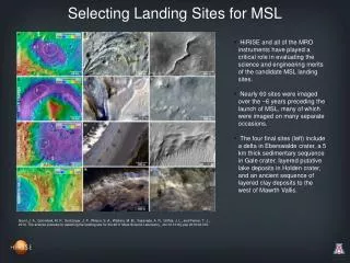
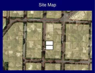
Landing Site Map Compilation for MSL *Objective is to produce maps of MSL landing site regions for: *Aid to science team selection of final landing site. *Aid to NAV team in determining whether TCMs needed en route. *Assessment of surface hazards to EDL. *Accurate location of surface features for localization after landing. *Accurate location of surface features for rover traverse planning. *High-quality image map as multi-layer “virtual map” file: *Enables rapid inclusion of latest orbiter images and derived data products. *MOLA topography Base map MDIM1 and 2 base maps for MPF and initially for MER. *Viking MDIM2 Supplements MOLA registration at low latitudes *THEMIS Daytime IR images. Provides uniform illumination and resolution coverage *THEMIS VIS images. *MOC images. *HIRISE images. *Derived products (e.g., Thermal Inertia, Rock abundance models/counts). *Does not require resampling of images of different pixel scales to common value, thus preserving original data. *New GIS plug-in for Canvas should enable export of fine registration information to users of other GIS applications.
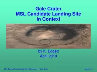
Terby Topography • Terby Topography
Terby • Topography, THEMIS IR, some VIS