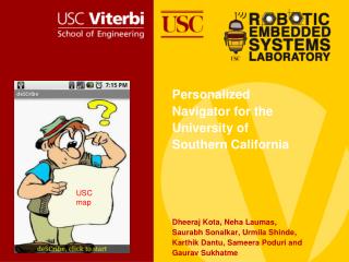
USC map
Discover deSCribe, a virtual tour guide providing turn-by-turn navigational instructions and contextual information for USC visitors. The system uses GPS and compass features to enhance navigation and building recognition on campus. It offers audio descriptions and floor distinctions for seamless exploration. Find out about related work, design details, and limitations in this innovative solution. Explore USC with ease using deSCribe's advanced functionality.


USC map
E N D
Presentation Transcript
Personalized Navigator for the University of Southern California Dheeraj Kota, Neha Laumas, Saurabh Sonalkar, Urmila Shinde,Karthik Dantu, Sameera Poduri and Gaurav Sukhatme USC map
Agenda Motivation Introduction to deSCribe Related work Features of deSCribe Design deSCribe in action Limitations and Assumptions
Motivation Problem • Hundreds of visitors unfamiliar with the University of Southern California campus every year • Campus is very large and paper maps are difficult to read Solution • A virtual tour guide providing • Turn-by-turn navigational instructions from the current location to a requested destination • Contextual information regarding the surroundings
What is deSCribe? Contextual Information System • Used as a pointing device to recognize buildings on campus with the help of the compass on the phone • Distinguishes between the floors of a building and provides information regarding the floor being pointed to. • Both features include audio descriptions using Text To Speech A Navigation System • Turn by turn navigation to any location on campus. • Displays current location on the USC map and the next location the user would need to move to reach the destination.
Related Work • Schmidt-Belz et al. report their findings of a user validation study for the CRUMPET system which is location aware mobile based tourism system. People need more textual/audio tour description as they find it difficult to interpret maps. Location based services would be very important for mobile based tourism • Kray et al. review several navigation assisting services/devices Observation is that more situational awareness is crucial for future mobile guides. • Wikitude is an augmented reality application which provides contextual information by using the HTC G-1 camera view to display annotated landscape, mountain names, landmark descriptions, and interesting stories.
Phone as a remote control Allows a user to determine the name of a campus building just by pointing to it with the phone Design • The phone uses the compass and GPS sensor that are inbuilt to determine the building being pointed to Capabilities • Gives the user the option to choose the granularity of details (fine/coarse) provided regarding the building Requires • Database of all USC campus buildings including • Building names • GPS co-ordinates • Description of buildings
Compass Algorithm y Distance (d1) 135 deg x Distance (d2) Distance (d4) Distance (d3)
Route Determination • The user can navigate through the USC campus to any building on the USC campus. • Design • Manually created a database that includes GPS co-ordinates of • The end-point of every street • Street intersections • Calculate the point of intersection of a perpendicular line passing through the current point and the nearest road to find nearest point on the road. • A* algorithm is used to provide further directions. Usability • Directions are provided relative to the direction the phone is pointing • Dynamically updates directions when user goes along a wrong path.
Floor Information • Extracts the floor number being pointed to by the phone. The floor number along with a brief description of the floor are spoken in clear audio. Speaks weather information on pointing to the sky. • Uses the Y axis of the compass GPS Co-ordinate Error (Err) • Height = tan (Y-axis) * distance • Floor No = ceil (Height/Height of a floor) [Height of a floor = 3.7 m] • Get weather information using the Google weather API Building Angle with Y-axis Half Building Width (x) Distance (d)
Map functionality • Displays current user location (red marker) based on GPS co-ordinate acquired • Indicates next hop location (blue marker) on route to final destination • USC map is overlaid on Google map to allow user to see relevant campus information with ease
Results • We collected data from 30 buildings and our accuracy rate was 83.2% . • Buildings incorrectly identified were large in size. E.g. Parking Structures.
Assumptions and Limitations • Database currently identifies each building on campus by a single GPS coordinate. Estimation of the building being pointed at would be extremely precise if GPS coordinates identifying all four corners of the building were available • GPS coordinates are often not located in the center of buildings and building sizes are variable on campus. This sometimes leads to some inaccuracy in the estimation of the angle the phone is making with the buildings in the vicinity and leads to incorrect estimates by the phone. • Assumed that all roads on campus are linear – not always true. This sometimes leads to slightly ambiguous directions being given to the user when roads are curved. • GPS measurements are used extensively by our application. These measurements use a lot of power – negatively impacts phone battery lifetime.
Conclusion Built a mobile tour guide for the University of Southern California Framework extensible to other large geographic areas like theme parks, campuses etc. Introduced the use of the phone as a pointing device to personalize information delivery 14/15
Thank You! Questions?