Download
1 / 18
190 likes | 379 Vues
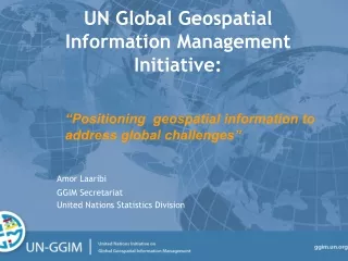
The UN discusses Global Geospatial Information Management. “Just like statistics, every country must have authoritative, trusted, maintained, definitive mapping data”. Professor Paul Cheung, Director, United Nations Statistics Division, Geospatial World Forum, Amsterdam, May 2012.

E N D
The UN discussesGlobal Geospatial Information Management • “Just like statistics, every country must have authoritative, trusted, maintained, definitive mapping data” • Professor Paul Cheung, Director, United Nations Statistics Division, Geospatial World Forum, Amsterdam, May 2012
UN-GGIM – What is it? • The United Nations Initiative on Global Geospatial Information Management, an initiative to enhance and coordinate global geospatial information management • Provides a formal mechanism under the UN to discuss and coordinate GGIM activities by involving Member States at the highest Government level as the key participants
UN-GGIM: Mandates • ECOSOC, recognizing the importance of geospatial information in national and global development, established UN-GGIM in July 2011 following extensive consultation with Member States • ECOSOC encouraged Member States to ‘hold regular high-level, multi-stakeholder discussions on global geospatial information, including through the convening of global forums, with a view to promoting a comprehensive dialogue with all relevant actors and bodies’ • “Recognize the importance of comprehensive hazard and risk assessments, and knowledge and information sharing, including reliable geospatial information”2012 Rio +20 Conference, ‘The Future We Want’
UN-GGIM motivation • Strengthen national capacity and improve global availability of authoritative, trusted, maintained, definitive mapping data and its appropriate coordination and dissemination • There was no global forum at governmental level for member states where global geospatial information management issues can be discussed; Statistics and Environment already have similar structures • Due to the global nature of policy challenges and the opportunities offered by the fast development of IT capabilities, there was general support for the idea to create a global forum, supported by an expert committee, to discuss and help address Geospatial Information Management issues
UN-GGIM: its role An Inter-Governmental mechanism to make joint decisions and set directions on the production and use of geospatial information within national and global policy frameworks Working with Governments to improve policy, institutional arrangements and legal frameworks Addressing global issues and contributing collective knowledge as a community with shared interests and concerns Developing effective strategies to build geospatial capacity in developing countries Realizing a Vision: To make accurate, reliable and authoritative geospatial information readily available to support national, regional and global development.
UN-GGIM – 24-26 October 2011 • 1st High Level Forum on UN-GGIM opened by Prime Minister Hwang Sik Kim, Republic of Korea; United Nations Under-Secretary-General Mr. Sha Zukang; and Prof. Bill Cartwright, President of the JBGIS • 350 participants from 90 countries, 15 from international organisations, 22 from industry, and many United Nations agencies (UNSD, UNCS, UNGEGN, UNOOSA, etc)
UN-GGIM – Ministerial Segment Ministers from Chile, Finland, India, Korea, Malaysia, Mongolia, Namibia, and Niger provided views, including the value proposition, on the role of geospatial information in national development
First Session of the Committee of Experts October 2011 The inaugural UN-GGIM Committee of Experts met in October 2011, immediately following the High Level Forum
Second Session of the Committee of Experts August 2012 “…building effective geospatial infrastructures and promoting greater use of geospatial information are part of a new frontier in harnessing science and technology for advancing sustainable development.” Wu HungboUnder-Secretary General, United Nations Department of Economic and Social Affairs, August 2012
Second Session of the Committee of Experts August 2012 The second session of the UN-GGIM Committee of Experts (UN-GGIM2) convened at UN Headquarters in New York in August 2012, with over 200 delegates in attendance
UN-GGIM2: Key Decisions • Decisions adopted to progress the effective development and coordination of global geospatial information: • Establish a global geodetic reference framework • Gather global case studies that demonstrate the value proposition of GI • Communicate the efforts of UN-GGIM in supporting sustainable development agenda • Regional entities undertake an assessment of regional efforts and priorities • Consider issues related to standards setting in the international community • Consider a shared statement of principles for the UN-GGIM community • Consider ways to develop a global map for sustainable development • Develop a global knowledge base for geospatial information
UN-GGIM: regional representation • UN-mandated regional bodies are already well established in the Asia-Pacific, Africa and the Americas. A UN-GGIM Europe Committee has also recently been formed. • Permanent Committee on GIS Infrastructure for Asia-Pacific recently re-constituted as UN-GGIM Asia-Pacific. Similar approach under consideration for the Americas. • Regional bodies have a vital role liaising with the UN-GGIM Secretariat on topics of interest and major developments in intervening periods between meetings of the Committee of Experts, facilitating regional developments and discussion, and formally feeding into the Committee of Experts.