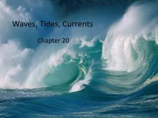
Waves, Tides, Currents
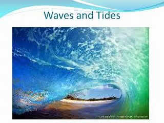
Waves, Tides, Currents. John Huth Harvard University. Wave Parameters (Figure 7-1a). What Causes Waves?. Wind Submarine disturbance Gravitational attraction of sun and moon (tides – very long wavelength waves). Motion of Water Particles Beneath Waves (Figure 7-3b).

Waves, Tides, Currents
E N D
Presentation Transcript
Waves, Tides, Currents John Huth Harvard University
What Causes Waves? • Wind • Submarine disturbance • Gravitational attraction of sun and moon (tides – very long wavelength waves)
Deep Water Waves(Figure 7-4a) Waves do not interact with the seafloor Orbits of the water molecules are circular.
Shallow Water Waves(Figure 7-4b) Waves interact with the seafloor are known as Orbits of the water molecules become elliptical.
Characteristics of water waves • Velocity depends on wavelength *or* water depth • Unlike sound or light – velocity is independent of wavelength for these • Waves become unstable when height is 1/7th of wavelength – whitecaps (120 degree interior angle) • Longer wavelength waves hold more energy • Depth for “shallow” versus “deep” is about 2 times wavelength
Deep Shallow Gravitation 32 ft/sec/sec Water depth (ft) Wave length (ft)
Instability – when h > 1/7 L OR – when interior angle is less 120 degrees 120o h L
Wind Generation of Waves • The type of wave generated by wind is determined by: • Wind velocity • Wind duration • Fetch (distance over which wind blows) • Simply put, wave size increases as the strength and duration of the wind, and distance over which it blows increases.
Fetch Conditions • Time and distance • Small waves buildup, break • Larger waves begin – hold more energy before breaking • Generally a range of wavelengths • High wind velocity produces more uniform and longer wavelength waves • Typically for NE waters – fully developed seas only for 10 knot winds • Larger seas in open ocean • Swells travel huge distances unaffected
Comments on Swells • Product of distant storms • Can travel thousands of miles without losing energy • Period of swell indicates severity of storm – • Longer period – more severe storm • 4 seconds – small • 8-10 seconds – hurricane • Mid ocean – can have multiple swells crossing • In New England, sheltering of coast line limits significant swell direction • E.g. Gulf of Maine typically will only see SE swells • Rhode Island catches a lot of Atlantic storms • Newport beaches/surfing
Reflecting Swells at Great Wass Island (Jonesport) Angle of incidence equals angle of reflection
Wave Refraction(Figure 7-8a) • Bending of the wave crest as waves enter shallow water. It is due to • Drag along the bottom. • Differential speed along the crest.
Wave Refraction at Chatham Inlet Gradual transition between deep and shallow water Shallowwater Deep Water
Extreme refraction at Baker Island (Mt. Desert)
Swell patterns around an atoll reflections Main swell Refractions
Polynesian stick chart – illustrating swell patterns from two islands
Tides • Tides are like very long period waves. • Caused by the divergence of the gravitational lines of force from one body to another • Sun and moon on earth • Moon’s tidal forces are five times larger than the sun’s • Causes a distortion of the shape of the earth • The earth rotates underneath a tidal “bulge” • Horizontal forces push water up against the continental shelves, causing the water level to rise and fall
Parallel lines, plus… Tidal forces Gravitational field lines from the moon Moon
Largest tides occur when pull from the sun and moon are in the same direction. Spring tides Neap tides
Why worry about tides? • Affects navigation, particularly near land • Passages through shallow areas • Passages through constricted channels • Currents can be substantial (3-6 knots) • Can frequently be clues to the presence of land • E.g. current draining from an atoll • Tides in the middle of the ocean are small (a few inches) • Tides in embayments can be huge • A result of resonance • Bay of Fundy – 40’ tides • Straits of Ungava
Coriolis force causes rotary tides Points of zero disturbance called “amphidromic” points – high tides rotate around these points
Diurnal and Semi-diurnal tides Depends on location, the forcing function comes from the moon twice a day and from the sun twice a day. (12 hours, 26 minutes, to be exact) The harmonic properties of a body of water determine how it responds. There is also a diurnal inequality from the inclination of the Moon’s orbit.
Understanding local tides • Local knowledge: tide chart (bait shops, marinas, web) • Look at water line – observe it for 15 minutes • Is water dry above, or wet and drying out • Incoming or outgoing tides • From the structure of docks, height of seaweed zone, etc, can figure out maximum height of tide • Look for necks of land where current flows quickly – use periods of slack tide to your advantage.
Currents • Currents affect passage, must be taken into account for any voyage – near land or away from land. • Many forces at play • Wind • Tide • Thermal gradients, salinity gradients • Gravity • Fluid dynamics • Geography
Seasonal Variations – Summer vs. Winter in the North Pacific Winter Summer
How Polynesians estimated currents Current direction Initial bearing Initial position Final bearing Position after drift
Considerations for currents • Without something stationary, like an island, you can’t really measure currents • Exception – when the wind is running against a current, the waves become steeper facing into the wind • Need to adjust heading for currents • Change angle of heading to take this into account
Sea Surface temperatures – some sharp boundaries can be aids to navigations