Download
1 / 19
190 likes | 371 Vues
Indian GNSS Industry Overview Challenges and future prospects. Expert Presentation By Dr. S.V. Kibe Consultant, SATCOM & GNSS, Bangalore, India (Former Programme Director, SATNAV,ISRO HQ) On February 20,2013 GNSS.India Asia Seminar EBGI , Bangalore.

E N D
Indian GNSS Industry Overview Challenges and future prospects Expert Presentation By Dr. S.V. Kibe Consultant, SATCOM & GNSS, Bangalore, India (Former Programme Director, SATNAV,ISRO HQ) On February 20,2013 GNSS.India Asia Seminar EBGI , Bangalore
Basic Positioning, Navigation,Time : Today • Navigation satellites are Earth Satellites. Require 24 satellites in MEO (19-24,000 Km altitude) for Global Coverage • Follow Kepler’s laws of motion, transmit their Position, Navigation, Time (PNT). Range from 4 visible satellites required for (x,y,z,t) • Provide PNT service through hand-held receivers to users. • Satellites’ orbits and health monitored through an elaborate ground segment. • C/A Code on L1,No Selective Availability. 10-20 m
Participating industries in the seminar today Original Equipment Manufacturers: ACCORD (Jayanto), SEPTENTRIO (Peter) Use of GNSS in Indian Railways, Defense : ASL (Ramakrishna Rao) Industrial applications: EI labs (Vaidyanathan) GIS, Land, surveys, photogrammetric mapping: SECON (Appachu) Education through tablet PCs : EPIGON (JK) Precision agriculture : Dr.JaganathRao ,Bangalore GIS, LBS, Fleet management: MAGNASOFT (Bobbie) Aviation: Airports Authority of India (Sudhir, GM,AAI) These industries mostly use GPS L1 receivers. No Indian industry is into GNSS in mobile phones. Intelligent Transport System yet to use GNSS. Many Indian industries are unaware of the existence of GAGAN!! ISRO experimenting with GPS occultation for accurate temperature profiles for weather prediction.
Challenges and future prospects GNSS services with QoS for Infrastructure development Road development, Railways (wagon tracking, anti-collision) GIS, satellite imagery + GPS and RTK Large dams, shipyards, tunnels (channel) Location Based Services, Airports and Air-space management CNS/ATM Management of mobilty Green fields airports Efficient management of City transport, Police and Para-military forces Safety of Life services
National Council for Applied Economic Review study National Council of Applied Economic Research (NCAER), Delhi in its report on “Economic Impact study of Delhi International Airport” dated April 2012 has reported: Quote Contribution to Indian and Regional GDP Delhi airport’s operations contributed in (2009–10) Rs 294.7 billion (0.45 per cent) to the national GDP and its contribution relative to Delhi’s GSDP is 13.53 per cent. The total comprises of: Rs 42.9 billion directly contributed through value added (air transport and airport services) Rs 77.2 billion indirectly contributed through supply chain (multipliers impact). Rs 174.6 billion in induced impact through tourism and investment. By 2020, the overall economic impact of Delhi Airport is expected to be approx Rs 909.5 billion, which will be 0.7 per cent of the National GDP and relative to Delhi’s GSDP would be 22.2 per cent. Unquote
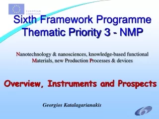
Spectrum for GNSS GNSS spectral bands are: • L1 (1559 – 1610 MHz), • L2 (1215 – 1300 MHz), • L5 (1164 – 1215 MHz), • S-band (2483.5 – 2500 MHz) L1 and L2 bands are being used for 30 years now. L5 is the latest and much sought after band. S-band is for Regional use in Region 3. The World Radio Conference (WRC-12) discussed global allocation for this band. Proximity of this band with MSS and the 2500-2690 MHz is an added advantage
Radioastronomy 1610.6 – 1613.6 MHz S C L2 L1 L5 E5 GPS GPS GPS GLONASS GLONASS GALILEO GALILEO GALILEO 1260.000 MHz 1239.600 MHz 1215.000 MHz 1215.600 MHz 1237.827 MHz 1559.000 MHz 1261.610 MHz 1164.000 MHz 1188.000 MHz 1212.000 MHz 1300.000 MHz 1563.420 MHz 1587.420 MHz 1592.952 MHz 1610.000 MHz 1620.610 MHz 1626.500 MHz 5010.000 MHz 5030.000 MHz 2483.5 - 2500 MHz Spectral bands for Radio Navigation Satellite Systems
Global Navigation Satellite Systems GPS GALILEO GLONASS All Global Systems have more than 24 satellites each in 19000 – 24000 km altitude orbits. All transmissions from the satellite to date are in L-band. The satellites transmit the ephemeris, clock and ionospheric data. The details of the signal structure and data structure vary slightly. User receivers measure their distance from atleast 4 satellites through one-way ranging technique. Most downlink signals use Code Division Multiple Access (CDMA) and RF modulation such as, BPSK, Binary Offset Carrier (BOC) etc. GLONASS uses CDMA ranging codes with Frequency Division Multiple Access (FDMA) These constellations represent a wonderful laboratory for fundamental scientific work
What’s in store for the future – More satellites, SBASs, increased QoS, cheaper multifunction chipsets 31 GPS, 24 GLONASS,4 GALILEO satellites 12 GEOs for SBASs over US, Europe, India and Japan (Korea, Africa, Canada, South America, South East Asia ?) More satellites in view for better ranging solution, accuracies More frequencies to eliminate atmospheric errors Compatible and Interoperable signal structure Positioning and communications integration Healthy growth in the GNSS receivers sales internationally Increased awareness about GNSS applications in CA and non CA applications GNSS receivers with 76 channels available in Indian market GNSS receivers for indoor applications, 32 dB extension in performance Synergy between European EGNOS and Indian GAGAN for applications
GPS Augmentation systems in the World(For APV - 1.5 capability) 2008 2011 2011? RNP 0.3 GAGAN 2012-13
GEO GEO GAGAN Ground Segment Concept GPS L1 L5 C1 L2 L1 L1/L2 (GPS) L1/L5 (GEO) L1/L5 (GEO) L2 L1 INRES L GEO C1 GEO C2 INLUS 1 INLUS 2 INMCC
GPS Space Based Augmentation Systems (SBASs) GPS alone is not accurate enough for position accuracies required for aircraft landing. SBAS improves the accuracy, integrity, availability and continuity. GPS and GEO satellite position is calculated with a large ground segment of Range and Integrity Monitoring Systems(RIMS) connected to an Uplink E/S communicating with the augmenting GEOs. GEO transmits improved position, clock, ionosphere and ephemeris in L1 and L5 centre freq. Info rate is 500 bits/sec. GAGAN has 15 RIMS and two GEOs at present . Three GEOs are planned. Augmentation is possible through Ground Based Augmentation System(GBAS) or RAIM.
Benefits of SBASs • Uniform & Accurate levels of Navigation performance over the entire Airspace and enhanced safety, integrity, continuity and availability for civil aviation. • Provides coverage of oceanic areas which is not possible by terrestrial systems. • Improves efficiency and flexibility by increasing use of operator preferred trajectories at all altitudes. • Improves airport and airspace access in all weather conditions. • Enhances reliability and reduces delays. • Reduces workload and improves productivity of air traffic controllers. • Saves aviation fuel through optimised routes. • GAGAN can be used on ground for safety critical applications.
EC-India co-operation – Road ahead India represents a large and open market To serve Indian market Indian presence and tie-ups are necessary. Many European MNCs have done it: Rolls-Royce India, Robert Bosch India, MICO are leading examples. Solve the IPR issues Identify Indian partners and suitable applications in any of the infrastructure development projects You may have to deal with Indian Govt. but business opportunities outside the purview of Govt. are plenty. India is a good country to do business with!!