Coordinate systems & projections
Coordinate systems & projections. Today’s dilemma – What coordinate system shall we use?. Coordinate systems (ways to find things). Once a projection is chosen, the map needs a coordinate grid to measure location. Common systems: UTM State Plane Coordinates. About “LatLong”.

Coordinate systems & projections
E N D
Presentation Transcript
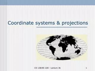
Coordinate systems & projections CS 128/ES 228 - Lecture 3b
Today’s dilemma – What coordinate system shall we use? CS 128/ES 228 - Lecture 3b
Coordinate systems (ways to find things) Once a projection is chosen, the map needs a coordinate grid to measure location. Common systems: • UTM • State Plane Coordinates CS 128/ES 228 - Lecture 3b
About “LatLong” • Latitude and Longitude are two coordinates used to describe a point in 3-dimensional space. • They are NOT planar • Thus, they are not easy to use on a (planar) map • Ergo, graticules1are useful, but not for maps 1a network of parallels and meridians on a map or chart. CS 128/ES 228 - Lecture 3b
Where is the Library ( )? According to Dave ( ), it is at (3, -1) According to Ted ( ), it is at (1, 1) CS 128/ES 228 - Lecture 3b
Lesson? • Where you place the origin matters • Not so much to the data, but definitely in how you refer to it CS 128/ES 228 - Lecture 3b
Least distortion along line of contact In this case equator But nobody lives there! Cylindrical projections http://ioc.unesco.org/oceanteacher/resourcekit/Module2/GIS/Module/Module_c/module_c4.html CS 128/ES 228 - Lecture 3b
www-atlas.usgs.gov Moving the Line of Contact If we turn the cylinder transversely and place the line of contact through Olean, then there will be little error near Bonas! (and all points due north or south of here) CS 128/ES 228 - Lecture 3b
The Politics of Mapmaking • Problem: We might like Bonas to be the most accurate portion of the map, but folks in California may differ. • Solution: Let them use a different projection! • Create “Zones” for each region of interest CS 128/ES 228 - Lecture 3b
Universal Transverse Mercator system • Based on a set of cylindrical projections running along meridians • Distortion minimized in a N – S “strip” (zone) • Zones are 8o wide but overlap by 1o on each side. 60 world wide. CS 128/ES 228 - Lecture 3b
www.ems-i.com World Wide UTM Zones CS 128/ES 228 - Lecture 3b
UTM coordinates • Coordinates are based on an arbitrary origin at equator and 500,000 m west of central meridian • E-W position: “easting”N-S position: “northing” • NYS has 3 zones – most state-wide datasets for New York use zone 18 CS 128/ES 228 - Lecture 3b
Where is Our Origin? • We “live” in UTM zone 17. Its origin is at 0˚ latitude (the equator) and 84˚ W longitude • That’s just west of Detroit, but on the equator (just off the coast of Ecuador) • If we use UTM zone 18, the boundary would be near Belmont and the origin in a suburb of Quito CS 128/ES 228 - Lecture 3b
State Plane Coordinate System • Older system – usually based on Clarke 1866 ellipsoid and NAD 27 datum • Goal: distortion < 1 part in 10,000 • Each state divided into either E-W or N-S zones, depending on its orientation. Most use either Transverse Mercator or Lambert Conformal projections (Alaska, New York, and Florida use both) • Only exception: Alaska panhandle (uses Oblique Transverse Mercator) CS 128/ES 228 - Lecture 3b
State Plane Coordinate Zones CS 128/ES 228 - Lecture 3b
An interesting concept of North? CS 128/ES 228 - Lecture 3b
North? Which way is north on this map? Does this make sense? CS 128/ES 228 - Lecture 3b
What is North? • There are three “kinds” of north • Magnetic North • Grid North • True North CS 128/ES 228 - Lecture 3b
http://geo.phys.uit.no/articl/roadto.html Magnetic North Pole • Lines that point to “magnetic north” point to the magnetic north pole on earth. • This location “moves” • Currently about 1000 miles off at 81.3°N,110.8°W CS 128/ES 228 - Lecture 3b
Geographic North Pole • Always found at same place (90° North Latitude) Famous as home of Santa Claus. • Lines on a map that point to the geographic North pole represent “True North” • Lines on a map parallel to the central meridian represent “Grid North” CS 128/ES 228 - Lecture 3b
So what’s the difference? Declination Computation CS 128/ES 228 - Lecture 3b
Who went out of their way? • Choice of projection has a great influence on perception of distance! CS 128/ES 228 - Lecture 3b
Conclusions • Designing a map is like writing an essay – you can only do a decent job if you know • What you wish to convey, and • Who your audience is • With these in mind, you choose • Your projections/coordinate systems CS 128/ES 228 - Lecture 3b