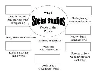
Social Studies - Objectives
Social Studies - Objectives. Students will learn the names of physical features in the following regions in Africa: North Africa West Africa (Coastal & Sahel) East Africa Central Africa Southern Africa Students will use these features in a complete sentence. North Africa.

Social Studies - Objectives
E N D
Presentation Transcript
Social Studies - Objectives • Students will learn the names of physical features in the following regions in Africa: • North Africa • West Africa (Coastal & Sahel) • East Africa • Central Africa • Southern Africa • Students will use these features in a complete sentence.
North Africa Physical features
Example sentence: Very few people live in the Sahara. Definition: The largest desert in the world. It covers most of North Africa. The Sahara (North Africa)
Example sentence: People crossing the Sahara have depended on oases for water and shade. Definition: A wet, fertile area in a desert where a natural spring or well provides water. Oasis (North Africa)
Example: The Nile flows north through the Eastern Sahara for about 4,000 miles and empties into the Mediterranean Sea. Definition: The world’s longest river is formed by the Blue Nile and the White Nile. The Nile
Example: Between the Sinai Peninsula and the rest of Egypt is the Suez Canal. Definition: The French built this canal in the 1860s to connect the Mediterranean Sea and the Red Sea. The Suez Canal
Example: There are some large mountain ranges in the Sahara Desert. One of them is the Atlas Mountain Range. Definition: A large mountain range on the northwestern side of the Sahara Desert. The Atlas Mountains
West Africa (Coastal & Sahel) Physical Features
Definition: The Niger River is the most important river in West Africa. The Niger River (West Africa)
Definition: A strip of land that divides the desert from wetter areas. South of the Sahara is the Sahel. It has a steppe* climate. The Sahel (West Africa) Steppe: A big grass-covered plain that receives only a little rain (between 10-20 inches annually).
Desertification is the spread of desert like conditions. The Sahel is becoming more like the Sahara. Animals have overgrazed the land in some areas. Also, people have cut down trees for firewood. Without these plants to hold down the soil, wind blows the soil away. These conditions, along with drought*, are causing desertification in the Sahel. Desertification (West Africa) *Drought: period when little rain falls and crops get damaged.
Definition: An area of tall grasses and scattered trees and shrubs. Savanna (West Africa)
Reading Plan: • Preview pp. 372-375
East Africa Physical Features
Definition: Rift valleys are places on earth’s surface where the crust stretches until it breaks. Example: East Africa has rift valleys that cut from north to south across the region. Rift Valley (East Africa)
Definition: The Great Rift Valley is the largest rift on Earth and its made up of two rifts—the eastern rift and the western rift. Example: Seen from the air, the Great Rift Valley looks like a giant scar. The Great Rift Valley (East Africa)
Definition: The highest mountain in Africa is Mount Kilimanjaro. Example: The landscape of East Africa has many high volcanic mountains. One of them is Mount Kilimanjaro Mount Kilimanjaro (East Africa)
Definition: A large plain (or flatland) in Tanzania. Example: The Serengeti Plain’s grasses, trees, and water provide nutrition for wildlife that includes elephants, giraffes, lions, and zebras. Serengeti Plain (East Africa)
Definition: Lake Victoria is Africa’s largest lake. Example: The White Nile is formed by the water that flows into Lake Victoria. Lake Victoria (East Africa)
Reading Plan: • Preview pp. 392-397
Central Africa Physical Features
Example: You can think of Central Africa as a large bowl, or basin, with a wide rim around it. Definition: A flat region surrounded by higher land such as mountains and plateaus. Basin (Central Africa)
Example: Near the middle of the “bowl” is the Congo Basin. Definition: A basin in the Congo surrounded by plateaus and low hills. The Congo Basin (Central Africa)
Example: The Congo River drains the swampy Congo Basin and flows into the river as it runs toward the Atlantic. Definition: The Congo River is fed by hundreds of smaller rivers and is an important transportation route. The Congo River (Central Africa)
Example: The Zambezi has many waterfalls along its route, the most famous of which are the Victoria Falls. Definition: The Zambezi River is in the southern part of Central Africa. It flows toward the Indian Ocean. The Zambezi River (Central Africa)
Example: The copper belt stretches through northern Zambia and southern Democratic Republic of Congo. Definition: Africa’s copper is found in an area called the copper belt. The Copper Belt (Central Africa)
Reading Plan: • Preview pp. 414-419
Southern Africa Physical Features
Example: Most of the land in Southern Africa lies on a large plateau. The escarpment is on the edge of the plateau. Definition: The steep face at the edge of a plateau or other raised area. Escarpment (Southern Africa)
Example: A large savanna region covers much of Southern Africa. Shrubs and short trees grow on the grassy plains of the savanna, or veld. Definition: Open grassland areas in South Africa. Veld “velt” (Southern Africa)
Example: The Namib Desert is on the Atlantic coast. Definition: The driest area in Southern Africa. Namib Desert (Southern Africa)
Example: Another desert, the Kalahari, occupies most of Botswana. Ancient streams crossing the Kalahari have drained into low pans. Definition: flat areas where minerals are left behind after the water evaporates. Pans (Southern Africa)
Reading Plan: • Preview pp. 434 - 439