Download
1 / 47
470 likes | 637 Vues
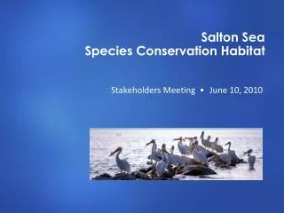
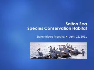
1-6 Salton Sea. Revanth Rameshkumar Ronald Shanderson P-4 4-12-12. Salton sea geography. The Salton Sea is located in California and is the largest lake in the state. It is part of the desert ecosystem. It has no outlets

E N D
1-6 Salton Sea RevanthRameshkumar Ronald Shanderson P-4 4-12-12
Salton sea geography • The Salton Sea is located in California and is the largest lake in the state. It is part of the desert ecosystem. • It has no outlets • Inflow comes from Whitewater, Alamo, and sources branching off from Colorado River. • Has very high salt content • Borders wetlands • Is shrinking • In 1920 it is developed into a tourist attraction • http://www.saltonsea.ca.gov/about/about.htm
The formation of the salton sea • Was formed in 1905 • California Development Company dug irrigation canals from the Colorado River • Massive flooding from the Colorado River broke through an irrigation canal and went into the Salton Basin for an estimated 18 months, making the Salton Sea • It has been maintained primarily by agricultural return flows and, by some amount, the other water sources outlined in the previous slide. • http://www.sci.sdsu.edu/salton/EnvirnEconValueSaltonSea.html • http://www.saltonsea.ca.gov/about/about.htm
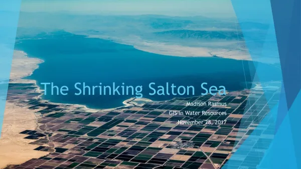
Present condition of the salton sea • It is currently a dead lake as it is a closed system and therefore, the current condition of the lake is accelerated as it has no natural output as the water evaporates, what previously washed into the lake remains. • http://www.institute.redlands.edu/salton/about/overview.aspx
Ecosystem and the salton sea • The ecosystem of the Salton Sea is unstable as there is constant accumulation of runoff from farm land and local businesses. It has also affected the environment around it has steadily caused the wildlife of the area to die off. • http://www.sci.sdsu.edu/salton/SSEcosystemInitiative.html
3 Environmental and 3 economic reasons why the salton sea is important • Economic Reasons • Productive fishery • Agricultural irrigation • Tourism • Environmental Reasons • Brown Pelican feeding area • Rich source of abundant life • High nutrient consent for the fish there • http://www.sci.sdsu.edu/salton/EnvirnEconValueSaltonSea.html • http://www.saltonsea.ca.gov/about/about.htm
Remediation of the salton sea • Remediation programs for the Salton sea started in the 1960’s and efforts are focused towards maintaining its recreational, agricultural, and environmental value. Solutions include diluting it with imported water, pumping the water to another location, and a number of other options. Chances are low as most methods are expensive and would also require the lowered use of water so the salinity wouldn’t continue to become concentrated. • http://www.usbr.gov/lc/region/saltnsea/ssbro.html
APES Water Diversion – Questions 7-12 Khorizon Dunn and Madeline Monahan
Question 7 • Both are worsening (at a fast pace) due to environmental as well as human-induced effects • Lake Chad is getting smaller while the Salton Sea is becoming more polluted
Question 8 • Located on the southern fringe of the Sahara Desert in north-central Africa • Importance as a center of trade and cultural exchange between people living north of the Sahara and people to the south • Has dramatically decreased in size… • …due to climate change and human demand for water (1/20 of its original size)
Part 2 - Question 9 • Uzbekistan and Kazakhstan
Question 10 • the Amu Darya and Syr Darya Rivers
Question 11 • Soviet central government
Question 12 • For an irrigation system • “to make the Soviet Union self-sufficient in cotton and increase rice production”
Citations • http://visearth.ucsd.edu/VisE_Int/aralseahtml/SaltSea.intro.html • www.ilec.or.jp/database/afr/afr-02.html • www.worldlakes.org/lakedetails.asp?lakeid=8357 • http://earthobservatory.nasa.gov/IOTD/view.php?id=1240 • http://visearth.ucsd.edu/VisE_Int/aralsea/index.html • http://orexca.com/aral_sea.shtml
13 • In the 1960s Soviet planners built a network of irrigation canals to divert their waters into cotton fields in Uzbekistan and Turkmenistan (reuters)
14 • Mismanagement of land and water resources has caused degradation extending to the entire Aral Sea basin, damaging fish production and causing high salinity and pollution as well as violent sand storms. Fresh water supplies have diminished and human health problems have risen (reuters)
15 • decline of fishing industry, decreased use of the Sea as a transportation medium, loss of irrigation for crops in the area around the Sea (G.R.I.D.A)
16 • The Aral Sea has lost three-fourths of its former volume and two-thirds of its former surface area. The Salton Sea alternates between a fresh water lake and a dry desert basin. The Salton Sea is closed and the Aral Sea is open to two inflow rivers.
17 • The region around the Aral sea shallow, arid, flat desert basin, and shrinking.
18 • 1) The pollution of the drinking water has put the people at high risk of disease2) The collapse of the healthcare system due to the economic collapse when the sea became too toxic for the life of fish the economy relied on caused mortality rates from illnesses to rise3) Maternal and infant mortality rates have increased4) Other reproductive pathologies have increased5) Brain damage and malfunction in livers and other major organs has increased due to the high rate of pesticides in the drinking water
www.jcu.edu.au/jrtph/vol/v01whish.pdf • http://www.grida.no/graphicslib/detail/shrinking-of-the-aral-sea-socio-economic-impacts_dbe5 • http://www.reuters.com/article/2008/06/24/idUSL23248577 • http://visearth.ucsd.edu/VisE_teach/lessons/Aral_SaltonLP.html
19. How can the Aral Sea be realistically rehabilitated? • Stabilizing and improving the environment of the Aral Sea Basin • Rehabilitating the disaster zones • Improving water resource management • Increasing the capacity of local and state institutions for planning and implementing programs • Collect funding from major outside countries (France, Japan, Kuwait, Great Britain) Taylor Puch and Christina Paulk
20. Compare the situation in Mono Lake in California with that of the Aral Sea. • Both have experienced ecosystem destruction due to the over use of water • Both have water taken from them via dams on the rivers that feed them • Both water resources are drying up • Water from Mono Lake is being used to supply Los Angeles • Water from Aral Sea is being used for irrigation
21. How did the Mono Lake problem arise? • The Los Angeles Department of Water Supply needed another source of water to supply the California Owens Valley region because their previous source of water, Owens Lake, dried up. They turned to Mono Lake to supply the water.
22. Describe three ways the problems of Mono Lake are similar to those of the Aral Sea • They both have ecosystem destruction • They both have significant overuse of water • Both resources of water are drying up
23. Discuss three ways the problems of Mono Lake are different from those of the Aral Sea. • Water is allowed to flow into Mono Lake for a short time each year to allow it to partially recover. No water flows into the Aral Sea, so it cannot recover. • The lack of fish in the Aral Sea is detrimental to the residents around it as opposed to the lack of fish in Mono Lake. • Aral Sea is used for crop irrigation, which involves people’s livelihoods whereas Mono Lake water supplies water for daily usage.
24. Summarize the proposals and actions to remediate Mono Lake. • The L.A. Department of Water and Power is responsible for implementing the Water Board-approved restoration plan. Mono Basin restoration is aimed at restoring natural processes and ecological function. This means establishing peak flows on the creeks that give the creeks enough energy to recreate their former habitats without significant intervention or continued maintenance. Other attempts include, reopening side channels on the streams to raise water tables and provide complex habitat, or planting native vegetation to jump-start streambank recovery.
Sources • http://www.africanwater.org/aral.htm • http://www1.american.edu/ted/mono.htm • http://www.pr-inside.com/the-aral-sea-problem-must-be-r565419.htm • http://www.monolake.org/mlc/restoration
25. The river diversion in Russia has caused the Aral Sea to retreat by tens if not hundreds of miles, destroying what once was a flourishing fishing industry. Once the fourth largest inland body of water, now the Aral Sea is the eighth largest inland body of water on account of large amounts of water diverted for crop irrigation from the Amudarya and Syrdarya rivers. Extreme shrinkage of the once abundant Sea has altered the climate and the livelihood of millions of people. The Salton Sea is undergoing a similar situation to the Aral Sea. Located in California’s desert region, the water from the Sea is being diverted to the western cities to supply the metropolitan area. The Colorado does not flow into an inland sea, although the river does have so much water diverted that it no longer reaches the ocean. The metropolitan area of California takes so much water out of the Colorado River that the river no longer supplies areas south of the California metro area. http://www.africanwater.org/aral.htm
26. 1. Water is taken out of the Colorado River for metropolitan uses, whereas water from the Aral Sea is used for irrigation and faming purposes. 2. Both the Salton and Aral Seas are large bodies of water with tributaries that feed their water supplies. The Colorado River does not end in large body of water and therefore just trickles until it ends in a dry river basin. 3. The Colorado River used to reach to the sea, whereas the Salton and Aral Seas are inland bodies of water and do not feed into the ocean. http://www.africanwater.org/aral.htm
27. Tributary: astream that flowsto a larger stream or other body of water. http://dictionary.reference.com/browse/tributary?s=t
28. Start of the Colorado River http://www.usbr.gov/lc/region/g4000/contracts/watersource.html
29. Gunnison, Green, San Juan, and Little Colorado are the main tributaries in the upper basin of the Colorado. The Gila is the chief tributary of the lower basin. Encyclopedia.com
30. The most important origin of water in the Colorado River is the runoff of the snow-pack on the surrounding mountains. http://www.onlineutah.com/colorado_river.shtml
31-36 Andrew Brasuk Alex Johnson
31 • The seven states of the Colorado River basin collectively decide how the water is allocated,...via the Colorado River Compact, an agreement established in 1922. • http://ag.arizona.edu/AZWATER/arroyo/101comm.html
32 • A watershed is the area of land where all of the water that is under it or drains off of it goes into the same place. • http://water.epa.gov/type/watersheds/whatis.cfm
33 • The Colorado River Compact divided the Colorado River Basin into the Upper Basin and the Lower Basin. The division point is Lees Ferry, a point in the Colorado River south of the Utah-Arizona boundary. The "Upper Basin" includes the parts of Arizona, Colorado, New Mexico, Utah, and Wyoming where the river system lies above Lees Ferry. The "Lower Basin" includes those parts of the states of Arizona, California, Nevada, New Mexico, and Utah below Lees Ferry, and may benefit from water diverted from the system below Lees Ferry. • http://www.usbr.gov/lc/hooverdam/faqs/riverfaq.html
34 • The Upper Basin is divided as- • Colorado, 51.75 percent • New Mexico, 11.25 percent • Utah, 23 percent • Wyoming, 14 percent • The Lower Basin is divided as- • California, 58.75 percent • Arizona, 37.3 percent • Nevada, 4 percent
35 • The Colorado River Compact usually is referred to to resolve conflicts, but it is sometimes deemed outdated. • Today, some of the conflicts include Las Vegas’ need for more water, along with Los Angeles and Southern California wanting more than their allocation allows for. • These are currently being worked on by the governments of the states that border the river. • http://ag.arizona.edu/AZWATER/arroyo/101comm.html
36 • The Colorado River Salinity Control Program and the Colorado River Compact is a federally funded management plan to control the use of public and private water in Colorado.
#37 • This problem exists because there is vast agricultural development along the river, therefore each country wants to claim more of the river. In order to resolve this dispute, a treaty should be made where each part of the Colorado river is evenly distributed between each country.
#38 • This problem is potentially greater than the one that exists on the river, because it is shared between more than one country, therefore causing a social dispute between these countries.
#39 • As a river increases in size, the problems associated with diversion increase exponentially. While we were able to bore/drill two diversion tunnels through solid rock, the extreme size of the Yangtze requires tunnels at least 5 times larger or more in number. (As you double the cross sectional area of the tunnel, you should be able to pass 4 X the volume).
#40 • The dam was built to create electricity and water storage for a population that is migrating from a sustainable existence to a more western urban culture. As more Chinese give up farming they are moving into urban cities.
#41 • The dam is much larger and more expensive. The 3 gorges dam also has locks on the side for shipping, since the river it dams is a shipping channel. The Colorado river is not used for commercial shipping.