Download
1 / 27
270 likes | 417 Vues
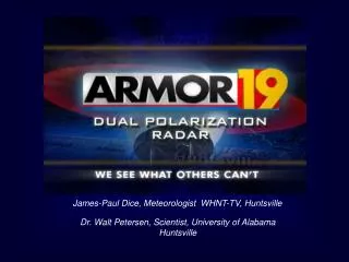
James-Paul Dice, Meteorologist WHNT-TV, Huntsville. Dr. Walt Petersen, Scientist, University of Alabama Huntsville. ARMOR : A dvanced R adar for M eteorological and O perational R esearch.

E N D
James-Paul Dice, Meteorologist WHNT-TV, Huntsville Dr. Walt Petersen, Scientist, University of Alabama Huntsville
ARMOR:Advanced Radar for Meteorological and Operational Research. Deployed in Huntsville by the NWS in 1977 as a local warning radar (WSR-74C) then refurbished and upgraded to Doppler in 1991. Radar donated to UAH in 2002 and upgraded to dual-polarimetry using the SIGMET Antenna Mounted Receiver 11/04. Renamed: ARMOR. • Location : Huntsville Intl. Airport • Transmit frequency: 5625 MHz • Peak Power: 350 kW • Antenna Diameter 3.7 m (12 ft CF Parabolic) • Antenna Beam width: 1.0o • Maximum rotation rate: 6 rpm • Transmit polarization: Simultaneous H and V, or H • Receive polarization: SIGMET dual-channel; H and V • Signal Process: SIGMET RVP/8 • Variables: Z, V, W, ZDR, fDP, KDP, rhv, LDR Partners: UAH, NASA, NSSTC, WHNT-TV
A UNIQUE COLLABORATION OPERATIONS RESEARCH
Digital dual-receiver Simultaneous transmit and receive via 4-port switch and magic-T Receiver Waveguide Assembly
POLARIMETRIC RADAR? Conventional Radar (NEXRAD) Polarimetric Radar (ARMOR)
Small ZDR Large ZDR vs Polarimetric Variables • Reflectivity factor Z at horizontal polarization • - Measure of size and concentration of scatters • (dominated by SIZE) • 2. Differential reflectivity ZDR • - Measure of median drop diameter→SIZE/SHAPE • - Useful for rain / hail / snow discrimination→SIZE/SHAPE/PHASE • 3. Differential phase ΦDP (Specific Differential Phase- KDP) • - Efficient for accurate rainfall estimation→NUMBER/SHAPE • - Immune to radar miscalibration, attenuation, and partial beam blockage • 4. Cross-correlation coefficient ρhv • - Indicator of mixed precipitation → SHAPE/PHASE • - Efficient for identifying nonmeteorological scatterers Operational: NEXRAD, TV Research: NCAR, CSU, NASA, UND, DLR, BMRC, NOAA-ETL ARMOR
vs vs Small ZDR Large ZDR Small drops Large drops Hail Rain Insects Rain vs Advantages of a Dual-Polarization Radar Really just a self-consistent way of obtaining a more complete description of the particle types and shapes present in a given volume of space. • More accurate rainfall estimation (10-20% max accumulation error as opposed to 200-300%). • Why? Because we collect information on drop size/shape/concentration and are able to mitigate hail contamination. • Identification of precipitation types and discrimination between meteorological and non-meteorological scatterers • Improvement in radar data quality: Self consistent way to calibrate using polarimetric variables Mitigates the multiple Z-R issues!
How Does Dual Polarimetric Radar Help Hydrology?RAINFALL: A CLASSIC EXAMPLEThe Fort Collins Flash Flood: A Robust Integrated Application of Dual-Polarization Radar CSU-CHILL: 2145 L 2108: RHI: dBZ, ZDR, KDP Review Petersen et al., BAMS, 1999
“ZDR Column” in developing convection “ZDR Hole” in Hail ZDR in Range-Height mode …………..(ARMOR has this scanning capability and this mode provides an early look into the development of intense storms) • Drop column clearly extends into sub-freezing portion of cloud- the hail process • Spherical shape and tumbling of hail results in low ZDR’s (a ZDR “hole”). • Large drop recirculation on edge of echo vault at x=25 km, z=2-3 km.
ZDR Ze CSU CHILL Winter: Rain-Snow lines- Application for ARMOR along AL-TN border • White line indicates a transition from snow to rain- e.g., melting. This process is amplified in the ZDR signal and not as apparent in the reflectivity (Z).
ARMOR: 1541 UTC 12/09/04 61+ dBZ in cells: Hail or Rain? ZDR >3.5 dB ZDR: Big rain drops or melting hail Note Lightning in LISDAD
ARMOR Dual-Polarimetric facility provides a unique opportunity for end-to-end transfer of research technology to public safety • Flooding (Radar “state of the art” rainfall estimates and flexible scanning) • Emergency Management • Surveillance, threat detection, warning • Mitigation • Case study and climatological area- accurate rainfall boundary conditions (0.125 x 0.5 km) for modeled watershed response (improved flood plain planning) • Severe Thunderstorms • Additional local source for improving detection, monitoring of severe weather (tornadic, strong winds, hail, lightning) • Winter Precipitation • Rain-snow boundary (HSV Airport Authority very interested in this product); planning decision support • Homeland Security • Boundary layer winds for plume dispersion modeling- feasibility?
ARMOR Operates Like No Other TV Radar • The radar alternates between a traditional Doppler mode and a multi-elevation polarimetric scan. This flexibility means more data into our office. • Traditional radar measurements (reflectivity and velocity) are available at all times. • Radar alternates its operation between a live .05o surveillance scan and a 3 elevation volumetric scan at .07o,1.3o, and 2.0o • Following each volume scan, a hydrometeor identification algorithm produces a product.
Hydrometeor ID Algorithm Output Large Hail
Hydrometeor ID Algorithm Output Large Hail
December 10, 2004 Hail Event 61 dBZ with VIL ~30 kg/m2
KHTX NEXRAD View of Storm Note: Pink Baron Services Severe SCIT. Neither NEXRAD or Baron Hail algorithm detected presence of hail during this event.
Rain/Hail -0.5 to 2 dB ARMOR: 12/10/04 17:55:06 EL=1.3o Rain/Hail 40-55 dBZ dBZ ZDR Hail -1.5 to 0.5 dB Hail 50-55 dBZ Rain 2 to 3.5 dB Rain 55+ dBZ -1.8 -0.9 0.1 1.0 1.9 2.9 3.6 -15 - 5 5 15 25 35 45 Hail 55+ dBZ Hail -1 to 0.5 dB LMA S. Cell 17:52:30 – 17:57:30 At 17:55 In-cloud (IC) flash rate ~ 3/minute in southern cell No IC’s in northern cell at 17:55 No Cloud-to-Ground (CG) lightning in either cell for 20 minutes centered on 17:55 Only 3 CG’s detected for duration of storms LMA Total Lightning Data (southern cell mass)
Ground-truth Report of Dime-Size Hail Owens Crossroads, Alabama.
ARMOR Control and Display Sigmet IRIS Workstation FasTrac VIPIR
This is the Next Generation of Doppler • Improved Flash Flood Forecasting • Hydrometeor Identification • Possible Tornado Debris Detection to Improve Warnings • The Bottom Line: More data is a competitive advantage